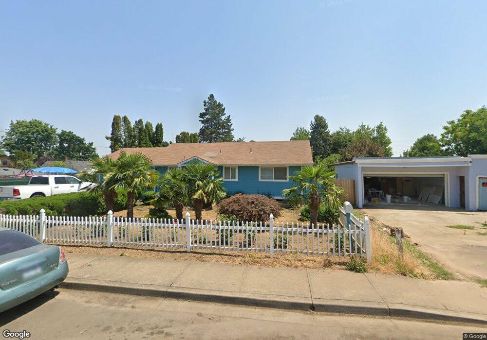
940 Carol St Woodburn, OR 97071
Estimated Value: $341,000 - $384,000
2
Beds
1
Bath
972
Sq Ft
$370/Sq Ft
Est. Value
About This Home
This home is located at 940 Carol St, Woodburn, OR 97071 and is currently estimated at $359,935, approximately $370 per square foot. 940 Carol St is a home located in Marion County with nearby schools including Washington Elementary School, French Prairie Middle School, and Woodburn Arthur Academy.
Ownership History
Date
Name
Owned For
Owner Type
Purchase Details
Closed on
Apr 13, 2007
Sold by
Bautista Cesar Ascencio
Bought by
Hernandez Silvia
Current Estimated Value
Purchase Details
Closed on
Dec 17, 2001
Sold by
Albright Ann H and Albright Raymond G
Bought by
Bautista Cesar Ascencio
Home Financials for this Owner
Home Financials are based on the most recent Mortgage that was taken out on this home.
Original Mortgage
$104,362
Interest Rate
6.39%
Mortgage Type
FHA
Create a Home Valuation Report for This Property
The Home Valuation Report is an in-depth analysis detailing your home's value as well as a comparison with similar homes in the area
Home Values in the Area
Average Home Value in this Area
Purchase History
| Date | Buyer | Sale Price | Title Company |
|---|---|---|---|
| Hernandez Silvia | $176,000 | Ticor Title | |
| Bautista Cesar Ascencio | $106,000 | Fidelity National Title |
Source: Public Records
Mortgage History
| Date | Status | Borrower | Loan Amount |
|---|---|---|---|
| Previous Owner | Bautista Cesar Ascencio | $104,362 |
Source: Public Records
Tax History Compared to Growth
Tax History
| Year | Tax Paid | Tax Assessment Tax Assessment Total Assessment is a certain percentage of the fair market value that is determined by local assessors to be the total taxable value of land and additions on the property. | Land | Improvement |
|---|---|---|---|---|
| 2024 | $2,280 | $118,230 | -- | -- |
| 2023 | $2,266 | $114,790 | $0 | $0 |
| 2022 | $2,146 | $111,450 | $0 | $0 |
| 2021 | $2,083 | $108,210 | $0 | $0 |
| 2020 | $2,021 | $105,060 | $0 | $0 |
| 2019 | $1,965 | $102,000 | $0 | $0 |
| 2018 | $1,925 | $0 | $0 | $0 |
| 2017 | $1,868 | $0 | $0 | $0 |
| 2016 | $1,812 | $0 | $0 | $0 |
| 2015 | $1,759 | $0 | $0 | $0 |
| 2014 | $1,672 | $0 | $0 | $0 |
Source: Public Records
Map
Nearby Homes
- 1600 E Blk Lincoln Rd
- 1151 Queen City Blvd
- 1600 blk E Lincoln Rd
- 119 N Pacific Hwy
- 955 Bryan St
- 885 Mckinley St
- 1051 Orchard Ln
- 778 E Lincoln St
- 1700 NE Laurel Ave
- 365 Bryan St
- 1500 George St
- 1390 George St
- 1078 Young St
- 795 Corby St
- 1554-1570-1588 Barn St
- 1551-1569-1593 Barn St
- 1475-1481-1487 Barn St
- 1528-1534 Barn St
- 1515-1537 Barn St
- 1479-1491 Barn St
- 920 Carol St
- 1404 Hardcastle Ave
- 1444 Hardcastle Ave
- 1015 Williams Ave
- 1007 Williams Ave
- 1027 Williams Ave
- 1540 Hardcastle Ave
- 1031 Williams Ave
- 1560 Hardcastle Ave
- 1380 Hardcastle Ave
- 1409 Hardcastle Ave
- 1016 Williams Ave
- 1008 Williams Ave
- 1028 Williams Ave
- 1326 Hardcastle Ave
- 1032 Williams Ave
- 1399 Hardcastle Ave
- 1429 Hardcastle Ave
- 1505 Hardcastle Ave
- 1280 Hardcastle Ave