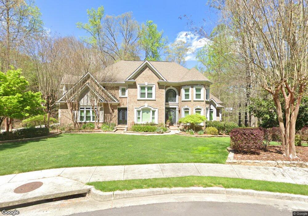
940 Dunster Ct Alpharetta, GA 30009
Estimated Value: $1,515,000 - $1,958,648
6
Beds
6
Baths
7,965
Sq Ft
$220/Sq Ft
Est. Value
About This Home
This home is located at 940 Dunster Ct, Alpharetta, GA 30009 and is currently estimated at $1,751,662, approximately $219 per square foot. 940 Dunster Ct is a home located in Fulton County with nearby schools including Alpharetta Elementary School, Northwestern Middle School, and Milton High School.
Ownership History
Date
Name
Owned For
Owner Type
Purchase Details
Closed on
May 16, 2005
Sold by
Coomes Joseph L and Coomes Faith
Bought by
Clynch Larry F and Clynch Laura
Current Estimated Value
Home Financials for this Owner
Home Financials are based on the most recent Mortgage that was taken out on this home.
Original Mortgage
$359,650
Outstanding Balance
$185,713
Interest Rate
5.69%
Mortgage Type
New Conventional
Estimated Equity
$1,565,949
Purchase Details
Closed on
Mar 15, 2000
Sold by
Ply Marts Inc
Bought by
Estate Dev Inc +
Purchase Details
Closed on
Nov 4, 1999
Sold by
Est Developers Inc
Bought by
Coomes Joseph L and Coomes Faith M
Home Financials for this Owner
Home Financials are based on the most recent Mortgage that was taken out on this home.
Original Mortgage
$200,000
Interest Rate
7%
Mortgage Type
New Conventional
Create a Home Valuation Report for This Property
The Home Valuation Report is an in-depth analysis detailing your home's value as well as a comparison with similar homes in the area
Home Values in the Area
Average Home Value in this Area
Purchase History
| Date | Buyer | Sale Price | Title Company |
|---|---|---|---|
| Clynch Larry F | $902,300 | -- | |
| Estate Dev Inc + | $2,200 | -- | |
| Coomes Joseph L | $536,700 | -- |
Source: Public Records
Mortgage History
| Date | Status | Borrower | Loan Amount |
|---|---|---|---|
| Open | Clynch Larry F | $359,650 | |
| Previous Owner | Coomes Joseph L | $200,000 |
Source: Public Records
Tax History Compared to Growth
Tax History
| Year | Tax Paid | Tax Assessment Tax Assessment Total Assessment is a certain percentage of the fair market value that is determined by local assessors to be the total taxable value of land and additions on the property. | Land | Improvement |
|---|---|---|---|---|
| 2025 | $2,097 | $670,960 | $201,680 | $469,280 |
| 2023 | $16,254 | $575,840 | $152,680 | $423,160 |
| 2022 | $9,471 | $469,880 | $135,360 | $334,520 |
| 2021 | $1,746 | $394,840 | $101,920 | $292,920 |
| 2020 | $11,255 | $367,040 | $67,520 | $299,520 |
| 2019 | $1,758 | $365,520 | $58,360 | $307,160 |
| 2018 | $9,518 | $356,960 | $57,000 | $299,960 |
| 2017 | $9,415 | $337,800 | $99,960 | $237,840 |
| 2016 | $9,370 | $337,800 | $99,960 | $237,840 |
| 2015 | $11,061 | $337,800 | $99,960 | $237,840 |
| 2014 | $9,490 | $324,280 | $108,560 | $215,720 |
Source: Public Records
Map
Nearby Homes
- 275 Heatherton Way
- 1580 Mayfield Rd
- 245 Heatherton Way
- 175 Heatherton Ln
- 1645 Mayfield Rd
- 13039 Freemanville Rd
- 1360 Bethany Ct
- 13440 Hipworth Rd
- 1895 Henley Way
- 1050 Little River Ln
- 14050 Providence Rd
- 900 Crabapple Hill
- 4110 Providence Square
- 1835 Henley Way
- 14040 Providence Rd
- 735 Hammock Ln
- 785 Briars Bend
- 0 Providence Way Rear
- 925 Pebblestone Ct
- 165 Oakhurst Leaf Dr Unit 4
- 935 Dunster Ct
- 920 Dunster Ct
- 925 Dunster Ct
- 0 Dunster Ct Unit 8179748
- 0 Dunster Ct Unit 7475739
- 0 Dunster Ct Unit 7287774
- 0 Dunster Ct
- 910 Dunster Ct
- 915 Dunster Ct
- 13275 Bethany Rd
- 13305 Bethany Rd
- 255 Eversedge Ct
- 900 Dunster Ct
- 905 Dunster Ct
- 245 Eversedge Ct
- 1595 Eversedge Dr
- 0 Eversedge Dr Unit 8684127
- 0 Eversedge Dr Unit 9060846
- 0 Eversedge Dr Unit 8809876
- 0 Eversedge Dr Unit 8827824