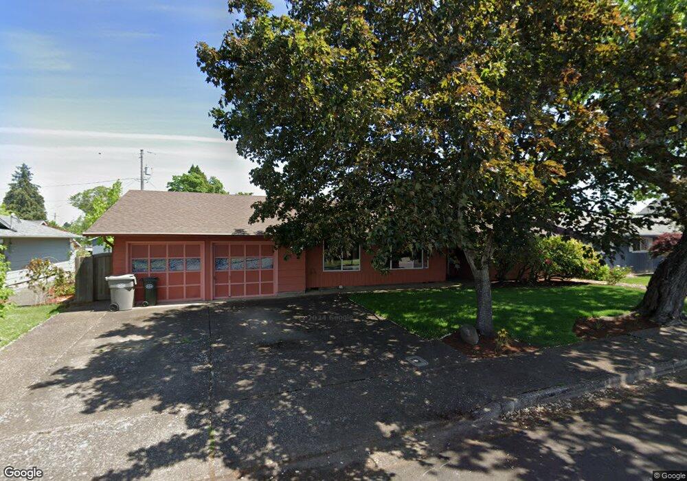
940 Oak St Junction City, OR 97448
Estimated Value: $382,000 - $431,000
4
Beds
2
Baths
1,672
Sq Ft
$247/Sq Ft
Est. Value
About This Home
This home is located at 940 Oak St, Junction City, OR 97448 and is currently estimated at $413,122, approximately $247 per square foot. 940 Oak St is a home located in Lane County with nearby schools including Junction City High School.
Ownership History
Date
Name
Owned For
Owner Type
Purchase Details
Closed on
Jan 15, 2025
Sold by
Trotter Richard G and Trotter Kathryn A
Bought by
Trotter Family Trust and Trotter
Current Estimated Value
Purchase Details
Closed on
Jan 15, 1999
Sold by
Piercy Judy A and Miller Keith L
Bought by
Trotter Richard G and Trotter Kathryn A
Home Financials for this Owner
Home Financials are based on the most recent Mortgage that was taken out on this home.
Original Mortgage
$120,600
Interest Rate
6.66%
Create a Home Valuation Report for This Property
The Home Valuation Report is an in-depth analysis detailing your home's value as well as a comparison with similar homes in the area
Home Values in the Area
Average Home Value in this Area
Purchase History
| Date | Buyer | Sale Price | Title Company |
|---|---|---|---|
| Trotter Family Trust | -- | None Listed On Document | |
| Trotter Family Trust | -- | None Listed On Document | |
| Trotter Richard G | $134,000 | Cascade Title Co |
Source: Public Records
Mortgage History
| Date | Status | Borrower | Loan Amount |
|---|---|---|---|
| Previous Owner | Trotter Richard G | $120,600 |
Source: Public Records
Tax History Compared to Growth
Tax History
| Year | Tax Paid | Tax Assessment Tax Assessment Total Assessment is a certain percentage of the fair market value that is determined by local assessors to be the total taxable value of land and additions on the property. | Land | Improvement |
|---|---|---|---|---|
| 2024 | $3,656 | $217,748 | -- | -- |
| 2023 | $3,656 | $211,406 | $0 | $0 |
| 2022 | $3,410 | $205,249 | $0 | $0 |
| 2021 | $3,342 | $199,271 | $0 | $0 |
| 2020 | $3,235 | $193,467 | $0 | $0 |
| 2019 | $3,121 | $187,833 | $0 | $0 |
| 2018 | $3,031 | $177,051 | $0 | $0 |
| 2017 | $2,925 | $177,051 | $0 | $0 |
| 2016 | $2,844 | $171,894 | $0 | $0 |
| 2015 | $2,514 | $166,887 | $0 | $0 |
| 2014 | $2,524 | $162,026 | $0 | $0 |
Source: Public Records
Map
Nearby Homes
- 1011 Rose St
- 1225 W 10th Ave Unit 53
- 1225 W 10th Ave Unit 50
- 1225 W 10th Ave Unit 28
- 1225 W 10th Ave Unit 26
- 850 Spruce St
- 1262 Kalmia St
- 617 Juniper St
- 1377 Juniper St
- 1176 Unity Dr
- 847 Unity Dr
- 0 Holly St
- 945 W 17th Ave
- 930 Holly St
- 1480 Ivy St
- 351 Juniper St
- 1085 W 1st Ave Unit 8
- 94403 Oaklea Dr
- 188 Sumac Ct
- 1816 W 4th Ave