Estimated Value: $246,000 - $268,000
3
Beds
2
Baths
1,202
Sq Ft
$215/Sq Ft
Est. Value
About This Home
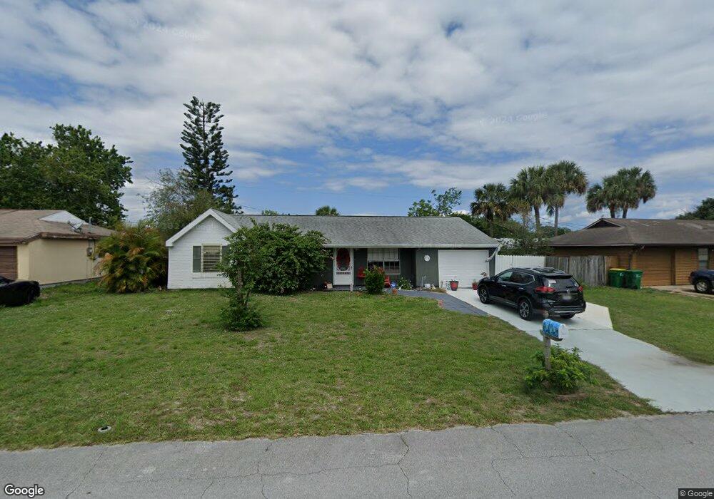
This home is located at 940 Tope St, Cocoa, FL 32927 and is currently estimated at $258,133, approximately $214 per square foot. 940 Tope St is a home located in Brevard County with nearby schools including Atlantis Elementary School, Space Coast Junior/Senior High School, and East Atlantic Prep of Brevard County.
Ownership History
Date
Name
Owned For
Owner Type
Purchase Details
Closed on
Nov 26, 2002
Sold by
Leab Jerry W
Bought by
Bieniasz Patricia V
Current Estimated Value
Home Financials for this Owner
Home Financials are based on the most recent Mortgage that was taken out on this home.
Original Mortgage
$63,350
Outstanding Balance
$27,329
Interest Rate
6.3%
Mortgage Type
Purchase Money Mortgage
Estimated Equity
$230,804
Purchase Details
Closed on
Feb 9, 2001
Sold by
Kiser Gregory W and Kiser Tammy B
Bought by
Leab Jerry W
Home Financials for this Owner
Home Financials are based on the most recent Mortgage that was taken out on this home.
Original Mortgage
$75,304
Interest Rate
6.91%
Mortgage Type
FHA
Create a Home Valuation Report for This Property
The Home Valuation Report is an in-depth analysis detailing your home's value as well as a comparison with similar homes in the area
Home Values in the Area
Average Home Value in this Area
Purchase History
| Date | Buyer | Sale Price | Title Company |
|---|---|---|---|
| Bieniasz Patricia V | $84,500 | -- | |
| Leab Jerry W | $75,900 | -- |
Source: Public Records
Mortgage History
| Date | Status | Borrower | Loan Amount |
|---|---|---|---|
| Open | Bieniasz Patricia V | $63,350 | |
| Previous Owner | Leab Jerry W | $75,304 |
Source: Public Records
Tax History
| Year | Tax Paid | Tax Assessment Tax Assessment Total Assessment is a certain percentage of the fair market value that is determined by local assessors to be the total taxable value of land and additions on the property. | Land | Improvement |
|---|---|---|---|---|
| 2025 | $915 | $56,880 | -- | -- |
| 2024 | $897 | $55,280 | -- | -- |
| 2023 | $897 | $53,670 | $0 | $0 |
| 2022 | $859 | $52,110 | $0 | $0 |
| 2021 | $858 | $50,600 | $0 | $0 |
| 2020 | $812 | $49,910 | $0 | $0 |
| 2019 | $750 | $48,790 | $0 | $0 |
| 2018 | $741 | $47,890 | $0 | $0 |
| 2017 | $731 | $46,910 | $0 | $0 |
| 2016 | $725 | $45,950 | $18,000 | $27,950 |
| 2015 | $722 | $45,640 | $15,000 | $30,640 |
| 2014 | $722 | $45,280 | $11,000 | $34,280 |
Source: Public Records
Map
Nearby Homes
- 214 Chase Rd
- 000 Arabella Ln
- 361 Payne Ave
- 208 Capron Rd
- 973 Poinsetta St
- 977 Poinsetta St
- 0 Kanawha St
- 414 Oakridge Ave
- 873 Dunbar St
- 865 Dunbar St
- 925 MacCo Rd
- 7420 U S Route 1 Unit 106
- 7350 N Highway 1 Unit 201
- 7330 N Highway 1 Unit 206
- 7310 N Highway 1 Unit 201
- 7300 N Highway 1 Unit 104
- 1040 Jersey St
- 7240 N Highway 1 Unit 106
- 7400 N Highway 1 Unit 105
- 7470 N Highway 1 Unit 105
Your Personal Tour Guide
Ask me questions while you tour the home.