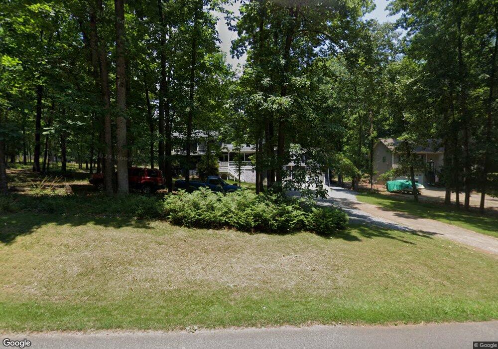
940 Victoria Landing Dr Woodstock, GA 30189
Sutallee NeighborhoodEstimated Value: $473,000 - $601,000
4
Beds
3
Baths
2,640
Sq Ft
$202/Sq Ft
Est. Value
About This Home
This home is located at 940 Victoria Landing Dr, Woodstock, GA 30189 and is currently estimated at $532,197, approximately $201 per square foot. 940 Victoria Landing Dr is a home located in Cherokee County with nearby schools including Boston Elementary School, E. T. Booth Middle School, and Etowah High School.
Ownership History
Date
Name
Owned For
Owner Type
Purchase Details
Closed on
Nov 5, 1998
Sold by
Hornsby Thomas H and Hornsby Anne W
Bought by
Hoopingarner Diana Lynn
Current Estimated Value
Home Financials for this Owner
Home Financials are based on the most recent Mortgage that was taken out on this home.
Original Mortgage
$128,250
Outstanding Balance
$26,378
Interest Rate
6.47%
Mortgage Type
New Conventional
Estimated Equity
$505,819
Create a Home Valuation Report for This Property
The Home Valuation Report is an in-depth analysis detailing your home's value as well as a comparison with similar homes in the area
Home Values in the Area
Average Home Value in this Area
Purchase History
| Date | Buyer | Sale Price | Title Company |
|---|---|---|---|
| Hoopingarner Diana Lynn | $135,000 | -- |
Source: Public Records
Mortgage History
| Date | Status | Borrower | Loan Amount |
|---|---|---|---|
| Open | Hoopingarner Diana Lynn | $128,250 |
Source: Public Records
Tax History Compared to Growth
Tax History
| Year | Tax Paid | Tax Assessment Tax Assessment Total Assessment is a certain percentage of the fair market value that is determined by local assessors to be the total taxable value of land and additions on the property. | Land | Improvement |
|---|---|---|---|---|
| 2025 | $977 | $186,052 | $34,000 | $152,052 |
| 2024 | $1,307 | $175,332 | $29,200 | $146,132 |
| 2023 | $777 | $166,012 | $29,200 | $136,812 |
| 2022 | $879 | $141,252 | $25,200 | $116,052 |
| 2021 | $863 | $117,452 | $21,040 | $96,412 |
| 2020 | $825 | $106,452 | $18,800 | $87,652 |
| 2019 | $782 | $95,040 | $16,200 | $78,840 |
| 2018 | $2,500 | $90,440 | $14,800 | $75,640 |
| 2017 | $2,540 | $228,300 | $14,800 | $76,520 |
| 2016 | $2,478 | $219,100 | $13,600 | $74,040 |
| 2015 | $2,227 | $195,100 | $13,600 | $64,440 |
| 2014 | $1,894 | $166,500 | $11,080 | $55,520 |
Source: Public Records
Map
Nearby Homes
- 504 N Little Victoria Rd
- 619 Lovinggood Trail
- 745 Cedar Creek Way Unit 1
- 819 Victoria Place
- 812 Willow Oak Dr
- 386 N Victoria Rd
- 1413 Reed Ln
- 401 Cottonwood Dr
- 617 Driftwood Dr
- 373 N Victoria Rd
- 923 Pine Cir
- 912 Oak Dr
- 313 Maltibe Dr
- 442 Colonial Walk
- 315 Pinewood Dr
- 0 Black Oak Trail Unit 7303191
- 0 Black Oak Trail Unit 10267626
- 146 Sunset Ln
- 1511 Harbor Watch Ct
- 7119 Big Woods Dr
- 942 Victoria Landing Dr
- 938 Victoria Landing Dr
- 936 Victoria Landing Dr
- 9128 Victoria Landing Dr
- 944 Victoria Landing Dr
- 931 Victoria Landing Dr
- 933 Victoria Landing Dr
- 929 Victoria Landing Dr
- 946 Victoria Landing Dr
- 934 Victoria Landing Dr
- 400 Lovinggood Landing Dr
- 927 Victoria Landing Dr
- 945 Victoria Landing Dr
- 506 Lovinggood Ct
- 948 Victoria Landing Dr
- 932 Victoria Landing Dr
- 504 Lovinggood Ct
- 401 Lovinggood Landing Dr
- 950 Victoria Landing Dr
- 925 Victoria Landing Dr