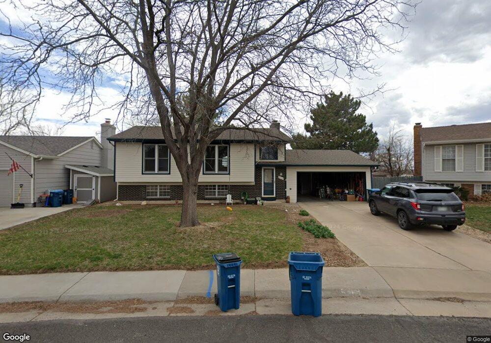
940 W Maple Ct Louisville, CO 80027
Estimated Value: $645,000 - $839,000
3
Beds
2
Baths
1,858
Sq Ft
$391/Sq Ft
Est. Value
About This Home
This home is located at 940 W Maple Ct, Louisville, CO 80027 and is currently estimated at $726,004, approximately $390 per square foot. 940 W Maple Ct is a home located in Boulder County with nearby schools including Coal Creek Elementary School, Louisville Middle School, and Monarch High School.
Ownership History
Date
Name
Owned For
Owner Type
Purchase Details
Closed on
Oct 14, 2005
Sold by
Dineen Mary E and Masterson Susan L
Bought by
Lucke Michael C
Current Estimated Value
Home Financials for this Owner
Home Financials are based on the most recent Mortgage that was taken out on this home.
Original Mortgage
$260,800
Outstanding Balance
$138,623
Interest Rate
5.65%
Mortgage Type
Fannie Mae Freddie Mac
Estimated Equity
$587,381
Purchase Details
Closed on
May 17, 1995
Sold by
Dinapoli Jeffrey M and Dinapoli Andrea
Bought by
Dineen Mary E
Home Financials for this Owner
Home Financials are based on the most recent Mortgage that was taken out on this home.
Original Mortgage
$85,000
Interest Rate
8.36%
Purchase Details
Closed on
Oct 30, 1981
Bought by
Lucke Michael C
Purchase Details
Closed on
Aug 3, 1979
Bought by
Lucke Michael C
Create a Home Valuation Report for This Property
The Home Valuation Report is an in-depth analysis detailing your home's value as well as a comparison with similar homes in the area
Home Values in the Area
Average Home Value in this Area
Purchase History
| Date | Buyer | Sale Price | Title Company |
|---|---|---|---|
| Lucke Michael C | $326,000 | Land Title Guarantee Company | |
| Dineen Mary E | $164,000 | -- | |
| Lucke Michael C | $80,500 | -- | |
| Lucke Michael C | -- | -- |
Source: Public Records
Mortgage History
| Date | Status | Borrower | Loan Amount |
|---|---|---|---|
| Open | Lucke Michael C | $260,800 | |
| Previous Owner | Dineen Mary E | $85,000 |
Source: Public Records
Tax History Compared to Growth
Tax History
| Year | Tax Paid | Tax Assessment Tax Assessment Total Assessment is a certain percentage of the fair market value that is determined by local assessors to be the total taxable value of land and additions on the property. | Land | Improvement |
|---|---|---|---|---|
| 2025 | $4,255 | $48,250 | $33,406 | $14,844 |
| 2024 | $4,255 | $48,250 | $33,406 | $14,844 |
| 2023 | $4,183 | $47,342 | $35,523 | $15,504 |
| 2022 | $3,334 | $34,639 | $22,970 | $11,669 |
| 2021 | $3,794 | $40,963 | $27,163 | $13,800 |
| 2020 | $3,345 | $35,743 | $17,446 | $18,297 |
| 2019 | $3,297 | $35,743 | $17,446 | $18,297 |
| 2018 | $2,881 | $32,249 | $10,440 | $21,809 |
| 2017 | $2,824 | $35,653 | $11,542 | $24,111 |
| 2016 | $2,550 | $28,982 | $13,054 | $15,928 |
| 2015 | $2,417 | $25,886 | $10,666 | $15,220 |
| 2014 | $2,213 | $25,886 | $10,666 | $15,220 |
Source: Public Records
Map
Nearby Homes
- 946 W Willow St
- 321 Majestic View Dr
- 160 Ponderosa Dr
- 1006 Honeysuckle Ln
- 848 Trail Ridge Dr
- 823 Trail Ridge Dr
- 182 Ridge Rd
- 810 Trail Ridge Dr
- 955 Arapahoe Cir
- 501 W Linden St
- 593 Wildrose Way
- 460 Paragon Dr
- 935 Eldorado Ln
- 935 Eldorado Ln Unit A
- 900 Eldorado Ln
- 958 Eldorado Ln
- 1136 W Enclave Cir
- 1000 Spring Dr
- 635 Paragon Dr
- 494 Owl Dr Unit 4
- 938 W Maple Ct
- 944 W Maple Ct
- 926 W Maple Ct
- 931 W Alder St
- 952 W Maple Ct
- 941 W Maple Ct
- 935 W Alder St
- 939 W Maple Ct
- 922 W Maple Ct
- 956 W Maple Ct
- 939 W Alder St
- 915 W Alder St
- 955 W Maple Ct
- 964 W Maple Ct
- 948 W Willow St
- 932 W Alder St
- 945 W Alder St
- 954 W Willow St
- 961 W Maple Ct
- 910 W Willow St