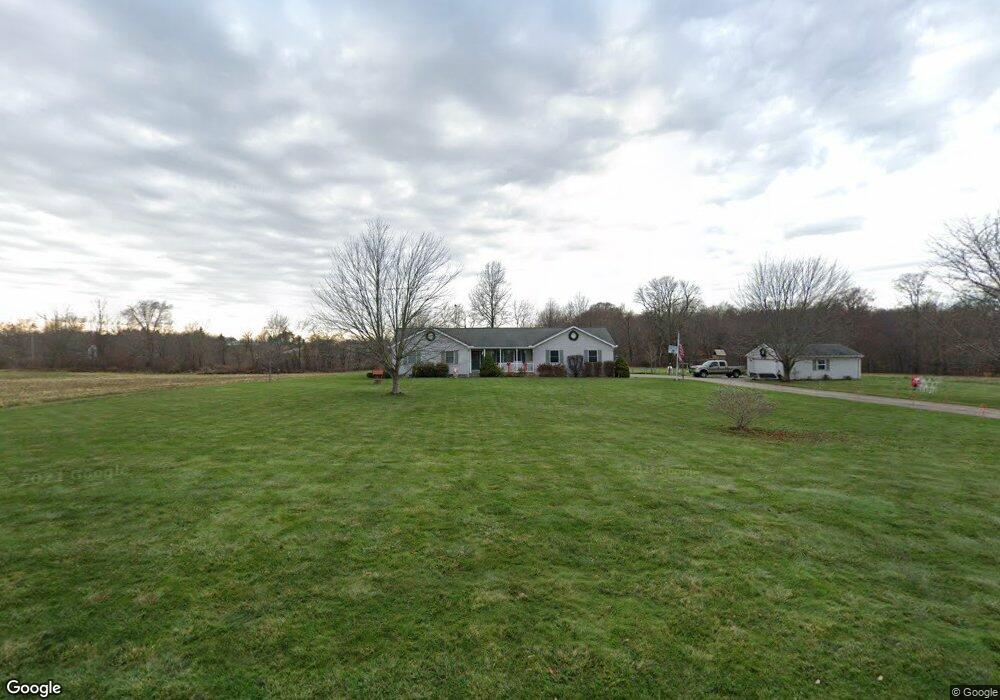
9400 County Road 20 Galion, OH 44833
Estimated Value: $288,000 - $408,133
5
Beds
3
Baths
1,404
Sq Ft
$249/Sq Ft
Est. Value
About This Home
This home is located at 9400 County Road 20, Galion, OH 44833 and is currently estimated at $350,033, approximately $249 per square foot. 9400 County Road 20 is a home located in Morrow County with nearby schools including Lexington High School.
Ownership History
Date
Name
Owned For
Owner Type
Purchase Details
Closed on
Aug 13, 2004
Sold by
Heimlich Charles S and Heimlich Rebecca T
Bought by
Dunham Timothy A and Dunham Mary K
Current Estimated Value
Purchase Details
Closed on
Apr 6, 1999
Sold by
Heimlich Charles S and Heimlich Rebecca T Smtih
Bought by
Heimlich Charles S and Heimlich Rebecca T
Purchase Details
Closed on
May 1, 1998
Bought by
Created **Parcel
Create a Home Valuation Report for This Property
The Home Valuation Report is an in-depth analysis detailing your home's value as well as a comparison with similar homes in the area
Home Values in the Area
Average Home Value in this Area
Purchase History
| Date | Buyer | Sale Price | Title Company |
|---|---|---|---|
| Dunham Timothy A | $193,000 | -- | |
| Heimlich Charles S | -- | -- | |
| Created **Parcel | $31,700 | -- |
Source: Public Records
Tax History Compared to Growth
Tax History
| Year | Tax Paid | Tax Assessment Tax Assessment Total Assessment is a certain percentage of the fair market value that is determined by local assessors to be the total taxable value of land and additions on the property. | Land | Improvement |
|---|---|---|---|---|
| 2024 | $5,423 | $110,180 | $21,350 | $88,830 |
| 2023 | $5,423 | $110,180 | $21,350 | $88,830 |
| 2022 | $4,661 | $78,720 | $14,070 | $64,650 |
| 2021 | $4,527 | $78,720 | $14,070 | $64,650 |
| 2020 | $4,532 | $78,720 | $14,070 | $64,650 |
| 2019 | $4,350 | $71,550 | $12,780 | $58,770 |
| 2018 | $3,721 | $71,550 | $12,780 | $58,770 |
| 2017 | $3,699 | $71,550 | $12,780 | $58,770 |
| 2016 | $3,543 | $67,560 | $10,540 | $57,020 |
| 2015 | $3,365 | $67,560 | $10,540 | $57,020 |
| 2014 | $3,412 | $67,560 | $10,540 | $57,020 |
| 2013 | $3,674 | $75,040 | $11,690 | $63,350 |
Source: Public Records
Map
Nearby Homes
- 9563 County Road 20
- 8444 County Road 20
- 9550 State Route 19
- 7775 Millsboro Rd
- 4663 Millsboro Rd W
- 7394 State Route 97 Unit Lot 580
- 4938 State Route 288
- 0 Oliver St
- 349 3rd Ave
- 7865 Anker Dr
- 8080 State Route 309
- 4695 Township 31 Rd
- 1009 State Route 314 S
- 771 S East St
- 7610 State Route 309
- 453 S Pierce St
- 911 Charles St
- 229 E Parson St
- 6602 Township Road 29
- 7425 Township Road 49
- 9424 County Road 20
- 6158 State Route 288
- 6140 State Route 288
- 6250 State Route 288
- 9523 County Road 20
- 6309 State Route 288
- 6309 Ohio 288
- 9250 County Road 20
- 5991 State Route 288
- 6000 State Route 288
- 6400 State Route 288
- 5975 State Route 288
- 6409 State Route 288
- 9601 County Road 20
- 6415 State Route 288
- 6401 Twp 255 Rd
- 5959 State Route 288
- 6435 State Route 288
- 6420 State Route 288
- 9661 County Road 20