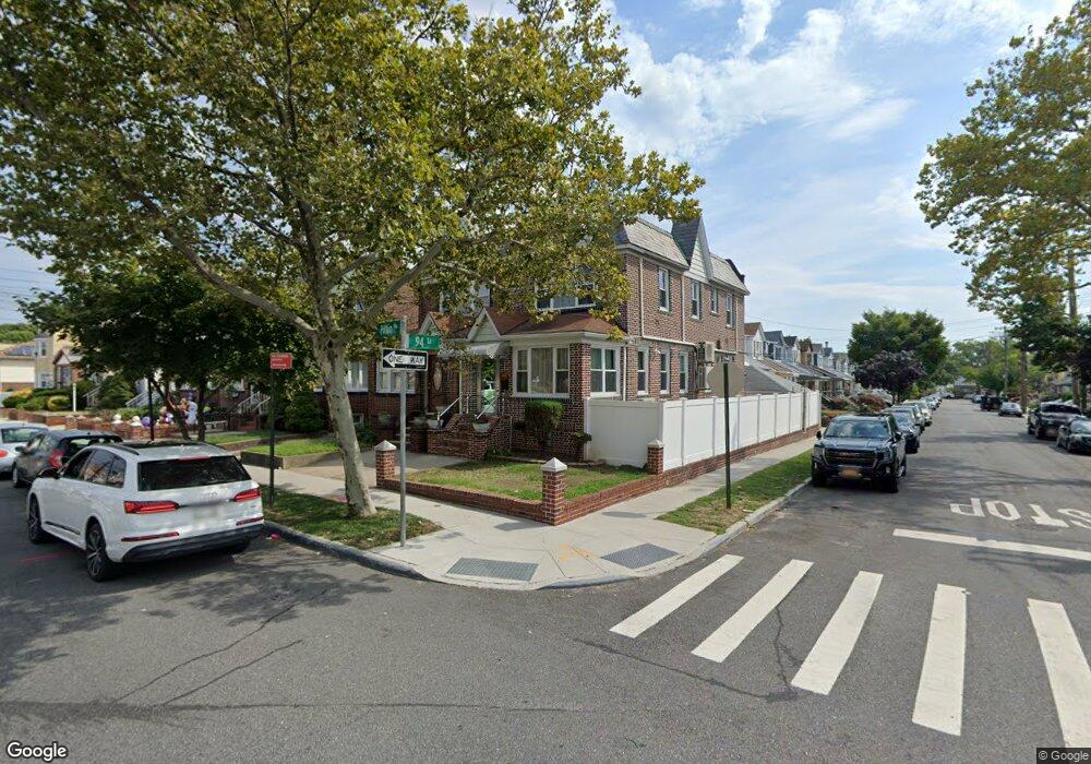
9404 Pitkin Ave Ozone Park, NY 11417
Ozone Park NeighborhoodEstimated Value: $750,000 - $893,000
--
Bed
--
Bath
1,428
Sq Ft
$586/Sq Ft
Est. Value
About This Home
This home is located at 9404 Pitkin Ave, Ozone Park, NY 11417 and is currently estimated at $837,010, approximately $586 per square foot. 9404 Pitkin Ave is a home located in Queens County with nearby schools including P.S./M.S. 146 Howard Beach, Robert H. Goddard High School, and John Adams High School.
Ownership History
Date
Name
Owned For
Owner Type
Purchase Details
Closed on
Dec 30, 1999
Sold by
Mcnulty Thomas and Mcnulty James
Bought by
Santiago Waleska
Current Estimated Value
Home Financials for this Owner
Home Financials are based on the most recent Mortgage that was taken out on this home.
Original Mortgage
$140,000
Outstanding Balance
$44,582
Interest Rate
7.87%
Estimated Equity
$792,428
Purchase Details
Closed on
Feb 9, 1998
Sold by
Pasaretti Salvatore and Passaretti Marie
Bought by
Mcnulty Thomas and Mcnulty James
Home Financials for this Owner
Home Financials are based on the most recent Mortgage that was taken out on this home.
Original Mortgage
$116,250
Interest Rate
6.85%
Create a Home Valuation Report for This Property
The Home Valuation Report is an in-depth analysis detailing your home's value as well as a comparison with similar homes in the area
Home Values in the Area
Average Home Value in this Area
Purchase History
| Date | Buyer | Sale Price | Title Company |
|---|---|---|---|
| Santiago Waleska | $175,000 | Stewart Title Insurance Co | |
| Mcnulty Thomas | $155,000 | Stewart Title Insurance Co |
Source: Public Records
Mortgage History
| Date | Status | Borrower | Loan Amount |
|---|---|---|---|
| Open | Santiago Waleska | $140,000 | |
| Previous Owner | Mcnulty Thomas | $116,250 |
Source: Public Records
Tax History Compared to Growth
Tax History
| Year | Tax Paid | Tax Assessment Tax Assessment Total Assessment is a certain percentage of the fair market value that is determined by local assessors to be the total taxable value of land and additions on the property. | Land | Improvement |
|---|---|---|---|---|
| 2025 | $7,197 | $36,427 | $10,600 | $25,827 |
| 2024 | $7,197 | $35,831 | $9,792 | $26,039 |
| 2023 | $6,797 | $33,840 | $9,581 | $24,259 |
| 2022 | $6,755 | $38,820 | $13,200 | $25,620 |
| 2021 | $6,772 | $39,900 | $13,200 | $26,700 |
| 2020 | $6,425 | $40,320 | $13,200 | $27,120 |
| 2019 | $6,246 | $37,980 | $13,200 | $24,780 |
| 2018 | $5,749 | $28,200 | $10,340 | $17,860 |
| 2017 | $2,930 | $28,200 | $12,508 | $15,692 |
| 2016 | $5,360 | $28,200 | $12,508 | $15,692 |
| 2015 | $2,989 | $25,297 | $13,656 | $11,641 |
| 2014 | $2,989 | $24,883 | $13,057 | $11,826 |
Source: Public Records
Map
Nearby Homes
- 9515 Pitkin Ave
- 95-18 Linden Blvd
- 9003 Albert Rd
- 96-15 149th Ave
- 13723 Lafayette St
- 96-06 134th Rd
- 94- 24 Magnolia Ct Unit 3A
- 13319 Crossbay Blvd
- 90-28 Pitkin Ave Unit 1,2 and 3
- 96-36 149th Ave
- 9704 Pitkin Ave
- 150-19 95th St Unit 3
- 91-25 Gold Rd
- 9439 134th Ave
- 150-06 Hawtree St
- 8851 Pitkin Ave
- 8837 Pitkin Ave
- 89- 25 151st Ave Unit 4S
- 150-45 Centerville St Unit 3B
- 8812 Albert Rd
- 94-04 Pitkin Ave
- 9402 Pitkin Ave
- 9406 Pitkin Ave
- 137-11 94th St
- 9408 Pitkin Ave
- 9410 Pitkin Ave
- 94-10 Pitkin Ave
- 13711 94th St
- 94-12 Pitkin Ave
- 9412 Pitkin Ave
- 13713 94th St
- 137-15 94th St
- 13715 94th St
- 9414 Pitkin Ave
- 137-08 94th St
- 94-14 Pitkin Ave
- 137-04 94th St
- 137-17 94th St
- 13717 94th St
- 13712 95th St