
Seller's Agent in 2021
Lee Jordan
Executive Group Realty LLC
(706) 577-7160
13 in this area
59 Total Sales


Estimated Value: $385,628 - $520,000
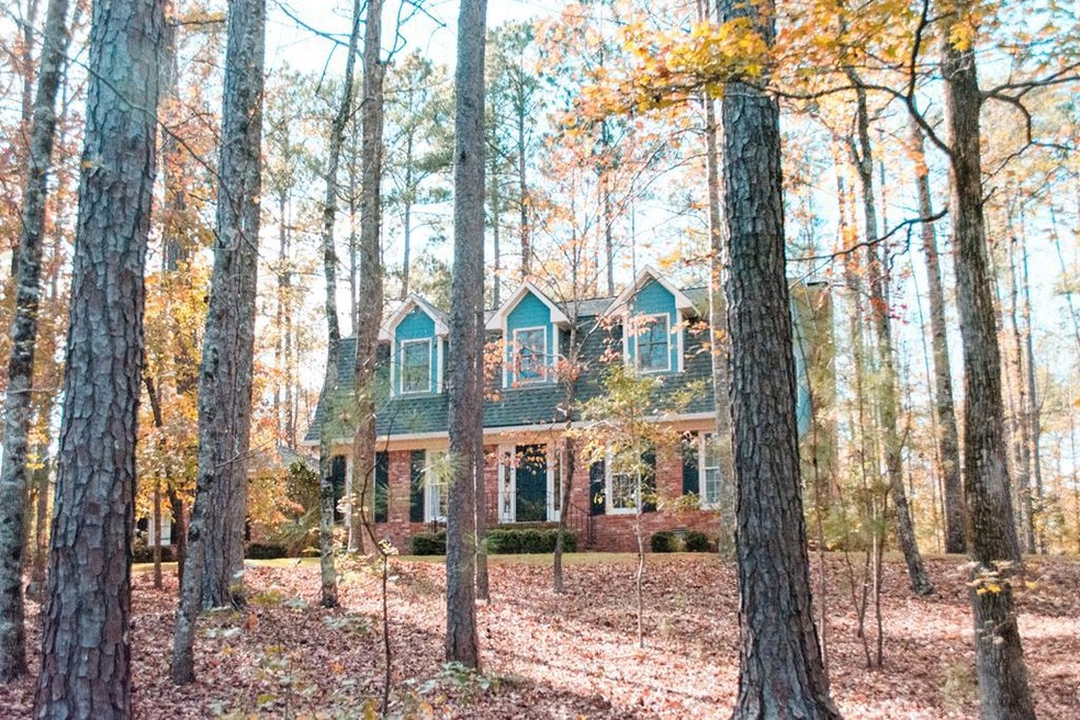
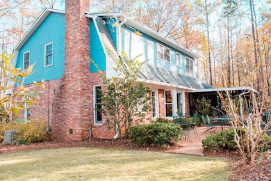
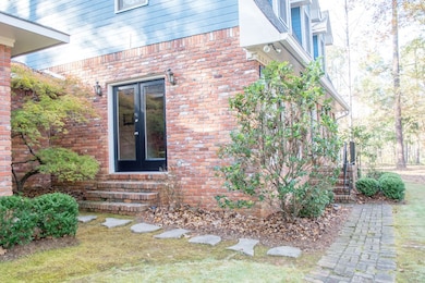
Back on the market! Contract fell through! Extremely well kept home in desirable NW Columbus. Custom built home on almost 2 acres. Listed as a 3 bedroom but the study could be considered a 4th bedroom. 2 car garge, covered patio, new paint, Great neighborhood to raise a family, convenient to I-185 and shopping but away from the city. Very desired school district. Custom woodwork on the interior from flooring to the staircase. Impressive home that is ready to raise another family!
Last Agent to Sell the Property
Executive Group Realty LLC Brokerage Phone: 7065071899 License #351371 Listed on: 11/24/2020
| Date | Buyer | Sale Price | Title Company |
|---|---|---|---|
| Warren April Marie | $305,000 | -- | |
| Harrelson David M | $246,000 | -- |
| Date | Status | Borrower | Loan Amount |
|---|---|---|---|
| Open | Warren April Marie | $244,000 | |
| Previous Owner | Harrelson David M | $196,800 |
| Date | Event | Price | List to Sale | Price per Sq Ft |
|---|---|---|---|---|
| 08/18/2024 08/18/24 | Off Market | $305,000 | -- | -- |
| 03/01/2021 03/01/21 | Sold | $305,000 | -1.6% | $116 / Sq Ft |
| 01/11/2021 01/11/21 | Pending | -- | -- | -- |
| 11/24/2020 11/24/20 | For Sale | $309,900 | -- | $118 / Sq Ft |
| Year | Tax Paid | Tax Assessment Tax Assessment Total Assessment is a certain percentage of the fair market value that is determined by local assessors to be the total taxable value of land and additions on the property. | Land | Improvement |
|---|---|---|---|---|
| 2025 | $3,980 | $131,840 | $24,416 | $107,424 |
| 2024 | $3,978 | $131,840 | $24,416 | $107,424 |
| 2023 | $331 | $131,840 | $24,416 | $107,424 |
| 2022 | $4,149 | $114,848 | $24,416 | $90,432 |
| 2021 | $3,422 | $97,192 | $24,416 | $72,776 |
| 2020 | $3,423 | $97,192 | $24,416 | $72,776 |
| 2019 | $3,435 | $97,192 | $24,416 | $72,776 |
| 2018 | $3,982 | $97,192 | $24,416 | $72,776 |
| 2017 | $1,538 | $97,192 | $24,416 | $72,776 |
| 2016 | $1,545 | $50,716 | $3,868 | $46,848 |
| 2015 | $619 | $50,716 | $3,868 | $46,848 |
| 2014 | $620 | $50,716 | $3,868 | $46,848 |
| 2013 | -- | $50,716 | $3,868 | $46,848 |
Seller's Agent in 2021
Lee Jordan
Executive Group Realty LLC
(706) 577-7160
13 in this area
59 Total Sales
S
Buyer's Agent in 2021
Sarah Smith
Coldwell Banker / Kennon, Parker, Duncan & Davis
(706) 415-5662
1 in this area
8 Total Sales
Source: Columbus Board of REALTORS® (GA)
MLS Number: 182434
APN: 177-004-003
Disclaimer: Certain information contained herein is derived from information provided by parties other than Homes.com. All information provided is deemed reliable, but is not guaranteed to be accurate and should be independently verified.
![]() IDX information is provided exclusively for personal, non-commercial use, and may not be used for any purpose other than to identify prospective properties consumers may be interested in purchasing. Information is deemed reliable but not guaranteed.
IDX information is provided exclusively for personal, non-commercial use, and may not be used for any purpose other than to identify prospective properties consumers may be interested in purchasing. Information is deemed reliable but not guaranteed.
Ask me questions while you tour the home.