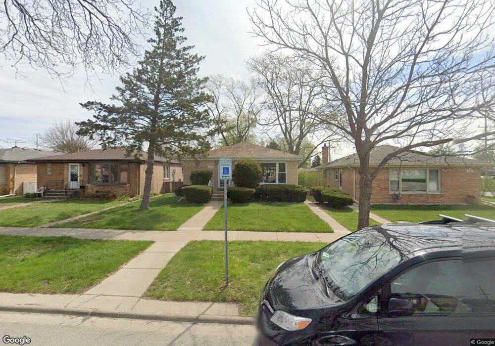
9405 Lorel Ave Skokie, IL 60077
Barcelona NeighborhoodEstimated Value: $422,000 - $480,000
3
Beds
2
Baths
1,378
Sq Ft
$328/Sq Ft
Est. Value
About This Home
This home is located at 9405 Lorel Ave, Skokie, IL 60077 and is currently estimated at $452,244, approximately $328 per square foot. 9405 Lorel Ave is a home located in Cook County with nearby schools including Old Orchard Jr High School, Jane Stenson School, and Niles North High School.
Ownership History
Date
Name
Owned For
Owner Type
Purchase Details
Closed on
Jan 6, 2023
Sold by
David Doris
Bought by
9405 Lorel Irrevocable Real Estate Trust
Current Estimated Value
Purchase Details
Closed on
Dec 6, 1993
Sold by
Zucker Bella
Bought by
David Robert Z and David Doris S
Home Financials for this Owner
Home Financials are based on the most recent Mortgage that was taken out on this home.
Original Mortgage
$79,250
Interest Rate
7.26%
Create a Home Valuation Report for This Property
The Home Valuation Report is an in-depth analysis detailing your home's value as well as a comparison with similar homes in the area
Home Values in the Area
Average Home Value in this Area
Purchase History
| Date | Buyer | Sale Price | Title Company |
|---|---|---|---|
| 9405 Lorel Irrevocable Real Estate Trust | -- | None Listed On Document | |
| David Robert Z | $105,666 | -- |
Source: Public Records
Mortgage History
| Date | Status | Borrower | Loan Amount |
|---|---|---|---|
| Previous Owner | David Robert Z | $79,250 |
Source: Public Records
Tax History
| Year | Tax Paid | Tax Assessment Tax Assessment Total Assessment is a certain percentage of the fair market value that is determined by local assessors to be the total taxable value of land and additions on the property. | Land | Improvement |
|---|---|---|---|---|
| 2025 | $6,504 | $34,001 | $8,138 | $25,863 |
| 2024 | $6,504 | $32,000 | $6,825 | $25,175 |
| 2023 | $2,647 | $32,000 | $6,825 | $25,175 |
| 2022 | $2,647 | $32,000 | $6,825 | $25,175 |
| 2021 | $166 | $26,194 | $4,200 | $21,994 |
| 2020 | $5,585 | $26,194 | $4,200 | $21,994 |
| 2019 | $5,730 | $29,432 | $4,200 | $25,232 |
| 2018 | $2,648 | $26,663 | $3,806 | $22,857 |
| 2017 | $2,621 | $26,663 | $3,806 | $22,857 |
| 2016 | $3,204 | $26,663 | $3,806 | $22,857 |
| 2015 | $3,621 | $22,336 | $3,281 | $19,055 |
| 2014 | $3,463 | $22,336 | $3,281 | $19,055 |
| 2013 | $3,537 | $22,336 | $3,281 | $19,055 |
Source: Public Records
Map
Nearby Homes
- 9539 Lorel Ave
- 9410 Lawler Ave
- 9655 Woods Dr Unit 517
- 9655 Woods Dr Unit 1102
- 9725 Woods Dr Unit 1913
- 9725 Woods Dr Unit 309
- 9725 Woods Dr Unit 1005
- 9725 Woods Dr Unit 802
- 9725 Woods Dr Unit 1502
- 5644 Lyons St
- 9529 Bronx Ave Unit 401
- 4949 Golf Rd Unit 308
- 5738 Lyons St
- 9350 Skokie Blvd Unit 510
- 9242 Gross Point Rd Unit C107
- 9242 Gross Point Rd Unit A310
- 9240 Gross Point Rd Unit 410E
- 9017 Major Ave
- 5536 Greenwood St
- 8912 Harms Rd
- 9401 Lorel Ave
- 9409 Lorel Ave
- 9415 Lorel Ave
- 9421 Lorel Ave
- 9404 Lockwood Ave
- 9410 Lockwood Ave
- 9410 Lockwood Ave
- 9400 Lockwood Ave
- 9414 Lockwood Ave
- 9416 Lockwood Ave
- 9425 Lorel Ave
- 9406 Lorel Ave
- 9400 Lorel Ave
- 9410 Lorel Ave
- 9414 Lorel Ave
- 9420 Lockwood Ave
- 9420 Lorel Ave
- 9429 Lorel Ave
- 9424 Lockwood Ave
- 9428 Lockwood Ave
Your Personal Tour Guide
Ask me questions while you tour the home.