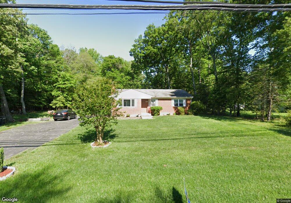
9409 Dangerfield Rd Clinton, MD 20735
Estimated Value: $327,000 - $441,000
--
Bed
2
Baths
1,236
Sq Ft
$312/Sq Ft
Est. Value
About This Home
This home is located at 9409 Dangerfield Rd, Clinton, MD 20735 and is currently estimated at $385,633, approximately $312 per square foot. 9409 Dangerfield Rd is a home located in Prince George's County with nearby schools including Francis T. Evans Elementary School, Stephen Decatur Middle School, and Dr. Henry A. Wise Jr. High School.
Ownership History
Date
Name
Owned For
Owner Type
Purchase Details
Closed on
Oct 29, 2020
Sold by
Dobbs Michael
Bought by
Dobbs Michael and Dobbs Rhonda A
Current Estimated Value
Home Financials for this Owner
Home Financials are based on the most recent Mortgage that was taken out on this home.
Original Mortgage
$202,000
Outstanding Balance
$179,043
Interest Rate
2.71%
Mortgage Type
New Conventional
Estimated Equity
$206,590
Purchase Details
Closed on
Jan 15, 2002
Sold by
Dobbs Michael
Bought by
Dobbs Michael
Purchase Details
Closed on
Feb 9, 2000
Sold by
Dobbs Michael
Bought by
Dobbs Michael and Dobbs Rhonda A
Purchase Details
Closed on
Nov 29, 1999
Sold by
Ventre Frances M
Bought by
Dobbs Michael
Create a Home Valuation Report for This Property
The Home Valuation Report is an in-depth analysis detailing your home's value as well as a comparison with similar homes in the area
Home Values in the Area
Average Home Value in this Area
Purchase History
| Date | Buyer | Sale Price | Title Company |
|---|---|---|---|
| Dobbs Michael | -- | Accommodation | |
| Dobbs Michael | -- | -- | |
| Dobbs Michael | -- | -- | |
| Dobbs Michael | $145,000 | -- |
Source: Public Records
Mortgage History
| Date | Status | Borrower | Loan Amount |
|---|---|---|---|
| Open | Dobbs Michael | $202,000 |
Source: Public Records
Tax History Compared to Growth
Tax History
| Year | Tax Paid | Tax Assessment Tax Assessment Total Assessment is a certain percentage of the fair market value that is determined by local assessors to be the total taxable value of land and additions on the property. | Land | Improvement |
|---|---|---|---|---|
| 2025 | $4,295 | $314,100 | $100,000 | $214,100 |
| 2024 | $4,295 | $287,133 | $0 | $0 |
| 2023 | $4,095 | $260,167 | $0 | $0 |
| 2022 | $2,593 | $233,200 | $100,000 | $133,200 |
| 2021 | $319 | $221,733 | $0 | $0 |
| 2020 | $319 | $210,267 | $0 | $0 |
| 2019 | $3,352 | $198,800 | $100,000 | $98,800 |
| 2018 | $3,252 | $192,100 | $0 | $0 |
| 2017 | $3,153 | $185,400 | $0 | $0 |
| 2016 | -- | $178,700 | $0 | $0 |
| 2015 | $2,788 | $176,000 | $0 | $0 |
| 2014 | $2,788 | $173,300 | $0 | $0 |
Source: Public Records
Map
Nearby Homes
- 9401 Cheltenham Ave
- 10104 Dangerfield Rd
- 9007 Oriley Dr
- 7804 New Ascot Ln
- 9008 Goldfield Place
- 9104 Rama Ct
- 9013 Helmsley Dr
- 9203 Foxcroft Ave
- 9004 Eldon Dr
- 9401 Surratts Manor Dr
- 8910 Edison Ln
- 9902 Fox Run Dr
- 8518 Cedar Chase Dr
- 9613 Quiet Brook Ln
- 0 Clinton Vista Ln
- 9923 Quiet Brook Ln
- 8403 Black Willow Ct
- 8301 Cedarview Ct
- 8304 Cedarview Ct
- 7716 Surratts Rd
- 9405 Dangerfield Rd
- 9410 Dangerfield Rd
- 9403 Dangerfield Rd
- 9404 Dangerfield Rd
- 9406 Dangerfield Rd
- 9500 Massie Dr
- 9401 Dangerfield Rd
- 9505 Atom Rd
- 9402 Dangerfield Rd
- 9317 Dangerfield Rd
- 9411 Dangerfield Rd
- 9504 Dangerfield Rd
- 9315 Dangerfield Rd
- 9506 Massie Dr
- 9415 Dangerfield Rd
- 9502 Atom Rd
- 9507 Atom Rd
- 9400 Dangerfield Rd
- 9508 Massie Dr
- 9504 Atom Rd