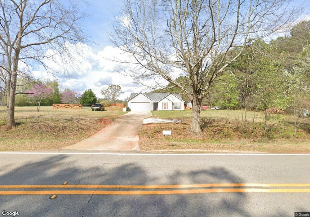
941 Coan Dr Locust Grove, GA 30248
Estimated Value: $255,000 - $264,000
3
Beds
2
Baths
1,443
Sq Ft
$180/Sq Ft
Est. Value
About This Home
This home is located at 941 Coan Dr, Locust Grove, GA 30248 and is currently estimated at $260,207, approximately $180 per square foot. 941 Coan Dr is a home located in Henry County with nearby schools including Tussahaw Elementary School, Locust Grove Middle School, and Locust Grove High School.
Ownership History
Date
Name
Owned For
Owner Type
Purchase Details
Closed on
Apr 22, 2004
Sold by
Powell Carolyn J and Powell Derek W
Bought by
Deutsch Michael A and Deutsch Samantha
Current Estimated Value
Home Financials for this Owner
Home Financials are based on the most recent Mortgage that was taken out on this home.
Original Mortgage
$113,705
Outstanding Balance
$54,328
Interest Rate
5.88%
Mortgage Type
New Conventional
Estimated Equity
$205,879
Purchase Details
Closed on
Jun 9, 1997
Sold by
Eagle Builders Inc
Bought by
Powell Derek W and Powell Carolyn J
Home Financials for this Owner
Home Financials are based on the most recent Mortgage that was taken out on this home.
Original Mortgage
$87,200
Interest Rate
8.01%
Mortgage Type
New Conventional
Create a Home Valuation Report for This Property
The Home Valuation Report is an in-depth analysis detailing your home's value as well as a comparison with similar homes in the area
Home Values in the Area
Average Home Value in this Area
Purchase History
| Date | Buyer | Sale Price | Title Company |
|---|---|---|---|
| Deutsch Michael A | $112,000 | -- | |
| Powell Derek W | $96,900 | -- |
Source: Public Records
Mortgage History
| Date | Status | Borrower | Loan Amount |
|---|---|---|---|
| Open | Deutsch Michael A | $113,705 | |
| Previous Owner | Powell Derek W | $87,200 |
Source: Public Records
Tax History Compared to Growth
Tax History
| Year | Tax Paid | Tax Assessment Tax Assessment Total Assessment is a certain percentage of the fair market value that is determined by local assessors to be the total taxable value of land and additions on the property. | Land | Improvement |
|---|---|---|---|---|
| 2025 | $2,877 | $106,560 | $15,160 | $91,400 |
| 2024 | $2,877 | $101,160 | $13,680 | $87,480 |
| 2023 | $2,301 | $99,400 | $13,160 | $86,240 |
| 2022 | $2,249 | $75,800 | $12,160 | $63,640 |
| 2021 | $1,978 | $64,360 | $10,440 | $53,920 |
| 2020 | $1,859 | $59,320 | $9,800 | $49,520 |
| 2019 | $1,725 | $53,640 | $9,320 | $44,320 |
| 2018 | $1,612 | $48,840 | $8,600 | $40,240 |
| 2016 | $1,156 | $36,160 | $6,400 | $29,760 |
| 2015 | $1,117 | $34,520 | $7,200 | $27,320 |
| 2014 | $971 | $30,640 | $7,200 | $23,440 |
Source: Public Records
Map
Nearby Homes
- 1000 Coan Dr
- 521 Deadwood Trail
- 705 Seabolt Rd
- 601 Amerigo Ct
- 678 Seabolt Rd
- 143 Kimbell Farm Dr
- 201 Nina Cir
- 604 Onieda Dr
- 560 Coan Dr
- 218 Baxter Ln
- 1579 S Bethany Rd
- 121, 125, 129 Case Dr
- 390 Coan Dr
- 705 S Bethany Rd
- 1126 Old Jackson Rd
- 435 Rabbit Run
- 100 Harbin Trail
- 1171 King Mill Rd
- 281 Laney Dr
- 995 Old Jackson Rd
- 931 Coan Dr
- 931 Coan Dr Unit 236
- 903 Coan Dr
- 940 Coan Dr
- 996 Coan Dr
- 75 Seabolt Dr
- 65 Seabolt Dr
- 912 Coan Dr
- 851 Coan Dr
- 40 Willow Creek Dr
- 971 Coan Dr
- 41 Willow Creek Dr
- 85 Seabolt Dr
- 0 Coan Dr Unit 3192244
- 0 Coan Dr Unit 8678334
- 0 Coan Dr Unit 8633343
- 0 Coan Dr Unit 8483798
- 0 Coan Dr Unit 8250616
- 0 Coan Dr Unit 8243014
- 0 Coan Dr Unit 8479314