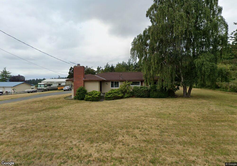
941 Monroe Landing Rd Oak Harbor, WA 98277
Estimated Value: $490,000 - $534,018
3
Beds
3
Baths
1,700
Sq Ft
$299/Sq Ft
Est. Value
About This Home
This home is located at 941 Monroe Landing Rd, Oak Harbor, WA 98277 and is currently estimated at $507,505, approximately $298 per square foot. 941 Monroe Landing Rd is a home located in Island County with nearby schools including Hillcrest Elementary School, Oak Harbor Middle School, and Oak Harbor High School.
Ownership History
Date
Name
Owned For
Owner Type
Purchase Details
Closed on
Sep 19, 2007
Sold by
Sem Henry A and Sem Jeanette M
Bought by
Sem Mark A
Current Estimated Value
Home Financials for this Owner
Home Financials are based on the most recent Mortgage that was taken out on this home.
Original Mortgage
$259,400
Outstanding Balance
$163,482
Interest Rate
6.57%
Mortgage Type
VA
Estimated Equity
$344,023
Create a Home Valuation Report for This Property
The Home Valuation Report is an in-depth analysis detailing your home's value as well as a comparison with similar homes in the area
Home Values in the Area
Average Home Value in this Area
Purchase History
| Date | Buyer | Sale Price | Title Company |
|---|---|---|---|
| Sem Mark A | $251,000 | Chicago Title Co Island Div |
Source: Public Records
Mortgage History
| Date | Status | Borrower | Loan Amount |
|---|---|---|---|
| Open | Sem Mark A | $259,400 |
Source: Public Records
Tax History Compared to Growth
Tax History
| Year | Tax Paid | Tax Assessment Tax Assessment Total Assessment is a certain percentage of the fair market value that is determined by local assessors to be the total taxable value of land and additions on the property. | Land | Improvement |
|---|---|---|---|---|
| 2025 | $2,988 | $459,803 | $220,000 | $239,803 |
| 2024 | $2,925 | $422,100 | $210,000 | $212,100 |
| 2023 | $2,925 | $415,563 | $200,000 | $215,563 |
| 2022 | $3,360 | $398,335 | $200,000 | $198,335 |
| 2021 | $3,024 | $325,188 | $150,000 | $175,188 |
| 2020 | $2,843 | $291,573 | $120,000 | $171,573 |
| 2019 | $2,244 | $276,166 | $150,000 | $126,166 |
| 2018 | $2,334 | $237,479 | $140,000 | $97,479 |
| 2017 | $1,906 | $218,365 | $120,000 | $98,365 |
| 2016 | $1,993 | $190,153 | $90,000 | $100,153 |
| 2015 | -- | $191,944 | $90,000 | $101,944 |
| 2013 | -- | $207,524 | $102,000 | $105,524 |
Source: Public Records
Map
Nearby Homes
- 1123 Forest Glen Rd
- 1345 Arnold Rd
- 577 Scenic Heights Rd
- 1066 View Ridge Dr
- 930 Cove View Cir
- 990 Cove View Cir
- 1085 Harrison St
- 1054 Donald Ave
- 967 Donald Ave
- 1594 Douglas St
- 994 Diane Ave
- 793 Starwana Ct
- 1223 Rainier Ln
- 0 State Route 20 Unit NWM2157311
- 0 State Route 20 Unit NWM2362163
- 0 State Route 20 Unit NWM2157309
- 27540 Sr 20
- 1204 NE Leisure St
- 27193 State Route 20
- 0 NW Front St Unit 1669999
- 937 Monroe Landing Rd
- 938 Monroe Landing Rd
- 929 Monroe Landing Rd
- 944 Monroe Landing Rd
- 934 Monroe Landing Rd
- 1215 Arnold Rd
- 948 Monroe Landing Rd
- 1192 Wildwood Dr
- 915 Monroe Landing Rd
- 937 Burroughs Ave
- 1182 Wildwood Dr
- 1189 Seawall Ln
- 943 Burroughs Ave
- 910 Monroe Landing Rd
- 947 Burroughs Ave
- 1189 Wildwood Dr
- 1183 Seawall Ln
- 1183 Wildwood Dr
- 1177 Seawall Ln
- 909 Burroughs Ave