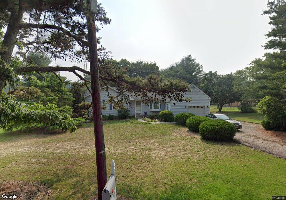
941 Reed Ave Franklinville, NJ 08322
Franklin Township NeighborhoodEstimated Value: $322,594 - $412,000
--
Bed
--
Bath
1,760
Sq Ft
$207/Sq Ft
Est. Value
About This Home
This home is located at 941 Reed Ave, Franklinville, NJ 08322 and is currently estimated at $365,149, approximately $207 per square foot. 941 Reed Ave is a home located in Gloucester County with nearby schools including Delsea Regional Middle School, Delsea Regional High School, and St Michael The Archangel Regional School.
Ownership History
Date
Name
Owned For
Owner Type
Purchase Details
Closed on
May 26, 2005
Sold by
Hauserman Christine M and Hauserman James
Bought by
Balasi Diane
Current Estimated Value
Home Financials for this Owner
Home Financials are based on the most recent Mortgage that was taken out on this home.
Original Mortgage
$120,000
Outstanding Balance
$62,728
Interest Rate
5.78%
Mortgage Type
Fannie Mae Freddie Mac
Estimated Equity
$302,421
Purchase Details
Closed on
Apr 26, 1999
Sold by
Griffin Daniel S and Griffin Terri L
Bought by
Toppi Christine M and Toppi Joseph M
Home Financials for this Owner
Home Financials are based on the most recent Mortgage that was taken out on this home.
Original Mortgage
$107,924
Interest Rate
6.92%
Mortgage Type
FHA
Create a Home Valuation Report for This Property
The Home Valuation Report is an in-depth analysis detailing your home's value as well as a comparison with similar homes in the area
Home Values in the Area
Average Home Value in this Area
Purchase History
| Date | Buyer | Sale Price | Title Company |
|---|---|---|---|
| Balasi Diane | $230,000 | -- | |
| Hauserman Christine M | -- | -- | |
| Toppi Christine M | $108,000 | Surety Title Corporation |
Source: Public Records
Mortgage History
| Date | Status | Borrower | Loan Amount |
|---|---|---|---|
| Open | Balasi Diane | $120,000 | |
| Previous Owner | Toppi Christine M | $107,924 |
Source: Public Records
Tax History Compared to Growth
Tax History
| Year | Tax Paid | Tax Assessment Tax Assessment Total Assessment is a certain percentage of the fair market value that is determined by local assessors to be the total taxable value of land and additions on the property. | Land | Improvement |
|---|---|---|---|---|
| 2025 | $5,482 | $143,400 | $30,400 | $113,000 |
| 2024 | $5,356 | $143,400 | $30,400 | $113,000 |
| 2023 | $5,356 | $143,400 | $30,400 | $113,000 |
| 2022 | $5,211 | $143,400 | $30,400 | $113,000 |
| 2021 | $4,684 | $143,400 | $30,400 | $113,000 |
| 2020 | $5,084 | $143,400 | $30,400 | $113,000 |
| 2019 | $5,016 | $143,400 | $30,400 | $113,000 |
| 2018 | $4,950 | $143,400 | $30,400 | $113,000 |
| 2017 | $4,858 | $143,400 | $30,400 | $113,000 |
| 2016 | $4,835 | $143,400 | $30,400 | $113,000 |
| 2015 | $4,648 | $143,400 | $30,400 | $113,000 |
| 2014 | $4,476 | $143,400 | $30,400 | $113,000 |
Source: Public Records
Map
Nearby Homes
- 48 Pine St
- 595 Royal Ave
- 124 Idle Lake Rd
- 32 5th St
- 30 2nd St
- 2165 Delsea Dr
- Lot 89 Delsea Dr
- 900 Delsea Dr
- 51 Elmer St
- 461 3 Bridge Rd
- 1800 Coles Mill Rd
- 141 Fries Mill Rd
- 1780 Coles Mill Rd
- 1756 Delsea Dr
- 0 Fries Mill Rd
- 1664 Delsea Dr
- 295 Blackwood Ave
- 1612 Delsea Dr
- 0 Pennsylvania Ave
- 1586 Delsea Dr