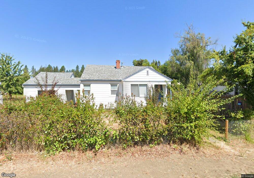
941 W First Ave Sutherlin, OR 97479
Estimated Value: $210,000 - $232,000
2
Beds
1
Bath
789
Sq Ft
$276/Sq Ft
Est. Value
About This Home
This home is located at 941 W First Ave, Sutherlin, OR 97479 and is currently estimated at $217,958, approximately $276 per square foot. 941 W First Ave is a home with nearby schools including East Sutherlin Primary School, West Sutherlin Intermediate School, and Sutherlin Middle School.
Ownership History
Date
Name
Owned For
Owner Type
Purchase Details
Closed on
Nov 30, 2017
Sold by
Hanlin John
Bought by
Wells Fargo Bank Na
Current Estimated Value
Purchase Details
Closed on
Nov 13, 2017
Sold by
Wylie Jerry L and Wylie Jerry Lee
Bought by
Wells Fargo Bank N A
Purchase Details
Closed on
Oct 2, 2017
Sold by
Robinson Brenda
Bought by
Robinson Brenda A and Robinson Living Trust
Purchase Details
Closed on
Jun 14, 2017
Sold by
Harris Joyce Darlene
Bought by
Lowry Vernon W
Purchase Details
Closed on
Jan 5, 2017
Sold by
Knox Roger S
Bought by
U S Bank Trust Na and Lsf9 Master Participation Trust
Create a Home Valuation Report for This Property
The Home Valuation Report is an in-depth analysis detailing your home's value as well as a comparison with similar homes in the area
Home Values in the Area
Average Home Value in this Area
Purchase History
| Date | Buyer | Sale Price | Title Company |
|---|---|---|---|
| Wells Fargo Bank Na | -- | None Listed On Document | |
| Wells Fargo Bank N A | -- | None Available | |
| Robinson Brenda A | -- | None Available | |
| Lowry Vernon W | -- | None Available | |
| U S Bank Trust Na | $113,499 | None Available |
Source: Public Records
Tax History Compared to Growth
Tax History
| Year | Tax Paid | Tax Assessment Tax Assessment Total Assessment is a certain percentage of the fair market value that is determined by local assessors to be the total taxable value of land and additions on the property. | Land | Improvement |
|---|---|---|---|---|
| 2025 | $1,208 | $97,573 | -- | -- |
| 2024 | $1,181 | $94,732 | -- | -- |
| 2023 | $1,147 | $91,973 | $0 | $0 |
| 2022 | $1,114 | $89,295 | $0 | $0 |
| 2021 | $1,083 | $86,695 | $0 | $0 |
| 2020 | $1,051 | $84,170 | $0 | $0 |
| 2019 | $1,020 | $81,719 | $0 | $0 |
| 2018 | $990 | $79,339 | $0 | $0 |
| 2017 | $1,013 | $77,029 | $0 | $0 |
| 2016 | $983 | $74,786 | $0 | $0 |
| 2015 | $957 | $72,608 | $0 | $0 |
| 2014 | $929 | $70,494 | $0 | $0 |
| 2013 | -- | $68,441 | $0 | $0 |
Source: Public Records
Map
Nearby Homes
- 165 Robinson St
- 226 Miller St
- 220 Miller St
- 401 N Comstock Ave
- 142 S Comstock Ave
- 575 Cedar St
- 0 N Fourth St Unit 24557651
- 181 SW Hutchins St
- 1660 Scardi Blvd
- 324 Dakota St
- 1688 W Central Ave
- 409 S State St
- 1716 Scardi Blvd Unit 174
- 427 S State St
- 328 S State St
- 444 S State St
- 201 Heavenly Ct
- 788 Schoon Mountain Rd
- 281 Heavenly Ct
- 1907 W Duke Rd
- 211 Branton St
- 959 W First Ave
- 233 Branton St
- 948 W Second Ave
- 960 W Second Ave
- 157 Branton St
- 265 NW Branton
- 265 Branton St
- 919 W Central Ave
- 201 Grant St
- 203 Grant St
- 907 W Central Ave Unit 1
- 891 W 1st Ave
- 1007 W Central Ave
- 232 Branton St
- 901 W Central Ave Unit 1
- 901 W Central Ave
- 207 Grant St
- 1009 W Central Ave
- 158 Branton St