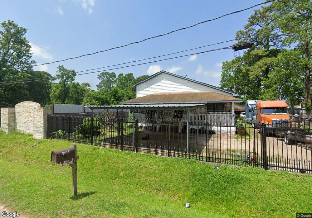
9417 Lanewood Dr Houston, TX 77016
Trinity-Houston Gardens NeighborhoodEstimated Value: $176,000 - $295,000
3
Beds
2
Baths
1,280
Sq Ft
$195/Sq Ft
Est. Value
About This Home
This home is located at 9417 Lanewood Dr, Houston, TX 77016 and is currently estimated at $249,631, approximately $195 per square foot. 9417 Lanewood Dr is a home located in Harris County with nearby schools including Shadydale Elementary School, Forest Brook Middle, and North Forest High School.
Ownership History
Date
Name
Owned For
Owner Type
Purchase Details
Closed on
Feb 17, 2020
Sold by
Martinez Javier
Bought by
Garcia Alma Rosa
Current Estimated Value
Purchase Details
Closed on
Dec 27, 2014
Sold by
Williams Steve R and Taplin Theresa
Bought by
Martinez Javier
Purchase Details
Closed on
Jun 20, 2013
Sold by
Deutsche Bank National Trust Company
Bought by
Williams Steve R and Taplin Theresa
Purchase Details
Closed on
Apr 17, 2004
Sold by
Williams Doris A and Williams Floyd
Bought by
Deutsche Bank National Trust Co
Create a Home Valuation Report for This Property
The Home Valuation Report is an in-depth analysis detailing your home's value as well as a comparison with similar homes in the area
Home Values in the Area
Average Home Value in this Area
Purchase History
| Date | Buyer | Sale Price | Title Company |
|---|---|---|---|
| Garcia Alma Rosa | -- | None Available | |
| Martinez Javier | -- | None Available | |
| Williams Steve R | -- | None Available | |
| Deutsche Bank National Trust Co | $26,550 | None Available |
Source: Public Records
Tax History Compared to Growth
Tax History
| Year | Tax Paid | Tax Assessment Tax Assessment Total Assessment is a certain percentage of the fair market value that is determined by local assessors to be the total taxable value of land and additions on the property. | Land | Improvement |
|---|---|---|---|---|
| 2025 | $2,499 | $237,073 | $51,795 | $185,278 |
| 2024 | $2,499 | $237,073 | $51,795 | $185,278 |
| 2023 | $2,499 | $233,989 | $38,846 | $195,143 |
| 2022 | $3,654 | $187,306 | $25,898 | $161,408 |
| 2021 | $3,516 | $159,466 | $17,265 | $142,201 |
| 2020 | $2,549 | $105,251 | $17,265 | $87,986 |
| 2019 | $2,381 | $94,112 | $13,812 | $80,300 |
| 2018 | $1,816 | $71,760 | $13,812 | $57,948 |
| 2017 | $1,815 | $71,760 | $13,812 | $57,948 |
| 2016 | $1,627 | $64,337 | $10,791 | $53,546 |
| 2015 | $704 | $49,160 | $9,927 | $39,233 |
| 2014 | $704 | $27,398 | $9,927 | $17,471 |
Source: Public Records
Map
Nearby Homes
- 5009 Tidwell Rd
- 6110 Tidwell Rd
- 6226 E Tidwell Rd
- 9317 Homestead Rd
- 9227 Homestead Rd
- 6206 Antha St
- 9603 Homestead Rd
- 9205 & 9207 Spaulding St
- 8504 Shady Dr
- 9603 Bertwood St
- 9009 Compton St
- 6219 Hesta Ln
- 9316 Sundown Dr
- 9711 Bertwood St
- 8914 Lanewood Dr
- 0 Crofton St
- 9412 Crofton St
- 9410 Dandy St
- 8928 Homestead Rd
- 9412 Firnat St Unit A-B
- 9414 Compton St
- 9410 Compton St
- 9418 Lanewood Dr
- 9401 Lanewood Dr
- 9414 Lanewood Dr
- 9406 Compton St
- 9410 Lanewood Dr
- 9406 Lanewood Dr
- 9402 Compton St
- 9321 Lanewood Dr
- 9413 Spaulding St
- 9322 Compton St
- 9322 Lanewood Dr
- 6520 E Tidwell Rd
- 9407 Compton St
- 9314 Lanewood Dr
- 9318 Compton St
- 9311 Lanewood Dr
- 9403 Compton St
- 9321 Compton St