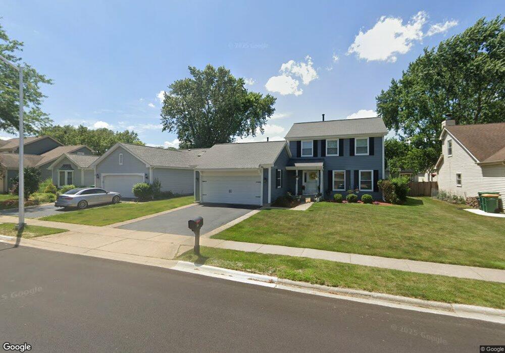
942 Pear Tree Ln Wheeling, IL 60090
Estimated Value: $446,752 - $493,000
3
Beds
3
Baths
1,605
Sq Ft
$290/Sq Ft
Est. Value
About This Home
This home is located at 942 Pear Tree Ln, Wheeling, IL 60090 and is currently estimated at $466,188, approximately $290 per square foot. 942 Pear Tree Ln is a home located in Cook County with nearby schools including Dwight D Eisenhower Elementary School, Anne Sullivan Elementary School, and Betsy Ross Elementary School.
Ownership History
Date
Name
Owned For
Owner Type
Purchase Details
Closed on
Apr 26, 1999
Sold by
Tung Edward H and Wesner Tung Marcie L
Bought by
Clifford Nicole
Current Estimated Value
Home Financials for this Owner
Home Financials are based on the most recent Mortgage that was taken out on this home.
Original Mortgage
$195,300
Outstanding Balance
$45,259
Interest Rate
6.75%
Mortgage Type
Balloon
Estimated Equity
$420,929
Purchase Details
Closed on
Jan 20, 1994
Sold by
Tung Edward H and Wesner Tung Marcie L
Bought by
Tung Edward H and Wesner Tung Marcie L
Create a Home Valuation Report for This Property
The Home Valuation Report is an in-depth analysis detailing your home's value as well as a comparison with similar homes in the area
Home Values in the Area
Average Home Value in this Area
Purchase History
| Date | Buyer | Sale Price | Title Company |
|---|---|---|---|
| Clifford Nicole | $216,500 | -- | |
| Tung Edward H | -- | -- |
Source: Public Records
Mortgage History
| Date | Status | Borrower | Loan Amount |
|---|---|---|---|
| Open | Clifford Nicole | $195,300 |
Source: Public Records
Tax History
| Year | Tax Paid | Tax Assessment Tax Assessment Total Assessment is a certain percentage of the fair market value that is determined by local assessors to be the total taxable value of land and additions on the property. | Land | Improvement |
|---|---|---|---|---|
| 2025 | $9,420 | $41,001 | $8,873 | $32,128 |
| 2024 | $9,420 | $31,616 | $7,508 | $24,108 |
| 2023 | $8,969 | $35,001 | $7,508 | $27,493 |
| 2022 | $8,969 | $35,001 | $7,508 | $27,493 |
| 2021 | $7,798 | $26,877 | $5,118 | $21,759 |
| 2020 | $7,660 | $26,877 | $5,118 | $21,759 |
| 2019 | $7,698 | $29,997 | $5,118 | $24,879 |
| 2018 | $6,084 | $22,550 | $4,436 | $18,114 |
| 2017 | $6,016 | $22,550 | $4,436 | $18,114 |
| 2016 | $7,440 | $27,994 | $4,436 | $23,558 |
| 2015 | $7,172 | $25,285 | $3,924 | $21,361 |
| 2014 | $7,004 | $25,285 | $3,924 | $21,361 |
| 2013 | $6,780 | $25,285 | $3,924 | $21,361 |
Source: Public Records
Map
Nearby Homes
- 988 Ridgefield Ln Unit 54
- 1105 N Maple Ln
- 448 Bridle Trail Unit 211
- 1111 Pleasant Run Dr Unit 911
- 1125 Pleasant Run Dr Unit 807
- 1201 Pleasant Run Dr Unit 312
- 270 Violet Ln
- 200 Violet Ln
- 1033 Wheeling Rd
- 651 Garth Rd
- 16 Robert Ave
- 1450 Sandpebble Dr Unit 333
- 1525 Sander Ct Unit 113
- 1525 Sander Ct Unit 108
- 1525 Sander Ct Unit 103
- 1550 Sandpebble Dr Unit 209
- 475 E Merle Ln
- 1211 Highland Dr
- 492 Bernice Ct
- 802 Andover Ct
- 932 Pear Tree Ln
- 952 Pear Tree Ln
- 973 Shady Tree Ln
- 983 Shady Tree Ln
- 922 Pear Tree Ln Unit 2
- 962 Pear Tree Ln
- 963 Shady Tree Ln
- 993 Shady Tree Ln
- 931 Pear Tree Ln
- 941 Pear Tree Ln
- 921 Pear Tree Ln
- 953 Shady Tree Ln
- 951 Pear Tree Ln Unit 2
- 972 Pear Tree Ln
- 1003 Shady Tree Ln Unit 2
- 912 Pear Tree Ln
- 911 Pear Tree Ln
- 961 Pear Tree Ln
- 943 Shady Tree Ln
- 984 Shady Tree Ln
Your Personal Tour Guide
Ask me questions while you tour the home.