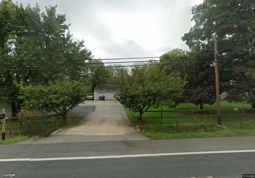
9421 Waynesboro Pike Emmitsburg, MD 21727
Estimated Value: $192,000 - $293,000
--
Bed
1
Bath
920
Sq Ft
$258/Sq Ft
Est. Value
About This Home
This home is located at 9421 Waynesboro Pike, Emmitsburg, MD 21727 and is currently estimated at $237,079, approximately $257 per square foot. 9421 Waynesboro Pike is a home located in Frederick County with nearby schools including Emmitsburg Elementary School, Thurmont Middle School, and Catoctin High School.
Ownership History
Date
Name
Owned For
Owner Type
Purchase Details
Closed on
Sep 3, 1998
Sold by
Hardman Mildred I F A Eyler
Bought by
King Steven Michael and Crutchley Penny Maria
Current Estimated Value
Purchase Details
Closed on
Dec 17, 1992
Sold by
Hewitt Hilda Hardman
Bought by
Hewitt Harry J and Hewitt Tammy D
Home Financials for this Owner
Home Financials are based on the most recent Mortgage that was taken out on this home.
Original Mortgage
$50,000
Interest Rate
8.23%
Create a Home Valuation Report for This Property
The Home Valuation Report is an in-depth analysis detailing your home's value as well as a comparison with similar homes in the area
Home Values in the Area
Average Home Value in this Area
Purchase History
| Date | Buyer | Sale Price | Title Company |
|---|---|---|---|
| King Steven Michael | $78,500 | -- | |
| Hewitt Harry J | $45,000 | -- |
Source: Public Records
Mortgage History
| Date | Status | Borrower | Loan Amount |
|---|---|---|---|
| Previous Owner | Hewitt Harry J | $50,000 | |
| Closed | King Steven Michael | -- |
Source: Public Records
Tax History Compared to Growth
Tax History
| Year | Tax Paid | Tax Assessment Tax Assessment Total Assessment is a certain percentage of the fair market value that is determined by local assessors to be the total taxable value of land and additions on the property. | Land | Improvement |
|---|---|---|---|---|
| 2025 | $1,737 | $149,200 | -- | -- |
| 2024 | $1,737 | $139,300 | $0 | $0 |
| 2023 | $1,591 | $129,400 | $62,700 | $66,700 |
| 2022 | $1,577 | $128,207 | $0 | $0 |
| 2021 | $1,539 | $127,013 | $0 | $0 |
| 2020 | $1,539 | $124,900 | $61,800 | $63,100 |
| 2019 | $1,490 | $120,733 | $0 | $0 |
| 2018 | $1,454 | $116,567 | $0 | $0 |
| 2017 | $1,393 | $112,400 | $0 | $0 |
| 2016 | $1,612 | $112,400 | $0 | $0 |
| 2015 | $1,612 | $112,400 | $0 | $0 |
| 2014 | $1,612 | $113,300 | $0 | $0 |
Source: Public Records
Map
Nearby Homes
- 816 W Main St
- 1417 Ramblewood Dr
- 1445 Ramblewood Dr
- 886 W Main St
- 884 W Main St
- 209 W Main St
- 201 W Main St
- 111 W Main St
- 34 Provincial Pkwy
- 102 Creekside Dr
- 325 Mountaineers Way (Lot 29)
- 323 Mountaineers Way
- 275 Depaul St
- 0 Creamery Way
- 179 Topper Rd
- 46 Mason Dixon Trail
- 31 Crossview Trail
- 32 Walnut Trail
- 580 Middle Creek Rd
- 0 Middle Creek Rd
- 9415 Waynesboro Pike
- 9428 Waynesboro Pike
- 9377 Waynesboro Pike
- 9433 Waynesboro Pike
- 9402 Waynesboro Pike
- 17401 Mountain View Rd
- 9375 Waynesboro Pike
- 3115 Stonehurst Ct
- 3105 Stonehurst Ct
- 9371 Waynesboro Pike
- 17400 Tract Rd
- 17400 Tract Rd
- 9375B Waynesboro Pike
- 3125 Stonehurst Ct
- 3100 Stonehurst Ct
- 1000 Brookfield Dr
- 3135 Stonehurst Ct
- 9363 Waynesboro Pike
- 17318 Nevin Ct
- 17289 Mountain View Rd