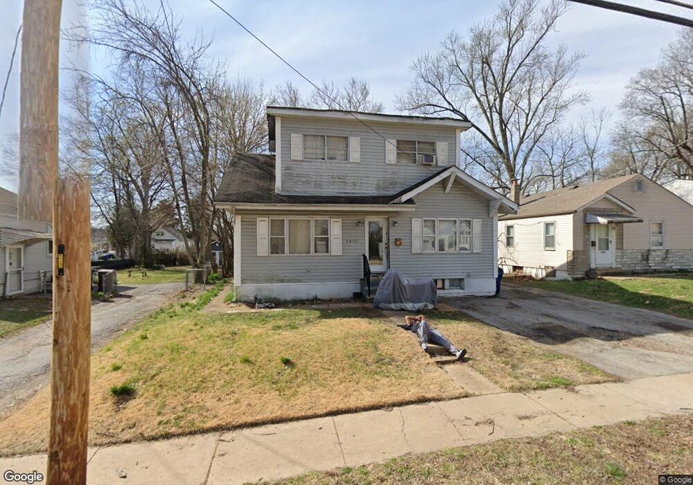
9426 Breckenridge Rd Saint Louis, MO 63114
Estimated Value: $102,000 - $159,000
4
Beds
1
Bath
1,345
Sq Ft
$99/Sq Ft
Est. Value
About This Home
This home is located at 9426 Breckenridge Rd, Saint Louis, MO 63114 and is currently estimated at $133,032, approximately $98 per square foot. 9426 Breckenridge Rd is a home located in St. Louis County with nearby schools including Marion Elementary School, Ritenour Middle School, and Ritenour Senior High School.
Ownership History
Date
Name
Owned For
Owner Type
Purchase Details
Closed on
Feb 22, 2013
Sold by
Coutroul Ronald Dee and Courtroul Mendy A
Bought by
Jpmorgan Chase Bank National Association
Current Estimated Value
Purchase Details
Closed on
Aug 26, 1999
Sold by
Blonde Gatlin and Gatlin Troy
Bought by
Gatlin Blonde and Gatlin Patricia
Home Financials for this Owner
Home Financials are based on the most recent Mortgage that was taken out on this home.
Original Mortgage
$31,000
Interest Rate
7.68%
Create a Home Valuation Report for This Property
The Home Valuation Report is an in-depth analysis detailing your home's value as well as a comparison with similar homes in the area
Home Values in the Area
Average Home Value in this Area
Purchase History
| Date | Buyer | Sale Price | Title Company |
|---|---|---|---|
| Jpmorgan Chase Bank National Association | $127,206 | None Available | |
| Gatlin Blonde | -- | -- |
Source: Public Records
Mortgage History
| Date | Status | Borrower | Loan Amount |
|---|---|---|---|
| Previous Owner | Gatlin Blonde | $31,000 |
Source: Public Records
Tax History Compared to Growth
Tax History
| Year | Tax Paid | Tax Assessment Tax Assessment Total Assessment is a certain percentage of the fair market value that is determined by local assessors to be the total taxable value of land and additions on the property. | Land | Improvement |
|---|---|---|---|---|
| 2025 | $1,957 | $25,920 | $5,990 | $19,930 |
| 2024 | $1,957 | $22,920 | $2,000 | $20,920 |
| 2023 | $1,916 | $22,920 | $2,000 | $20,920 |
| 2022 | $1,687 | $17,660 | $2,000 | $15,660 |
| 2021 | $1,685 | $17,660 | $2,000 | $15,660 |
| 2020 | $1,466 | $14,170 | $3,550 | $10,620 |
| 2019 | $1,450 | $14,170 | $3,550 | $10,620 |
| 2018 | $1,283 | $11,250 | $2,030 | $9,220 |
| 2017 | $1,224 | $11,250 | $2,030 | $9,220 |
| 2016 | $1,107 | $10,220 | $2,030 | $8,190 |
| 2015 | $1,132 | $10,220 | $2,030 | $8,190 |
| 2014 | $1,226 | $11,300 | $1,860 | $9,440 |
Source: Public Records
Map
Nearby Homes
- 3220 Marvin Ave
- 9432 Tudor Ave
- 2812 Woodson Rd
- 3219 Coles Ave
- 3321 Rex Ave
- 3355 Edmundson Rd
- 9111 Delphine Ave
- 3205 Airway Ave
- 3213 Airway Ave
- 3534 Calvert Ave
- 3219 Royalton Ave
- 3310 Royalton Ave
- 13 Jonell Ct
- 3513 Edmundson Rd
- 9436 North Ave
- 3562 Boswell Ave
- 9036 Argyle Ave
- 3329 W Milton Ave
- 9025 Olden Ave
- 3222 W Tennyson Ave
- 9422 Breckenridge Rd
- 9430 Breckenridge Rd
- 9418 Breckenridge Rd
- 9432 Breckenridge Rd
- 9427 Bristol Ave
- 9436 Breckenridge Rd
- 9431 Bristol Ave
- 9423 Bristol Ave
- 3200 Calvert Ave
- 9419 Bristol Ave
- 3203 Marvin Ave
- 9437 Bristol Ave
- 9440 Breckenridge Rd
- 3202 Calvert Ave
- 9441 Bristol Ave
- 3201 Marvin Ave
- 9443 Bristol Ave
- 9444 Breckenridge Rd
- 3206 Calvert Ave
- 3205 Marvin Ave
