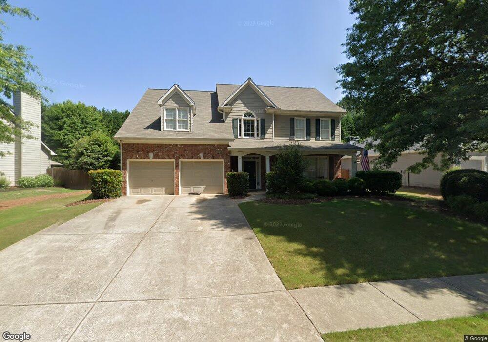
943 Bridge Mill Ave Unit 2F Canton, GA 30114
Sutallee NeighborhoodEstimated Value: $533,000 - $538,092
4
Beds
3
Baths
3,023
Sq Ft
$177/Sq Ft
Est. Value
About This Home
This home is located at 943 Bridge Mill Ave Unit 2F, Canton, GA 30114 and is currently estimated at $535,546, approximately $177 per square foot. 943 Bridge Mill Ave Unit 2F is a home located in Cherokee County with nearby schools including Sixes Elementary School, Freedom Middle School, and Woodstock High School.
Ownership History
Date
Name
Owned For
Owner Type
Purchase Details
Closed on
Jul 1, 2002
Sold by
Raines Ent Inc
Bought by
Polhemus Christopher
Current Estimated Value
Home Financials for this Owner
Home Financials are based on the most recent Mortgage that was taken out on this home.
Original Mortgage
$179,950
Outstanding Balance
$19,733
Interest Rate
4.25%
Mortgage Type
New Conventional
Estimated Equity
$515,813
Create a Home Valuation Report for This Property
The Home Valuation Report is an in-depth analysis detailing your home's value as well as a comparison with similar homes in the area
Home Values in the Area
Average Home Value in this Area
Purchase History
| Date | Buyer | Sale Price | Title Company |
|---|---|---|---|
| Polhemus Christopher | $225,000 | -- |
Source: Public Records
Mortgage History
| Date | Status | Borrower | Loan Amount |
|---|---|---|---|
| Open | Polhemus Christopher | $179,950 |
Source: Public Records
Tax History Compared to Growth
Tax History
| Year | Tax Paid | Tax Assessment Tax Assessment Total Assessment is a certain percentage of the fair market value that is determined by local assessors to be the total taxable value of land and additions on the property. | Land | Improvement |
|---|---|---|---|---|
| 2024 | $4,698 | $200,960 | $38,000 | $162,960 |
| 2023 | $4,145 | $195,320 | $38,000 | $157,320 |
| 2022 | $3,928 | $162,160 | $35,200 | $126,960 |
| 2021 | $3,602 | $134,080 | $25,600 | $108,480 |
| 2020 | $3,270 | $119,640 | $25,600 | $94,040 |
| 2019 | $3,137 | $113,920 | $25,600 | $88,320 |
| 2018 | $2,928 | $104,680 | $24,000 | $80,680 |
| 2017 | $2,876 | $255,200 | $20,400 | $81,680 |
| 2016 | $2,758 | $242,600 | $20,400 | $76,640 |
| 2015 | $2,635 | $229,800 | $18,000 | $73,920 |
| 2014 | $2,561 | $223,100 | $18,000 | $71,240 |
Source: Public Records
Map
Nearby Homes
- 202 Briarwood Ln
- 130 Windsong Trail
- 515 Hickory Hills Place
- 322 Walnut Hills Crossing
- 211 Parc Dr
- 1000 Delta Dr Unit A4-20
- 1000 Delta Dr
- 3021 Heatherbrook Trace
- 552 Steels Bridge Rd
- 238 Parc Dr
- 0 Steels Bridge Rd Unit 10560449
- 0 Steels Bridge Rd Unit 7612321
- 109 Hale View Cir
- 1059 Bridgemill Ave
- 160 Henley St
- 160 Henley St Unit 15
- 164 Henley St
- Jasper II Plan at Cambridge at Steels Bridge
- Fulton II Plan at Cambridge at Steels Bridge
- Brookwood Plan at Cambridge at Steels Bridge
- 945 Bridge Mill Ave
- 941 Bridge Mill Ave
- 941 Bridge Mill Ave
- 606 Birch Walk
- 947 Bridgemill Ave
- 939 Bridge Mill Ave
- 947 Bridge Mill Ave
- 942 Bridgemill Ave
- 201 Briarwood Ln Unit 2F
- 942 Bridge Mill Ave Unit 2F
- 604 Birch Walk
- 937 Bridge Mill Ave Unit 2F
- 949 Bridge Mill Ave Unit 2E
- 607 Birch Walk
- 949 Bridgemill Ave
- 944 Bridge Mill Ave
- 100 Windsong Trail
- 200 Briarwood Ln
- 935 Bridge Mill Ave Unit 2F
- 203 Briarwood Ln