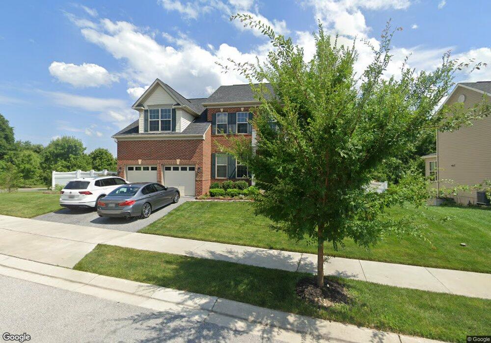
9431 Barnside Ct Perry Hall, MD 21128
Estimated Value: $775,549 - $891,000
Studio
1
Bath
3,849
Sq Ft
$220/Sq Ft
Est. Value
About This Home
This home is located at 9431 Barnside Ct, Perry Hall, MD 21128 and is currently estimated at $846,887, approximately $220 per square foot. 9431 Barnside Ct is a home located in Baltimore County with nearby schools including Honeygo Elementary School, Perry Hall Middle School, and Perry Hall High School.
Ownership History
Date
Name
Owned For
Owner Type
Purchase Details
Closed on
Dec 8, 2015
Sold by
D R Horton Inc
Bought by
Shrestha Rosina and Thapa Bimal Kumar
Current Estimated Value
Home Financials for this Owner
Home Financials are based on the most recent Mortgage that was taken out on this home.
Original Mortgage
$541,053
Outstanding Balance
$429,585
Interest Rate
3.99%
Mortgage Type
New Conventional
Estimated Equity
$417,302
Purchase Details
Closed on
Jul 16, 2015
Sold by
Khi/Chapel Road Llc
Bought by
D R Horton Inc
Create a Home Valuation Report for This Property
The Home Valuation Report is an in-depth analysis detailing your home's value as well as a comparison with similar homes in the area
Home Values in the Area
Average Home Value in this Area
Purchase History
| Date | Buyer | Sale Price | Title Company |
|---|---|---|---|
| Shrestha Rosina | $569,530 | Stewart Title Guaranty Co | |
| D R Horton Inc | $1,170,000 | Residential Title & Escrow C |
Source: Public Records
Mortgage History
| Date | Status | Borrower | Loan Amount |
|---|---|---|---|
| Open | Shrestha Rosina | $541,053 |
Source: Public Records
Tax History
| Year | Tax Paid | Tax Assessment Tax Assessment Total Assessment is a certain percentage of the fair market value that is determined by local assessors to be the total taxable value of land and additions on the property. | Land | Improvement |
|---|---|---|---|---|
| 2025 | $9,024 | $669,900 | -- | -- |
| 2024 | $9,024 | $613,100 | $0 | $0 |
| 2023 | $4,115 | $556,300 | $152,700 | $403,600 |
| 2022 | $8,248 | $548,367 | $0 | $0 |
| 2021 | $8,010 | $540,433 | $0 | $0 |
| 2020 | $8,010 | $532,500 | $152,700 | $379,800 |
| 2019 | $7,364 | $524,233 | $0 | $0 |
| 2018 | $7,267 | $515,967 | $0 | $0 |
| 2017 | $6,485 | $507,700 | $0 | $0 |
| 2016 | -- | $507,700 | $0 | $0 |
| 2015 | -- | $40,200 | $0 | $0 |
| 2014 | -- | $0 | $0 | $0 |
Source: Public Records
Map
Nearby Homes
- 9429 Barnside Ct
- 4413 Pensel Rd
- 9501 Robin Meadow Ct
- 9606 Amberleigh Ln Unit C
- 4501 Talcott Terrace Unit P
- 9601 Amberleigh Ln Unit K
- 9501 Kingscroft Terrace Unit K
- 4341 Chapel Rd
- 9500 Chase Creek Ct
- 4502 Dunton Terrace Unit 4502P
- 3 Mia Ct
- 5 Mia Ct
- 6 Mia Ct
- 9708 Redwing Dr
- 4 Mia Ct
- 2 Mia Ct
- 9608 Haven Farm Rd Unit H
- 9910 Redwing Dr
- 9560 Harvest Ln
- 3 Brook Farm Ct Unit 3J
- 4412 Pensel Rd
- 9427 Barnside Ct
- 4412 Cross Brook Dr
- 4410 Pensel Rd
- 9425 Barnside Ct
- 4413 Cross Brook Dr
- 4411 Pensel Rd
- 4314 Stoss Rd
- 4408 Pensel Rd
- 9423 Barnside Ct
- 4425 Cross Brook Dr
- 4411 Cross Brook Dr
- 4408 Cross Brook Dr
- 4312 Stoss Rd
- 4409 Pensel Rd
- 4429 Cross Brook Dr
- 9421 Barnside Ct
- 4406 Pensel Rd
- 4310 Stoss Rd
- 4409 Cross Brook Dr
Your Personal Tour Guide
Ask me questions while you tour the home.