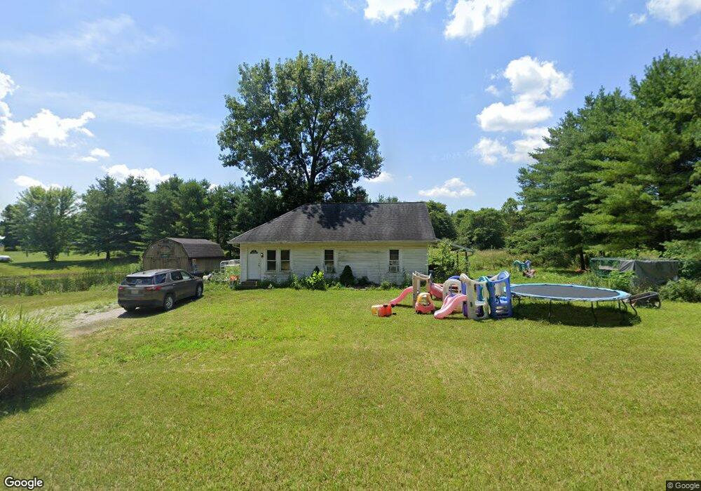
9431 E Big Rock Rd Morgantown, IN 46160
Estimated Value: $179,000 - $202,000
2
Beds
1
Bath
920
Sq Ft
$208/Sq Ft
Est. Value
About This Home
This home is located at 9431 E Big Rock Rd, Morgantown, IN 46160 and is currently estimated at $191,321, approximately $207 per square foot. 9431 E Big Rock Rd is a home located in Morgan County with nearby schools including Martinsville High School.
Ownership History
Date
Name
Owned For
Owner Type
Purchase Details
Closed on
Dec 5, 2016
Sold by
Lambert Nicholas J
Bought by
Lambert Mikel L and Lambert Rhonda F
Current Estimated Value
Home Financials for this Owner
Home Financials are based on the most recent Mortgage that was taken out on this home.
Original Mortgage
$47,000
Outstanding Balance
$37,952
Interest Rate
3.52%
Mortgage Type
Credit Line Revolving
Estimated Equity
$153,369
Purchase Details
Closed on
Oct 26, 2006
Sold by
Compton David
Bought by
Lambert Nicholas J
Home Financials for this Owner
Home Financials are based on the most recent Mortgage that was taken out on this home.
Original Mortgage
$61,000
Interest Rate
6.25%
Mortgage Type
Adjustable Rate Mortgage/ARM
Create a Home Valuation Report for This Property
The Home Valuation Report is an in-depth analysis detailing your home's value as well as a comparison with similar homes in the area
Home Values in the Area
Average Home Value in this Area
Purchase History
| Date | Buyer | Sale Price | Title Company |
|---|---|---|---|
| Lambert Mikel L | -- | None Available | |
| Lambert Nicholas J | -- | None Available |
Source: Public Records
Mortgage History
| Date | Status | Borrower | Loan Amount |
|---|---|---|---|
| Open | Lambert Mikel L | $47,000 | |
| Closed | Lambert Nicholas J | $61,000 |
Source: Public Records
Tax History Compared to Growth
Tax History
| Year | Tax Paid | Tax Assessment Tax Assessment Total Assessment is a certain percentage of the fair market value that is determined by local assessors to be the total taxable value of land and additions on the property. | Land | Improvement |
|---|---|---|---|---|
| 2024 | $1,438 | $141,900 | $61,100 | $80,800 |
| 2023 | $1,405 | $141,900 | $61,100 | $80,800 |
| 2022 | $1,182 | $135,100 | $61,100 | $74,000 |
| 2021 | $646 | $76,100 | $27,800 | $48,300 |
| 2020 | $619 | $75,700 | $27,400 | $48,300 |
| 2019 | $645 | $72,800 | $27,400 | $45,400 |
| 2018 | $610 | $70,900 | $27,400 | $43,500 |
| 2017 | $601 | $70,400 | $27,400 | $43,000 |
| 2016 | $129 | $66,000 | $27,400 | $38,600 |
| 2014 | $93 | $59,200 | $22,900 | $36,300 |
| 2013 | $93 | $59,200 | $22,900 | $36,300 |
Source: Public Records
Map
Nearby Homes
- 901 Carter Rd
- 8577 State Road 44
- 0 Banta Rd Unit MBR21966792
- 0 Skunk Hollow Rd
- Tract 3 Skunk Hollow Rd
- Tract 2 Skunk Hollow Rd
- 6820 W Road 150 N
- 7975 New Harmony Rd
- 7158 New Harmony Rd
- 5646 Paradise Dr
- 44 West St
- 8000 New Harmony Rd
- 0 Paradise Lake Rd Unit MBR22028606
- 1 Paradise Lake Rd
- 1156 Cope Rd
- 583 Old Moore Ln
- 4045 Chapel Hill Ct
- TBD Maple Grove Rd
- 0 Old Moore Rd
- 4385 Cragen Rd