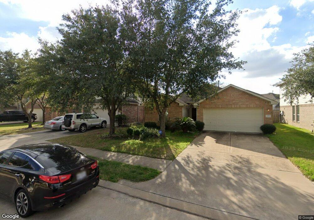
9431 Vander Rock Dr Houston, TX 77095
Canyon Lakes at Stonegate NeighborhoodEstimated Value: $343,000 - $388,000
4
Beds
3
Baths
3,031
Sq Ft
$119/Sq Ft
Est. Value
About This Home
This home is located at 9431 Vander Rock Dr, Houston, TX 77095 and is currently estimated at $361,015, approximately $119 per square foot. 9431 Vander Rock Dr is a home located in Harris County with nearby schools including Birkes Elementary School, Aragon Middle School, and Langham Creek High School.
Ownership History
Date
Name
Owned For
Owner Type
Purchase Details
Closed on
May 15, 2007
Sold by
Castlerock Communities Lp
Bought by
Mills Orlin and Mills Latosha
Current Estimated Value
Home Financials for this Owner
Home Financials are based on the most recent Mortgage that was taken out on this home.
Original Mortgage
$196,140
Outstanding Balance
$119,241
Interest Rate
6.16%
Mortgage Type
Purchase Money Mortgage
Estimated Equity
$241,774
Create a Home Valuation Report for This Property
The Home Valuation Report is an in-depth analysis detailing your home's value as well as a comparison with similar homes in the area
Home Values in the Area
Average Home Value in this Area
Purchase History
| Date | Buyer | Sale Price | Title Company |
|---|---|---|---|
| Mills Orlin | -- | Stewart Title Houston Div |
Source: Public Records
Mortgage History
| Date | Status | Borrower | Loan Amount |
|---|---|---|---|
| Open | Mills Orlin | $196,140 |
Source: Public Records
Tax History Compared to Growth
Tax History
| Year | Tax Paid | Tax Assessment Tax Assessment Total Assessment is a certain percentage of the fair market value that is determined by local assessors to be the total taxable value of land and additions on the property. | Land | Improvement |
|---|---|---|---|---|
| 2025 | $5,769 | $367,806 | $65,941 | $301,865 |
| 2024 | $5,769 | $372,117 | $59,894 | $312,223 |
| 2023 | $5,769 | $397,043 | $59,894 | $337,149 |
| 2022 | $7,361 | $336,131 | $44,344 | $291,787 |
| 2021 | $7,087 | $276,733 | $44,344 | $232,389 |
| 2020 | $7,199 | $269,686 | $27,643 | $242,043 |
| 2019 | $6,989 | $254,093 | $25,916 | $228,177 |
| 2018 | $2,362 | $236,321 | $25,916 | $210,405 |
| 2017 | $6,193 | $227,983 | $25,916 | $202,067 |
| 2016 | $5,968 | $219,712 | $25,916 | $193,796 |
| 2015 | $4,262 | $219,712 | $25,916 | $193,796 |
| 2014 | $4,262 | $205,566 | $25,916 | $179,650 |
Source: Public Records
Map
Nearby Homes
- 17038 Sperry Landing Dr
- 16827 Newlight Bend Dr
- 9406 Morley Lake Dr
- 16839 Mammoth Springs Dr
- 9631 Gorman Brook Dr
- 16827 Libson Falls Dr
- 9714 Coyote Creek Dr
- 9735 Coyote Creek Dr
- 8855 Distant Woods Dr
- 16758 Mammoth Springs Dr
- 16750 Libson Falls Dr
- 16802 Pine Castle Dr
- 9747 Wheaton Edge Ln
- 8714 Ridgebury Cir
- 16602 Grenada Falls Dr
- 16635 Greenbriar Point Ln
- 17215 Shallow Lake Ln
- 8711 Preston Field Ln
- 16414 Mesa Point Dr
- 9938 Adobe Dr
- 9503 Vander Rock Dr
- 9427 Vander Rock Dr
- 9423 Vander Rock Dr
- 9507 Vander Rock Dr
- 9430 Curry Landing Dr
- 9434 Curry Landing Dr
- 9426 Curry Landing Dr
- 9419 Vander Rock Dr
- 9422 Curry Landing Dr
- 9511 Vander Rock Dr
- 9430 Vander Rock Dr
- 9502 Curry Landing Dr
- 9502 Vander Rock Dr
- 9422 Vander Rock Dr
- 9418 Curry Landing Dr
- 9415 Vander Rock Dr
- 17007 Sperry Landing Dr
- 9418 Vander Rock Dr
- 9414 Curry Landing Dr
- 9506 Curry Landing Dr