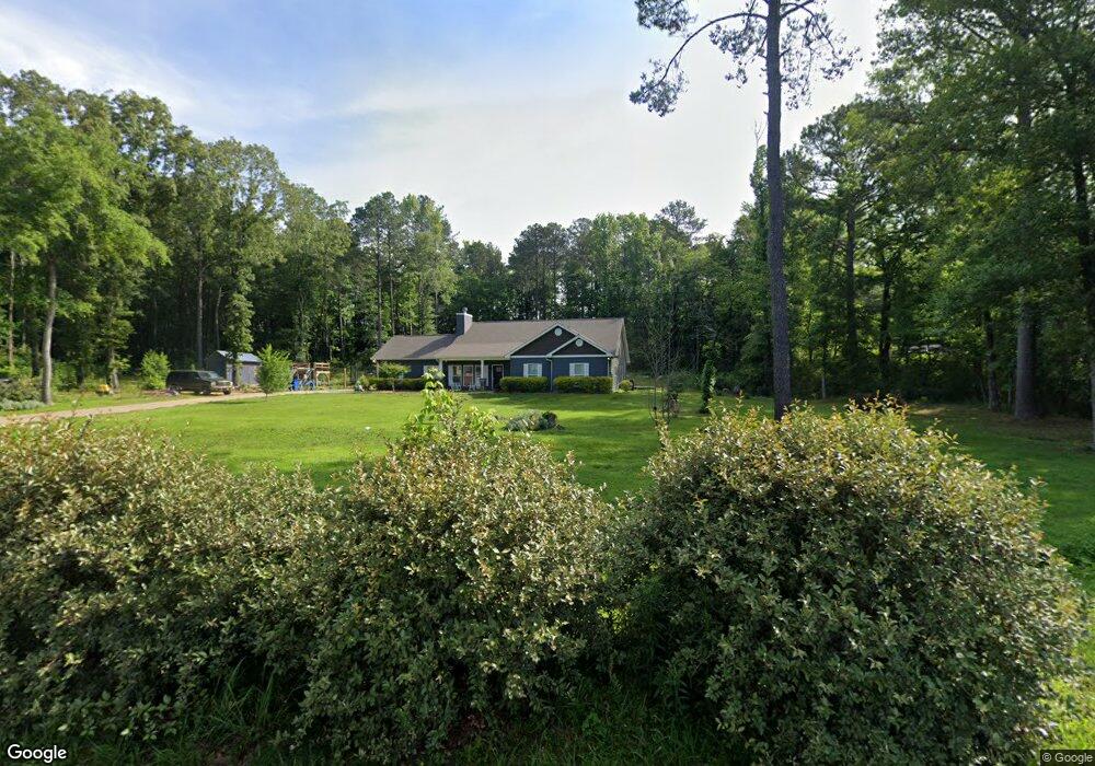
9435 Bill Jones Rd Kimberly, AL 35091
Estimated Value: $335,000 - $404,000
3
Beds
2
Baths
2,017
Sq Ft
$188/Sq Ft
Est. Value
About This Home
This home is located at 9435 Bill Jones Rd, Kimberly, AL 35091 and is currently estimated at $378,752, approximately $187 per square foot. 9435 Bill Jones Rd is a home located in Jefferson County with nearby schools including Bryan Elementary School, North Jefferson Middle School, and Mortimer Jordan High School.
Ownership History
Date
Name
Owned For
Owner Type
Purchase Details
Closed on
Dec 22, 2016
Sold by
Pope Judith Pharris
Bought by
Williams Jessica Erwin and Williams James Warren
Current Estimated Value
Purchase Details
Closed on
Oct 1, 1998
Sold by
Smith Roy R and Smith Carolyn A
Bought by
Stell Glenn D and Stell Breana
Home Financials for this Owner
Home Financials are based on the most recent Mortgage that was taken out on this home.
Original Mortgage
$104,550
Interest Rate
6.96%
Mortgage Type
FHA
Create a Home Valuation Report for This Property
The Home Valuation Report is an in-depth analysis detailing your home's value as well as a comparison with similar homes in the area
Home Values in the Area
Average Home Value in this Area
Purchase History
| Date | Buyer | Sale Price | Title Company |
|---|---|---|---|
| Williams Jessica Erwin | -- | -- | |
| Stell Glenn D | $104,800 | Cahaba Title Inc |
Source: Public Records
Mortgage History
| Date | Status | Borrower | Loan Amount |
|---|---|---|---|
| Previous Owner | Stell Glenn D | $104,550 |
Source: Public Records
Tax History Compared to Growth
Tax History
| Year | Tax Paid | Tax Assessment Tax Assessment Total Assessment is a certain percentage of the fair market value that is determined by local assessors to be the total taxable value of land and additions on the property. | Land | Improvement |
|---|---|---|---|---|
| 2024 | $1,895 | $31,120 | -- | -- |
| 2022 | $1,827 | $29,360 | $4,250 | $25,110 |
| 2021 | $3,420 | $54,640 | $8,500 | $46,140 |
| 2020 | $532 | $8,500 | $8,500 | $0 |
| 2019 | $532 | $8,500 | $0 | $0 |
| 2018 | $0 | $4,260 | $0 | $0 |
| 2017 | $0 | $4,260 | $0 | $0 |
| 2016 | $0 | $4,260 | $0 | $0 |
| 2015 | -- | $4,260 | $0 | $0 |
| 2014 | $266 | $4,260 | $0 | $0 |
| 2013 | $266 | $4,260 | $0 | $0 |
Source: Public Records
Map
Nearby Homes
- 9439 Polo Trace
- The Braselton Brunswick Ave
- 9462 Polo Trace
- The Landen Brunswick Ave
- The Braselton II Plan at Jersey Park
- The Benson II Plan at Jersey Park
- The McGinnis Plan at Jersey Park
- The Langford Plan at Jersey Park
- The Coleman Plan at Jersey Park
- The Caldwell Plan at Jersey Park
- The Landen Plan at Jersey Park
- The Greenbrier II Plan at Jersey Park
- The Harrington Plan at Jersey Park
- 12345 Brunswick Ave
- 9316 Brunswick Ave
- 1234 Brunswick Ave
- 9312 Brunswick Ave
- The McGinnis Brunswick Ave
- The Caldwell Brunswick Ave
- The Harrington Brunswick Ave
- 9431 Bill Jones Rd
- 9441 Bill Jones Rd
- 9571 Pharris Ln
- 1028 Derby Pkwy
- 1028 Derby Pkwy Unit 204
- 1032 Derby Pkwy
- 9567 Pharris Ln
- 1024 Derby Pkwy
- 1024 Derby Pkwy Unit 203
- 9495 Bill Jones Rd
- 1036 Derby Pkwy
- 1036 Derby Pkwy Unit 206
- 9563 Pharris Ln
- 9575 Pharris Ln
- 1040 Derby Pkwy
- 1040 Derby Pkwy Unit 207
- 1016 Derby Pkwy
- 1016 Derby Pkwy Unit 201
- 1020 Derby Pkwy
- 9559 Pharris Ln