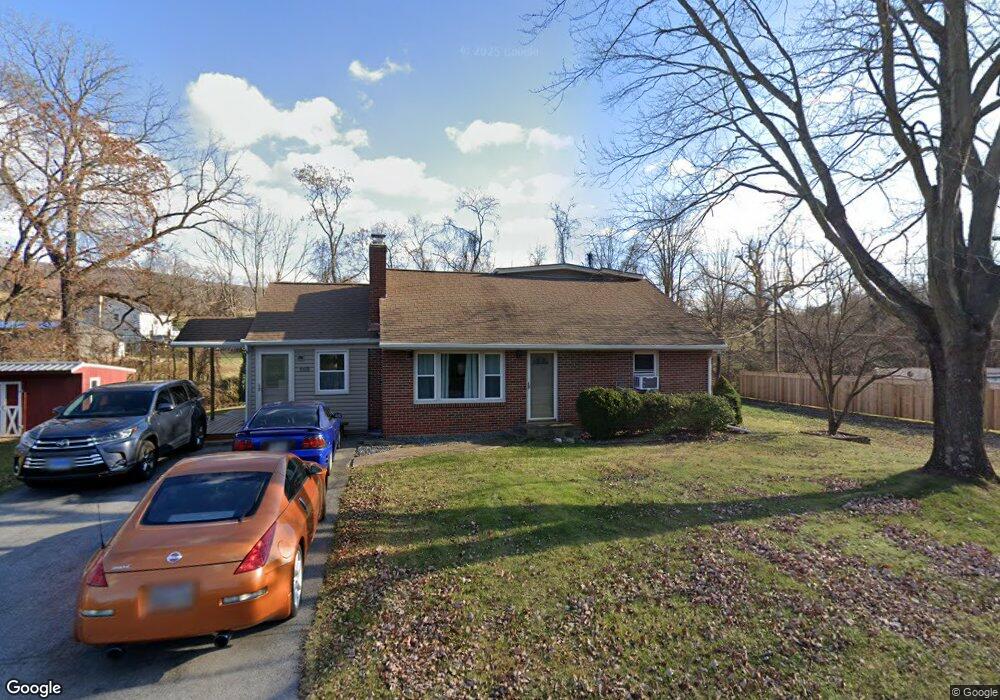
9435 Harmony Rd Myersville, MD 21773
Estimated Value: $297,263 - $406,000
--
Bed
1
Bath
1,300
Sq Ft
$268/Sq Ft
Est. Value
About This Home
This home is located at 9435 Harmony Rd, Myersville, MD 21773 and is currently estimated at $348,566, approximately $268 per square foot. 9435 Harmony Rd is a home located in Frederick County with nearby schools including Myersville Elementary School, Middletown Middle School, and Middletown High School.
Ownership History
Date
Name
Owned For
Owner Type
Purchase Details
Closed on
Sep 29, 2004
Sold by
Cover Alan Victor
Bought by
Cover Alan Victor and Cover Kimberle
Current Estimated Value
Purchase Details
Closed on
Aug 23, 2004
Sold by
Cover Alan Victor
Bought by
Cover Alan Victor and Cover Kimberle
Purchase Details
Closed on
Aug 31, 1999
Sold by
Cover Richard V and Cover Frances L
Bought by
Cover Alan Victor
Create a Home Valuation Report for This Property
The Home Valuation Report is an in-depth analysis detailing your home's value as well as a comparison with similar homes in the area
Home Values in the Area
Average Home Value in this Area
Purchase History
| Date | Buyer | Sale Price | Title Company |
|---|---|---|---|
| Cover Alan Victor | -- | -- | |
| Cover Alan Victor | -- | -- | |
| Cover Alan Victor | $105,100 | -- |
Source: Public Records
Mortgage History
| Date | Status | Borrower | Loan Amount |
|---|---|---|---|
| Closed | Cover Alan Victor | -- |
Source: Public Records
Tax History Compared to Growth
Tax History
| Year | Tax Paid | Tax Assessment Tax Assessment Total Assessment is a certain percentage of the fair market value that is determined by local assessors to be the total taxable value of land and additions on the property. | Land | Improvement |
|---|---|---|---|---|
| 2025 | $2,922 | $264,633 | -- | -- |
| 2024 | $2,922 | $242,367 | $0 | $0 |
| 2023 | $2,671 | $220,100 | $67,600 | $152,500 |
| 2022 | $2,550 | $209,200 | $0 | $0 |
| 2021 | $2,324 | $198,300 | $0 | $0 |
| 2020 | $2,324 | $187,400 | $63,800 | $123,600 |
| 2019 | $2,303 | $185,567 | $0 | $0 |
| 2018 | $2,301 | $183,733 | $0 | $0 |
| 2017 | $2,261 | $181,900 | $0 | $0 |
| 2016 | $2,212 | $178,800 | $0 | $0 |
| 2015 | $2,212 | $175,700 | $0 | $0 |
| 2014 | $2,212 | $172,600 | $0 | $0 |
Source: Public Records
Map
Nearby Homes
- 8842 Hawbottom Rd
- 8541 Pete Wiles Rd
- 55 Fox Rock Dr
- 3101 Brethren Church Rd
- 9 Fox Rock Dr
- 3 Poplar St
- 8935 Hawbottom Rd
- 4117 Crow Rock Rd
- Lot 1 Wolfsville Rd
- Lot 2 Wolfsville Rd
- 8511 Rosebud Ct
- 421 Main St
- 226 Mountain Terrace
- 14 Deerwoods Ct
- 8 Walnut St
- 2820 Milt Summers Rd
- 10444 Church Hill Rd
- 10255 Rollingridge Ct
- 2763 Flintridge Dr
- 10306 Church Hill Rd
- 9440 Hollow Rd
- 9433 Harmony Rd
- 9420 Harmony Rd
- 3943 Brethren Church Rd
- 9501 Harmony Rd
- 3948 Brethren Church Rd
- 9435 Hollow Rd
- 9428 Hollow Rd
- 3941 Brethren Church Rd
- 9510 Harmony Rd
- 3939 Brethren Church Rd
- 9508 Harmony Rd
- 9502 Harmony Rd
- 9428A Harmony Rd
- 3938 Brethren Church Rd
- 9416 Hollow Rd
- 9514 Harmony Rd
- 9521 Harmony Rd
- 9404 Harmony Rd
- 9518 Harmony Rd