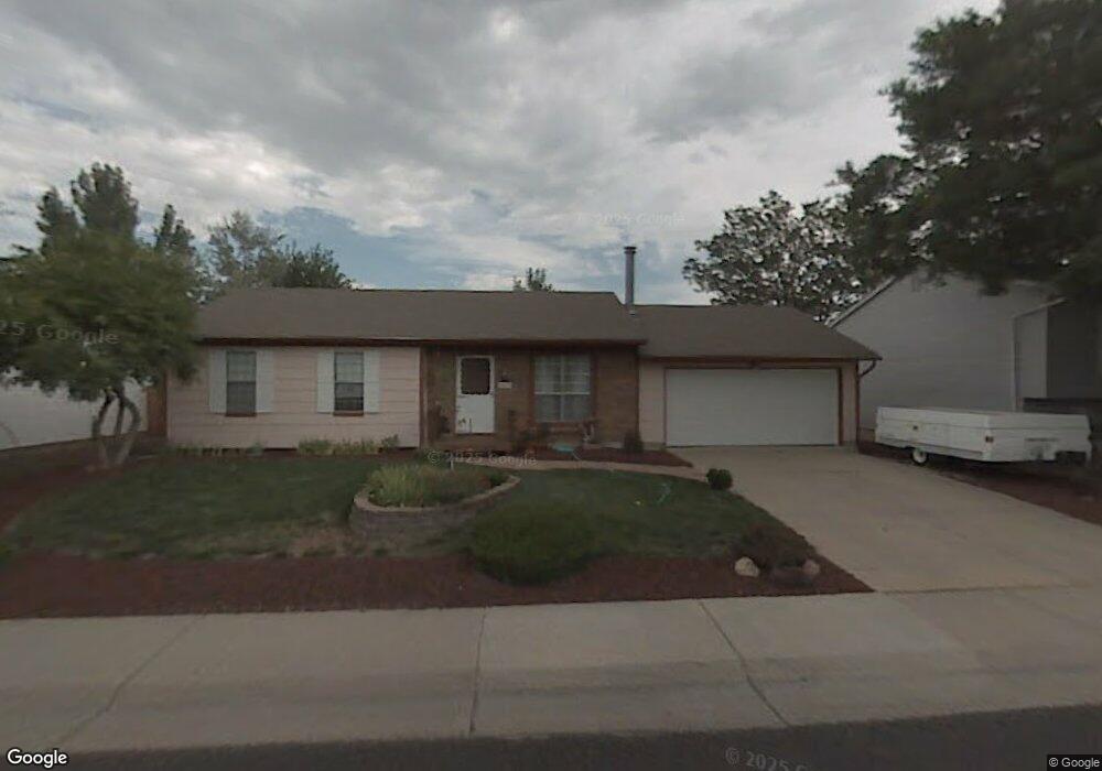
9436 Brentwood St Westminster, CO 80021
Kings Mill NeighborhoodEstimated Value: $488,420 - $525,000
3
Beds
3
Baths
1,106
Sq Ft
$460/Sq Ft
Est. Value
About This Home
This home is located at 9436 Brentwood St, Westminster, CO 80021 and is currently estimated at $508,605, approximately $459 per square foot. 9436 Brentwood St is a home located in Jefferson County with nearby schools including Lukas Elementary School, Wayne Carle Middle School, and Standley Lake High School.
Ownership History
Date
Name
Owned For
Owner Type
Purchase Details
Closed on
Nov 5, 2001
Sold by
Paul Vicki J and Shriver Gene E
Bought by
Wood Vicki J and Wood Barry
Current Estimated Value
Home Financials for this Owner
Home Financials are based on the most recent Mortgage that was taken out on this home.
Original Mortgage
$132,500
Outstanding Balance
$51,291
Interest Rate
6.59%
Estimated Equity
$457,314
Purchase Details
Closed on
Aug 16, 1999
Sold by
Rice Lorraine M
Bought by
Paul Vicki J and Shriver Gene E
Home Financials for this Owner
Home Financials are based on the most recent Mortgage that was taken out on this home.
Original Mortgage
$129,090
Interest Rate
7.68%
Mortgage Type
FHA
Create a Home Valuation Report for This Property
The Home Valuation Report is an in-depth analysis detailing your home's value as well as a comparison with similar homes in the area
Home Values in the Area
Average Home Value in this Area
Purchase History
| Date | Buyer | Sale Price | Title Company |
|---|---|---|---|
| Wood Vicki J | -- | -- | |
| Paul Vicki J | $130,000 | -- |
Source: Public Records
Mortgage History
| Date | Status | Borrower | Loan Amount |
|---|---|---|---|
| Open | Wood Vicki J | $132,500 | |
| Previous Owner | Paul Vicki J | $129,090 |
Source: Public Records
Tax History Compared to Growth
Tax History
| Year | Tax Paid | Tax Assessment Tax Assessment Total Assessment is a certain percentage of the fair market value that is determined by local assessors to be the total taxable value of land and additions on the property. | Land | Improvement |
|---|---|---|---|---|
| 2024 | $1,608 | $27,814 | $8,160 | $19,654 |
| 2023 | $1,608 | $27,814 | $8,160 | $19,654 |
| 2022 | $1,290 | $23,536 | $5,055 | $18,481 |
| 2021 | $1,309 | $24,213 | $5,200 | $19,013 |
| 2020 | $1,075 | $21,239 | $5,010 | $16,229 |
| 2019 | $1,057 | $21,239 | $5,010 | $16,229 |
| 2018 | $869 | $18,396 | $3,814 | $14,582 |
| 2017 | $778 | $18,396 | $3,814 | $14,582 |
| 2016 | $585 | $15,624 | $4,392 | $11,232 |
| 2015 | $498 | $15,624 | $4,392 | $11,232 |
| 2014 | $498 | $12,396 | $3,791 | $8,605 |
Source: Public Records
Map
Nearby Homes
- 9409 Brentwood St
- 9567 Brentwood Way Unit A
- 9663 Brentwood Way Unit B
- 9705 Carr Cir
- 9702 Carr Cir
- 9703 Independence Dr Unit 9703
- 9324 Field Ln
- 9677 Independence Dr Unit 9677
- 9251 Wadsworth Blvd
- 9495 Webster Way
- 9863 Zephyr Dr
- 8357 W 90th Place Unit 1703
- 8755 W 96th Dr
- 9026 Ammons Ct
- 7810 W 90th Dr
- 7423 W 93rd Place
- 10690 Dover St
- 9805 Garrison Ct
- 9263 W 98th Way
- 9281 Upham Way
- 9440 Brentwood St
- 9434 Brentwood St
- 9448 Brentwood St
- 9432 Brentwood St
- 9427 Brentwood St
- 9470 NW Brentwood Way
- 9428 Brentwood St
- 9452 Brentwood St
- 9491 NW Brentwood Way
- 9460 NW Brentwood Way
- 9419 Brentwood St
- 9456 Brentwood St
- 9424 Brentwood St
- 9481 NW Brentwood Way
- 9450 NW Brentwood Way
- 9415 Brentwood St
- 9457 Brentwood St
- 9471 NW Brentwood Way
- 9461 NW Brentwood Way
- 9440 NW Brentwood Way