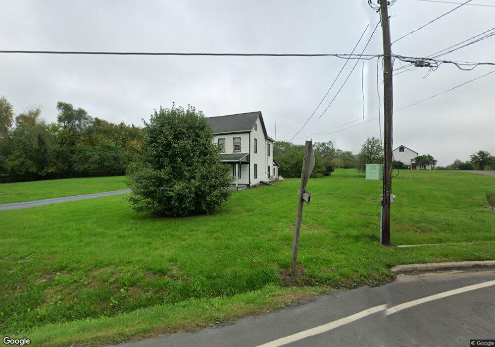
9436 Waynesboro Pike Emmitsburg, MD 21727
Estimated Value: $639,000 - $977,000
7
Beds
5
Baths
4,040
Sq Ft
$209/Sq Ft
Est. Value
About This Home
This home is located at 9436 Waynesboro Pike, Emmitsburg, MD 21727 and is currently estimated at $845,161, approximately $209 per square foot. 9436 Waynesboro Pike is a home located in Frederick County with nearby schools including Emmitsburg Elementary School, Thurmont Middle School, and Catoctin High School.
Ownership History
Date
Name
Owned For
Owner Type
Purchase Details
Closed on
Aug 27, 2010
Sold by
Sanderson Donald M and Sanderson Agnes M
Bought by
Walker Mark T and Walker Kathleen Kelly
Current Estimated Value
Purchase Details
Closed on
Sep 7, 1988
Sold by
Carr William H and Carr Chata I
Bought by
Sanderson Donald M and Sanderson Agnes M
Home Financials for this Owner
Home Financials are based on the most recent Mortgage that was taken out on this home.
Original Mortgage
$165,000
Interest Rate
10.65%
Create a Home Valuation Report for This Property
The Home Valuation Report is an in-depth analysis detailing your home's value as well as a comparison with similar homes in the area
Home Values in the Area
Average Home Value in this Area
Purchase History
| Date | Buyer | Sale Price | Title Company |
|---|---|---|---|
| Walker Mark T | $585,000 | -- | |
| Sanderson Donald M | $265,000 | -- |
Source: Public Records
Mortgage History
| Date | Status | Borrower | Loan Amount |
|---|---|---|---|
| Previous Owner | Sanderson Donald M | $165,000 |
Source: Public Records
Tax History Compared to Growth
Tax History
| Year | Tax Paid | Tax Assessment Tax Assessment Total Assessment is a certain percentage of the fair market value that is determined by local assessors to be the total taxable value of land and additions on the property. | Land | Improvement |
|---|---|---|---|---|
| 2025 | $9,397 | $658,900 | -- | -- |
| 2024 | $9,397 | $600,700 | $0 | $0 |
| 2023 | $8,321 | $542,500 | $92,800 | $449,700 |
| 2022 | $8,212 | $535,333 | $0 | $0 |
| 2021 | $7,992 | $528,167 | $0 | $0 |
| 2020 | $8,066 | $521,000 | $96,800 | $424,200 |
| 2019 | $7,955 | $519,800 | $0 | $0 |
| 2018 | $7,945 | $518,600 | $0 | $0 |
| 2017 | $7,762 | $517,400 | $0 | $0 |
| 2016 | $7,256 | $507,100 | $0 | $0 |
| 2015 | $7,256 | $496,800 | $0 | $0 |
| 2014 | $7,256 | $486,500 | $0 | $0 |
Source: Public Records
Map
Nearby Homes
- 816 W Main St
- 1417 Ramblewood Dr
- 1445 Ramblewood Dr
- 886 W Main St
- 884 W Main St
- 209 W Main St
- 201 W Main St
- 111 W Main St
- 34 Provincial Pkwy
- 102 Creekside Dr
- 325 Mountaineers Way (Lot 29)
- 323 Mountaineers Way
- 275 Depaul St
- 1005 Flat Run Ct
- 0 Creamery Way
- 179 Topper Rd
- 46 Mason Dixon Trail
- 31 Crossview Trail
- 580 Middle Creek Rd
- 32 Walnut Trail
- 9509 Waynesboro Pike
- 9433 Waynesboro Pike
- 9428 Waynesboro Pike
- 3145 Stonehurst Ct
- 3135 Stonehurst Ct
- 3205 Stonehurst Ct
- 3125 Stonehurst Ct
- 3215 Stonehurst Ct
- 3225 Stonehurst Ct
- 9421 Waynesboro Pike
- 9540 Waynesboro Pike
- 3115 Stonehurst Ct
- 3235 Stonehurst Ct
- 9415 Waynesboro Pike
- 9402 Waynesboro Pike
- 3010 Stonehurst Dr
- 3105 Stonehurst Ct
- 3245 Stonehurst Ct
- 3025 Stonehurst Dr
- 3120 Stonehurst Ct