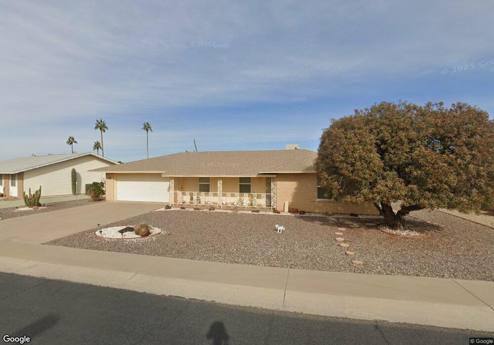
9438 W Newport Dr Sun City, AZ 85351
Estimated Value: $234,689 - $284,000
--
Bed
2
Baths
1,158
Sq Ft
$232/Sq Ft
Est. Value
About This Home
This home is located at 9438 W Newport Dr, Sun City, AZ 85351 and is currently estimated at $268,672, approximately $232 per square foot. 9438 W Newport Dr is a home located in Maricopa County with nearby schools including Sonoran Science Academy-Peoria, Black Mountain Science Academy Montessori, and Arrowhead Montessori.
Ownership History
Date
Name
Owned For
Owner Type
Purchase Details
Closed on
May 19, 2000
Sold by
Kempf Marie E
Bought by
Smith Harry Justin and Smith Sonja Elinor
Current Estimated Value
Purchase Details
Closed on
Aug 25, 1995
Sold by
Cullman Karin L and Arnold Gerald F
Bought by
Kempf Marie E
Purchase Details
Closed on
Oct 17, 1994
Sold by
Elder James C and Elder Agnes N
Bought by
Cullman Karin L and Arnold Gerald F
Home Financials for this Owner
Home Financials are based on the most recent Mortgage that was taken out on this home.
Original Mortgage
$38,000
Interest Rate
8.86%
Mortgage Type
Seller Take Back
Create a Home Valuation Report for This Property
The Home Valuation Report is an in-depth analysis detailing your home's value as well as a comparison with similar homes in the area
Home Values in the Area
Average Home Value in this Area
Purchase History
| Date | Buyer | Sale Price | Title Company |
|---|---|---|---|
| Smith Harry Justin | $88,000 | North American Title Agency | |
| Kempf Marie E | $89,000 | United Title Agency | |
| Cullman Karin L | $68,000 | United Title Agency |
Source: Public Records
Mortgage History
| Date | Status | Borrower | Loan Amount |
|---|---|---|---|
| Previous Owner | Cullman Karin L | $38,000 |
Source: Public Records
Tax History Compared to Growth
Tax History
| Year | Tax Paid | Tax Assessment Tax Assessment Total Assessment is a certain percentage of the fair market value that is determined by local assessors to be the total taxable value of land and additions on the property. | Land | Improvement |
|---|---|---|---|---|
| 2025 | $992 | $12,332 | -- | -- |
| 2024 | $893 | $11,744 | -- | -- |
| 2023 | $893 | $20,650 | $4,130 | $16,520 |
| 2022 | $839 | $16,130 | $3,220 | $12,910 |
| 2021 | $866 | $15,080 | $3,010 | $12,070 |
| 2020 | $843 | $13,280 | $2,650 | $10,630 |
| 2019 | $832 | $12,400 | $2,480 | $9,920 |
| 2018 | $800 | $11,230 | $2,240 | $8,990 |
| 2017 | $773 | $9,910 | $1,980 | $7,930 |
| 2016 | $371 | $7,200 | $1,440 | $5,760 |
| 2015 | $657 | $7,200 | $1,440 | $5,760 |
Source: Public Records
Map
Nearby Homes
- 9502 W Pineridge Dr
- 9414 W Newport Dr Unit 25
- 9445 W Rolling Hills Dr
- 14618 N Shiprock Dr
- 9517 W Indian Hills Dr
- 14830 N Cameo Dr
- 9442 W Raintree Dr Unit 25
- 9502 W Indian Hills Dr
- 9429 W Rolling Hills Dr
- 9409 W Indian Hills Dr
- 9434 W Raintree Dr
- 9433 W Greenway Rd
- 9702 W Pineridge Dr
- 9414 W Greenway Rd
- 9405 W Rolling Hills Dr
- 9437 W Long Hills Dr
- 9713 W Raintree Dr
- 9413 W Raintree Dr
- 9732 W Newport Dr Unit 25
- 15401 N Cameo Dr
- 9432 W Newport Dr
- 9444 W Newport Dr
- 9433 W Pineridge Dr
- 9439 W Pineridge Dr
- 9426 W Newport Dr
- 9439 W Newport Dr Unit 25
- 9435 W Newport Dr
- 9427 W Pineridge Dr
- 9443 W Newport Dr
- 9431 W Newport Dr
- 9447 W Newport Dr
- 9420 W Newport Dr Unit 25
- 9454 W Newport Dr
- 9421 W Pineridge Dr
- 9425 W Newport Dr
- 9449 W Pineridge Dr
- 9451 W Newport Dr
- 9438 W Brokenstone Dr
- 9442 W Brokenstone Dr
- 9434 W Brokenstone Dr