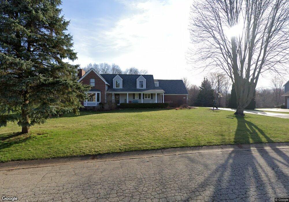
9439 Daleview Dr Unit Bldg-Unit South Lyon, MI 48178
Estimated Value: $565,000 - $626,000
4
Beds
4
Baths
2,840
Sq Ft
$211/Sq Ft
Est. Value
About This Home
This home is located at 9439 Daleview Dr Unit Bldg-Unit, South Lyon, MI 48178 and is currently estimated at $599,809, approximately $211 per square foot. 9439 Daleview Dr Unit Bldg-Unit is a home located in Livingston County with nearby schools including William A. Brummer Elementary School, Centennial Middle School, and South Lyon High School.
Ownership History
Date
Name
Owned For
Owner Type
Purchase Details
Closed on
Aug 22, 2018
Sold by
Webb Daniel C
Bought by
Narry Justin and Narry Stephanie
Current Estimated Value
Purchase Details
Closed on
Jun 2, 2015
Sold by
Rozycki James C and Roxycki Laura
Bought by
Webb Daniel C
Home Financials for this Owner
Home Financials are based on the most recent Mortgage that was taken out on this home.
Original Mortgage
$244,000
Interest Rate
0.78%
Mortgage Type
Purchase Money Mortgage
Purchase Details
Closed on
Aug 11, 1995
Sold by
Smith Steven R
Bought by
Mccune Timothy J and Mccune L
Home Financials for this Owner
Home Financials are based on the most recent Mortgage that was taken out on this home.
Original Mortgage
$130,000
Interest Rate
7.81%
Mortgage Type
New Conventional
Create a Home Valuation Report for This Property
The Home Valuation Report is an in-depth analysis detailing your home's value as well as a comparison with similar homes in the area
Home Values in the Area
Average Home Value in this Area
Purchase History
| Date | Buyer | Sale Price | Title Company |
|---|---|---|---|
| Narry Justin | $382,000 | -- | |
| Webb Daniel C | $305,000 | -- | |
| Mccune Timothy J | $237,000 | -- |
Source: Public Records
Mortgage History
| Date | Status | Borrower | Loan Amount |
|---|---|---|---|
| Previous Owner | Webb Daniel C | $244,000 | |
| Previous Owner | Mccune Timothy J | $130,000 |
Source: Public Records
Tax History Compared to Growth
Tax History
| Year | Tax Paid | Tax Assessment Tax Assessment Total Assessment is a certain percentage of the fair market value that is determined by local assessors to be the total taxable value of land and additions on the property. | Land | Improvement |
|---|---|---|---|---|
| 2025 | $6,958 | $280,400 | $0 | $0 |
| 2024 | $4,687 | $252,200 | $0 | $0 |
| 2023 | $4,471 | $244,300 | $0 | $0 |
| 2022 | $5,682 | $205,000 | $0 | $0 |
| 2021 | $5,682 | $195,600 | $0 | $0 |
| 2020 | $5,698 | $194,400 | $0 | $0 |
| 2019 | $6,182 | $205,000 | $0 | $0 |
| 2018 | $5,157 | $178,500 | $0 | $0 |
| 2017 | $5,234 | $179,600 | $0 | $0 |
| 2016 | $5,310 | $164,200 | $0 | $0 |
| 2014 | -- | $141,900 | $0 | $0 |
| 2012 | -- | $141,600 | $0 | $0 |
Source: Public Records
Map
Nearby Homes
- 9859 Aylebury Dr
- 9851 Atwood Dr
- 13428 Sequoia Ln
- 13708 Monarch Dr
- 26003 N Dixboro Rd
- 13500 12 Mile Rd
- Bradford Plan at Charleston Park
- Bradford with Second Floor Plan at Charleston Park
- Bartelle Plan at Charleston Park
- Upton Plan at Charleston Park
- Westford Plan at Charleston Park
- Addison Plan at Charleston Park
- Madison Plan at Charleston Park
- Nantucket Plan at Charleston Park
- Preston Plan at Charleston Park
- Rockport II Plan at Charleston Park
- Remington Plan at Charleston Park
- 62622 Raleigh Ct Unit 4
- 174 Singh Blvd
- 124 Shannon Partin Ct
- 9439 Daleview Dr
- 9421 Daleview Dr
- 9403 Daleview Dr
- 13479 Daleview Ct Unit Bldg-Unit
- 13479 Daleview Ct
- 9420 Daleview Dr
- 9475 Daleview Dr
- 13461 Daleview Ct
- 9493 Daleview Dr
- 9385 Daleview Dr
- 9494 Daleview Dr
- 9388 Daleview Dr
- 13417 Daleview Ct
- 13464 Daleview Ct
- 9511 Daleview Dr
- 13343 Daleview Ct
- 9528 Sunnywood Trail
- 9525 Sunnywood Trail
- 9512 Daleview Dr
- 13446 Daleview Ct