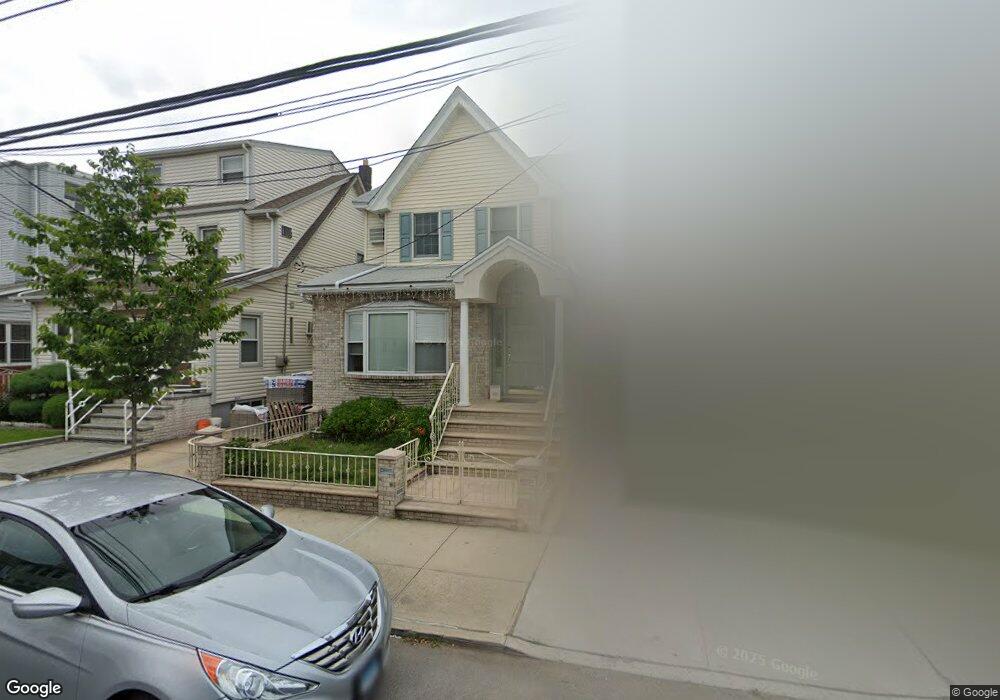
9439 Plattwood Ave Ozone Park, NY 11417
Ozone Park NeighborhoodEstimated Value: $792,898 - $1,103,000
--
Bed
--
Bath
2,201
Sq Ft
$430/Sq Ft
Est. Value
About This Home
This home is located at 9439 Plattwood Ave, Ozone Park, NY 11417 and is currently estimated at $947,475, approximately $430 per square foot. 9439 Plattwood Ave is a home located in Queens County with nearby schools including P.S. 63 - Old South, Robert H. Goddard High School, and John Adams High School.
Ownership History
Date
Name
Owned For
Owner Type
Purchase Details
Closed on
Feb 24, 2016
Sold by
Anthony T Pepe and Pepe As Surviving Tenant Felicia
Bought by
Ramasami Balram and Ramasami Renita
Current Estimated Value
Home Financials for this Owner
Home Financials are based on the most recent Mortgage that was taken out on this home.
Original Mortgage
$505,000
Outstanding Balance
$401,555
Interest Rate
3.79%
Mortgage Type
Purchase Money Mortgage
Estimated Equity
$545,920
Create a Home Valuation Report for This Property
The Home Valuation Report is an in-depth analysis detailing your home's value as well as a comparison with similar homes in the area
Home Values in the Area
Average Home Value in this Area
Purchase History
| Date | Buyer | Sale Price | Title Company |
|---|---|---|---|
| Ramasami Balram | $595,000 | -- |
Source: Public Records
Mortgage History
| Date | Status | Borrower | Loan Amount |
|---|---|---|---|
| Open | Ramasami Balram | $505,000 |
Source: Public Records
Tax History Compared to Growth
Tax History
| Year | Tax Paid | Tax Assessment Tax Assessment Total Assessment is a certain percentage of the fair market value that is determined by local assessors to be the total taxable value of land and additions on the property. | Land | Improvement |
|---|---|---|---|---|
| 2025 | $6,780 | $35,783 | $9,054 | $26,729 |
| 2024 | $6,780 | $33,758 | $9,218 | $24,540 |
| 2023 | $6,397 | $31,849 | $8,014 | $23,835 |
| 2022 | $6,351 | $50,220 | $13,860 | $36,360 |
| 2021 | $6,652 | $41,640 | $13,860 | $27,780 |
| 2020 | $6,312 | $40,200 | $13,860 | $26,340 |
| 2019 | $5,885 | $34,440 | $13,860 | $20,580 |
| 2018 | $5,410 | $26,541 | $9,857 | $16,684 |
| 2017 | $5,404 | $26,512 | $9,599 | $16,913 |
| 2016 | $4,956 | $26,512 | $9,599 | $16,913 |
| 2015 | $2,797 | $24,849 | $11,937 | $12,912 |
| 2014 | $2,797 | $23,444 | $13,242 | $10,202 |
Source: Public Records
Map
Nearby Homes
- 9426 Sutter Ave
- 9439 134th Ave
- 107-62 93rd St
- 10723 96th St
- 10719 96th St
- 13319 Crossbay Blvd
- 9108 Sutter Ave
- 106-38 95th St
- 96-06 134th Rd
- 107-20 92nd St
- 91-25 Gold Rd
- 95-18 Linden Blvd
- 132-01 100th St
- 10010 133rd Ave
- 13408 Sitka St
- 13421 Hawtree St
- 107-50 90th St
- 10751 89th St
- 92-18 Liberty Ave
- 9407 Pitkin Ave
- 9443 Plattwood Ave
- 9435 Plattwood Ave
- 9431 Plattwood Ave
- 9447 Plattwood Ave
- 9453 Plattwood Ave
- 9427 Plattwood Ave
- 9436 Sutter Ave
- 9432 Sutter Ave
- 9438 Sutter Ave
- 94-30 Sutter Ave
- 9430 Sutter Ave
- 9442 Sutter Ave
- 9438 Sutter Ave
- 9455 Plattwood Ave
- 9428 Sutter Ave
- 9423 Plattwood Ave
- 9450 Sutter Ave
- 9442 Plattwood Ave
- 9457 Plattwood Ave
- 9454 Sutter Ave