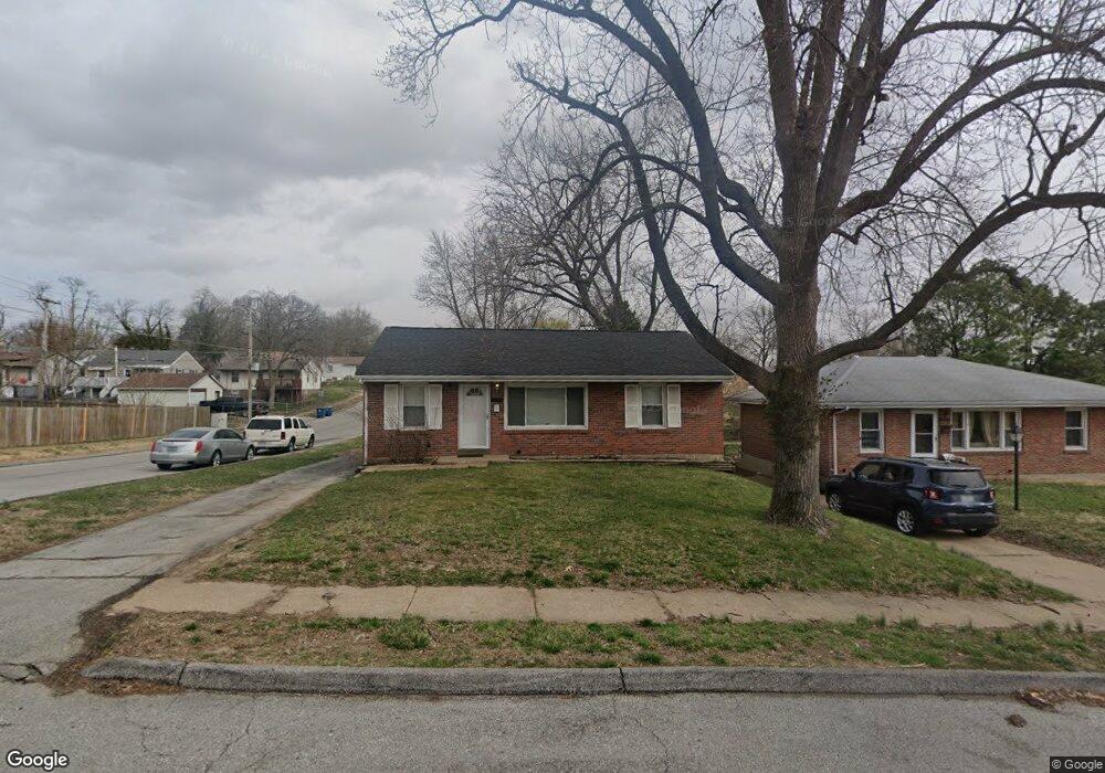
9439 Theodosia Ave Saint Louis, MO 63114
Estimated Value: $144,000 - $158,000
2
Beds
1
Bath
925
Sq Ft
$161/Sq Ft
Est. Value
About This Home
This home is located at 9439 Theodosia Ave, Saint Louis, MO 63114 and is currently estimated at $148,509, approximately $160 per square foot. 9439 Theodosia Ave is a home located in St. Louis County with nearby schools including Wyland Elementary School, Ritenour Middle School, and Ritenour Senior High School.
Ownership History
Date
Name
Owned For
Owner Type
Purchase Details
Closed on
Mar 27, 2013
Sold by
Dnw Development Company Llc
Bought by
Bs & Dw Properties Llc
Current Estimated Value
Purchase Details
Closed on
Nov 13, 2012
Sold by
Lewis Mitchell Company
Bought by
Dnw Development Company Llc
Purchase Details
Closed on
Sep 25, 2012
Sold by
Swierk Paul Lee
Bought by
Lewis Mitchell Co
Purchase Details
Closed on
Jul 20, 2001
Sold by
Paul Scott
Bought by
Swierk Paul Lee
Home Financials for this Owner
Home Financials are based on the most recent Mortgage that was taken out on this home.
Original Mortgage
$66,400
Interest Rate
7.07%
Create a Home Valuation Report for This Property
The Home Valuation Report is an in-depth analysis detailing your home's value as well as a comparison with similar homes in the area
Home Values in the Area
Average Home Value in this Area
Purchase History
| Date | Buyer | Sale Price | Title Company |
|---|---|---|---|
| Bs & Dw Properties Llc | -- | None Available | |
| Dnw Development Company Llc | $34,000 | Title Partners Agency Llc | |
| Lewis Mitchell Co | $22,993 | None Available | |
| Swierk Paul Lee | $69,900 | -- |
Source: Public Records
Mortgage History
| Date | Status | Borrower | Loan Amount |
|---|---|---|---|
| Previous Owner | Swierk Paul Lee | $66,400 |
Source: Public Records
Tax History Compared to Growth
Tax History
| Year | Tax Paid | Tax Assessment Tax Assessment Total Assessment is a certain percentage of the fair market value that is determined by local assessors to be the total taxable value of land and additions on the property. | Land | Improvement |
|---|---|---|---|---|
| 2025 | $1,918 | $26,030 | $6,860 | $19,170 |
| 2024 | $1,918 | $22,370 | $3,140 | $19,230 |
| 2023 | $1,876 | $22,370 | $3,140 | $19,230 |
| 2022 | $1,586 | $16,550 | $3,140 | $13,410 |
| 2021 | $1,586 | $16,550 | $3,140 | $13,410 |
| 2020 | $1,574 | $15,150 | $3,520 | $11,630 |
| 2019 | $1,558 | $15,150 | $3,520 | $11,630 |
| 2018 | $1,273 | $11,100 | $2,950 | $8,150 |
| 2017 | $1,215 | $11,100 | $2,950 | $8,150 |
| 2016 | $909 | $8,400 | $2,760 | $5,640 |
| 2015 | $929 | $8,400 | $2,760 | $5,640 |
| 2014 | $914 | $12,730 | $2,130 | $10,600 |
Source: Public Records
Map
Nearby Homes
- 9515 Cote Brilliante Ave
- 9446 Miriam Ave
- 2223 Burns Ave
- 9430 Ridge Ave
- 9617 Cote Brilliante Ave
- 9417 Romaine Ave
- 2228 Spencer Ave
- 1910 Leondale Ave
- 1947 Brown Rd
- 9705 Miriam Ave
- 2327 Gaebler Ave
- 2326 Hood Ave
- 2325 Goodale Ave
- 9816 Lullaby Ln
- 9515 Marlowe Ave
- 9825 Zykan Dr
- 9833 Eastbrook Dr
- 9833 Zykan Dr
- 2106 Lackland Rd
- 29 W Sherwood Dr
- 9437 Theodosia Ave
- 9435 Theodosia Ave
- 9501 Theodosia Ave
- 9436 Cote Brilliante Ave
- 9434 Cote Brilliante Ave
- 9433 Theodosia Ave
- 9500 Cote Brilliante Ave
- 9438 Theodosia Ave
- 9436 Theodosia Ave
- 9502 Cote Brilliante Ave
- 9430 Cote Brilliante Ave
- 9431 Theodosia Ave
- 9505 Theodosia Ave
- 9434 Theodosia Ave
- 9500 Theodosia Ave
- 9432 Theodosia Ave
- 9502 Theodosia Ave
- 9504 Cote Brilliante Ave
- 9428 Cote Brilliante Ave
- 9507 Theodosia Ave