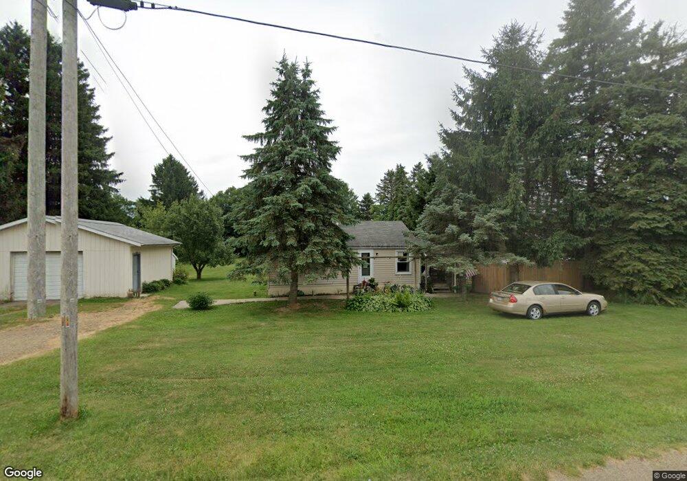
944 Hoover Rd Mansfield, OH 44905
Estimated Value: $95,779 - $230,000
2
Beds
1
Bath
616
Sq Ft
$242/Sq Ft
Est. Value
About This Home
This home is located at 944 Hoover Rd, Mansfield, OH 44905 and is currently estimated at $149,195, approximately $242 per square foot. 944 Hoover Rd is a home located in Richland County with nearby schools including Madison High School, Temple-Christian School, and St. Mary Catholic School.
Ownership History
Date
Name
Owned For
Owner Type
Purchase Details
Closed on
Dec 23, 2013
Sold by
Armstrong Patricia A and Armstrong Dale D
Bought by
Armstrong Patricia A and Armstrong Dale D
Current Estimated Value
Home Financials for this Owner
Home Financials are based on the most recent Mortgage that was taken out on this home.
Original Mortgage
$53,900
Outstanding Balance
$40,618
Interest Rate
4.42%
Mortgage Type
New Conventional
Estimated Equity
$108,577
Purchase Details
Closed on
Oct 29, 1992
Sold by
Bush Richard M
Bought by
Armstrong Patricia A
Create a Home Valuation Report for This Property
The Home Valuation Report is an in-depth analysis detailing your home's value as well as a comparison with similar homes in the area
Home Values in the Area
Average Home Value in this Area
Purchase History
| Date | Buyer | Sale Price | Title Company |
|---|---|---|---|
| Armstrong Patricia A | -- | First American | |
| Armstrong Patricia A | $17,600 | -- |
Source: Public Records
Mortgage History
| Date | Status | Borrower | Loan Amount |
|---|---|---|---|
| Open | Armstrong Patricia A | $53,900 |
Source: Public Records
Tax History Compared to Growth
Tax History
| Year | Tax Paid | Tax Assessment Tax Assessment Total Assessment is a certain percentage of the fair market value that is determined by local assessors to be the total taxable value of land and additions on the property. | Land | Improvement |
|---|---|---|---|---|
| 2024 | $730 | $24,820 | $10,640 | $14,180 |
| 2023 | $730 | $24,820 | $10,640 | $14,180 |
| 2022 | $632 | $20,290 | $9,520 | $10,770 |
| 2021 | $632 | $20,290 | $9,520 | $10,770 |
| 2020 | $637 | $20,290 | $9,520 | $10,770 |
| 2019 | $539 | $17,430 | $8,060 | $9,370 |
| 2018 | $504 | $17,430 | $8,060 | $9,370 |
| 2017 | $473 | $17,430 | $8,060 | $9,370 |
| 2016 | $451 | $16,250 | $7,660 | $8,590 |
| 2015 | $451 | $16,250 | $7,660 | $8,590 |
| 2014 | $429 | $16,250 | $7,660 | $8,590 |
| 2012 | $226 | $17,100 | $8,060 | $9,040 |
Source: Public Records
Map
Nearby Homes
- 0 Hoover Rd
- 1171 Hoover Rd
- 920 Piper Rd
- 1585 Beal Rd
- 1791 Beal Rd
- 1292 Wolford Rd
- 1245 N Stewart Rd
- 1158 Delwood Rd
- 1150 Delwood Dr
- 1151 Beal Rd
- 1140 5th Ave
- 1106 Keller Dr Unit 1108
- 0 Wesley
- 741 Yale Ave
- 735 Pennsylvania Ave
- 903 Mayflower Ave
- 1806 Richard Dr
- 1199 Evergreen Ave W
- 1183 Evergreen Ave W
- 1951 Woodmont Rd
- 964 Hoover Rd
- 918 Hoover Rd
- 910 Hoover Rd
- 900 Hoover Rd
- 890 Hoover Rd
- 868 Hoover Rd
- 856 Hoover Rd
- 840 Hoover Rd
- 1087 Hoover Rd
- 814 Hoover Rd
- 1804 N Stewart Rd
- 1885 N Stewart Rd
- 1669 N Stewart Rd
- 1105 Hoover Rd
- 805 Hoover Rd
- 1844 N Stewart Rd
- 802 Hoover Rd
- 793 Hoover Rd
- 1631 N Stewart Rd
- 1121 Hoover Rd