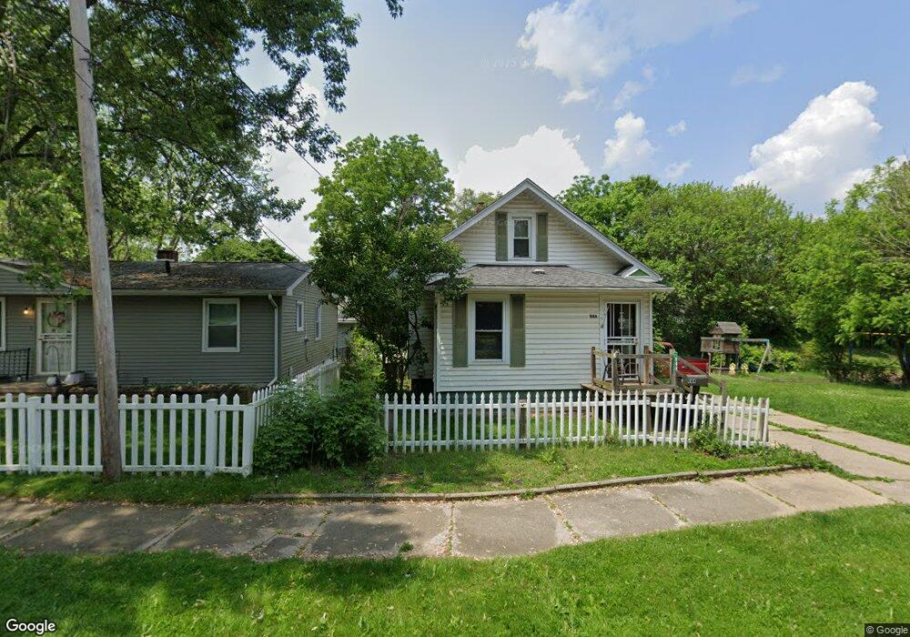
944 Middleton St Flint, MI 48503
Mannhall Park NeighborhoodEstimated Value: $43,000 - $85,525
3
Beds
1
Bath
880
Sq Ft
$65/Sq Ft
Est. Value
About This Home
This home is located at 944 Middleton St, Flint, MI 48503 and is currently estimated at $57,381, approximately $65 per square foot. 944 Middleton St is a home located in Genesee County with nearby schools including Durant-Tuuri-Mott Elementary School, St. Paul Lutheran School, and St John Vianney Catholic School.
Ownership History
Date
Name
Owned For
Owner Type
Purchase Details
Closed on
Feb 28, 2014
Sold by
Mccooy Donna Lou
Bought by
Robinson Kathleen A and Robinson Robin D
Current Estimated Value
Purchase Details
Closed on
Nov 4, 2010
Sold by
Mccoy Donna L
Bought by
Mccoy Donna L and Robinson Kathleen A
Purchase Details
Closed on
Nov 8, 2007
Sold by
Mccoy Donna Lou
Bought by
Mccoy Donna Lou and Mccoy Robert Lee
Purchase Details
Closed on
Nov 7, 2007
Sold by
Coulter Ladonna Peak
Bought by
Mccoy Donna Lou
Create a Home Valuation Report for This Property
The Home Valuation Report is an in-depth analysis detailing your home's value as well as a comparison with similar homes in the area
Home Values in the Area
Average Home Value in this Area
Purchase History
| Date | Buyer | Sale Price | Title Company |
|---|---|---|---|
| Robinson Kathleen A | -- | None Available | |
| Mccoy Donna L | -- | Cislo Title Company | |
| Mccoy Donna Lou | -- | None Available | |
| Mccoy Donna Lou | $17,000 | None Available |
Source: Public Records
Tax History
| Year | Tax Paid | Tax Assessment Tax Assessment Total Assessment is a certain percentage of the fair market value that is determined by local assessors to be the total taxable value of land and additions on the property. | Land | Improvement |
|---|---|---|---|---|
| 2025 | $910 | $19,500 | $0 | $0 |
| 2024 | $849 | $18,900 | $0 | $0 |
| 2023 | $834 | $16,200 | $0 | $0 |
| 2022 | $0 | $13,800 | $0 | $0 |
| 2021 | $842 | $11,500 | $0 | $0 |
| 2020 | $780 | $9,900 | $0 | $0 |
| 2019 | $767 | $8,600 | $0 | $0 |
| 2018 | $745 | $7,500 | $0 | $0 |
| 2017 | $959 | $0 | $0 | $0 |
| 2016 | $857 | $0 | $0 | $0 |
| 2015 | -- | $0 | $0 | $0 |
| 2014 | -- | $0 | $0 | $0 |
| 2012 | -- | $12,600 | $0 | $0 |
Source: Public Records
Map
Nearby Homes
- 911 Hughes Ave
- 915 Stocker Ave
- 932 Bradley Ave
- 3018 Fielding St
- 960 Mann Ave
- 3302 Van Buren Ave
- 612 Bradley Ave
- 1017 Stocker Ave
- 3318 Norwood Dr
- 976 Barney Ave
- 1122 Stocker Ave
- 3320 Pencombe Place
- 2464 Gibson St
- 0000 Beecher Rd
- 2621 Swayze St
- 3617 Sherwood Dr
- 2618 Brown St
- 3413 Augusta St
- 2437 Zimmerman St
- 2509 Corunna Rd
- 948 Middleton St
- 939 Hughes Ave
- 945 Hughes Ave
- 935 Hughes Ave
- 939 Middleton St
- 935 Middleton St
- 945 Middleton St
- 925 Hughes Ave
- 951 Hughes Ave
- 2917 Mann Hall Ave
- 2925 Mann Hall Ave
- 921 Hughes Ave
- 955 Hughes Ave
- 919 Hughes Ave
- 929 Middleton St
- 940 Mcqueen St
- 944 Mcqueen St
- 938 Hughes Ave
- 948 Mcqueen St
- 936 Mcqueen St
Your Personal Tour Guide
Ask me questions while you tour the home.