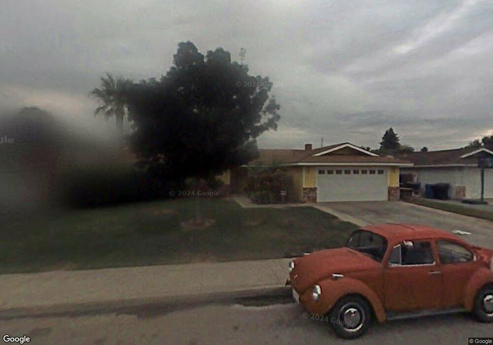
944 Rose St Porterville, CA 93257
Porterville Northwest NeighborhoodEstimated Value: $326,465 - $348,000
3
Beds
3
Baths
1,470
Sq Ft
$228/Sq Ft
Est. Value
About This Home
This home is located at 944 Rose St, Porterville, CA 93257 and is currently estimated at $335,366, approximately $228 per square foot. 944 Rose St is a home located in Tulare County with nearby schools including Oak Grove Elementary School, Burton Middle School, and Monache High School.
Ownership History
Date
Name
Owned For
Owner Type
Purchase Details
Closed on
Nov 26, 2001
Sold by
Carrillo Tony
Bought by
Carrillo Tony and Carrillo Martha
Current Estimated Value
Home Financials for this Owner
Home Financials are based on the most recent Mortgage that was taken out on this home.
Original Mortgage
$95,200
Interest Rate
6.63%
Purchase Details
Closed on
Jan 26, 2000
Sold by
Carrillo Tony
Bought by
Carrillo Martha and Carillo Tony
Purchase Details
Closed on
Mar 17, 1998
Sold by
Carrillo Rita
Bought by
Carrillo Tony
Create a Home Valuation Report for This Property
The Home Valuation Report is an in-depth analysis detailing your home's value as well as a comparison with similar homes in the area
Home Values in the Area
Average Home Value in this Area
Purchase History
| Date | Buyer | Sale Price | Title Company |
|---|---|---|---|
| Carrillo Tony | -- | Fidelity National Title Co | |
| Carrillo Martha | -- | -- | |
| Carrillo Tony | -- | -- |
Source: Public Records
Mortgage History
| Date | Status | Borrower | Loan Amount |
|---|---|---|---|
| Closed | Carrillo Tony | $95,200 |
Source: Public Records
Tax History
| Year | Tax Paid | Tax Assessment Tax Assessment Total Assessment is a certain percentage of the fair market value that is determined by local assessors to be the total taxable value of land and additions on the property. | Land | Improvement |
|---|---|---|---|---|
| 2025 | $1,838 | $182,038 | $43,341 | $138,697 |
| 2024 | $1,838 | $178,470 | $42,492 | $135,978 |
| 2023 | $1,841 | $174,971 | $41,659 | $133,312 |
| 2022 | $1,736 | $171,542 | $40,843 | $130,699 |
| 2021 | $1,740 | $168,178 | $40,042 | $128,136 |
| 2020 | $1,707 | $166,453 | $39,631 | $126,822 |
| 2019 | $1,705 | $163,189 | $38,854 | $124,335 |
| 2018 | $1,628 | $159,989 | $38,092 | $121,897 |
| 2017 | $1,601 | $156,852 | $37,345 | $119,507 |
| 2016 | $1,524 | $153,777 | $36,613 | $117,164 |
| 2015 | $1,368 | $151,467 | $36,063 | $115,404 |
| 2014 | $1,368 | $139,000 | $35,000 | $104,000 |
Source: Public Records
Map
Nearby Homes
- 1041 Greenfield Dr
- 1621 W Westfield Ave
- 1709 W Cheryll Ave
- 635 N Belmont St
- 1440 San Lucia Ave
- 1076 N Beverly St
- 1690 W Kanai Ave
- 1304 N Birch St
- 1865 La Vida Ave
- 1350 N Lindale Way
- 480 N Belmont St
- 936 N Red Oak St
- 1253 W Jean Ave
- 1852 Santa Maria Ave
- 2273 W Santa Maria Ct Unit Lw179
- 2164 W San Lucia Ct
- 2222 Santa Maria Ave Unit Lw187
- 2232 Santa Maria Ave Unit Lw188
- 2242 W Santa Maria Ct Unit Lw189
- 2212 Santa Maria Ave Unit Lw186
- 934 N Rose St
- 934 Rose St
- 954 Rose St
- 945 N Patsy St
- 945 Patsy St
- 1708 Bel Aire Ave
- 955 N Patsy St
- 955 Patsy St
- 964 Rose St
- 1747 Terry Cir
- 1740 Bel Aire Ave
- 965 Patsy St
- 1757 Terry Cir
- 1725 Bel Aire Ave
- 1715 Bel Aire Ave
- 974 Rose St
- 1740 Terry Cir
- 1735 Bel Aire Ave
- 1705 Bel Aire Ave
- 1680 Bel Aire Ave
Your Personal Tour Guide
Ask me questions while you tour the home.