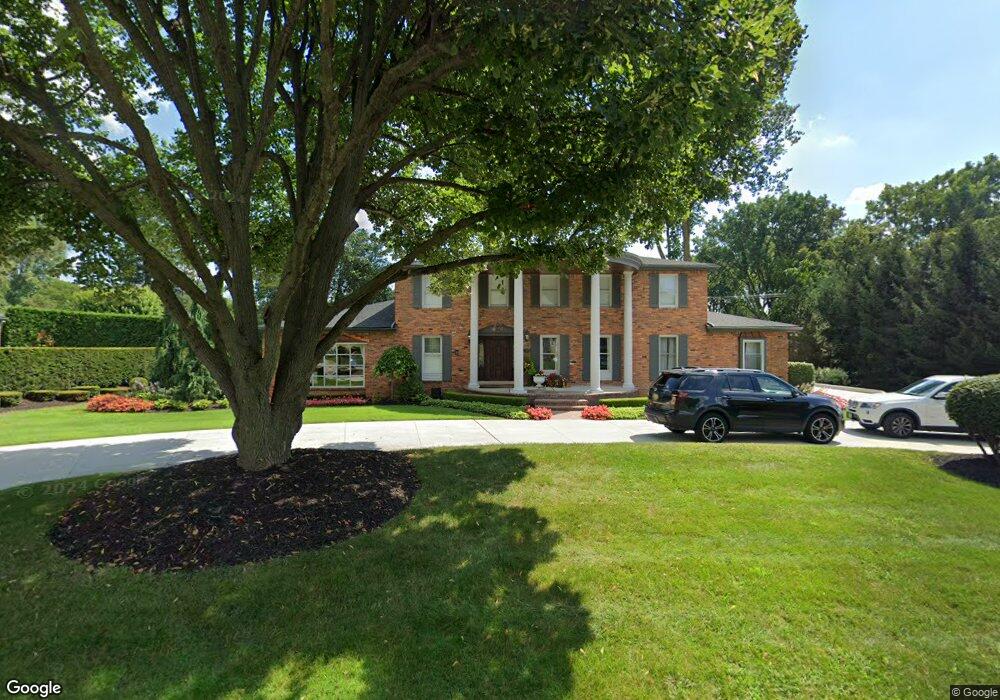
944 Stuyvessant Rd Bloomfield Hills, MI 48301
Estimated Value: $1,283,882 - $1,602,000
4
Beds
7
Baths
3,868
Sq Ft
$364/Sq Ft
Est. Value
About This Home
This home is located at 944 Stuyvessant Rd, Bloomfield Hills, MI 48301 and is currently estimated at $1,409,721, approximately $364 per square foot. 944 Stuyvessant Rd is a home located in Oakland County with nearby schools including Quarton Elementary, Ernest W. Seaholm High School, and Cranbrook School.
Ownership History
Date
Name
Owned For
Owner Type
Purchase Details
Closed on
Jul 9, 2019
Sold by
Armstrong Mark and Armstrong Mark H
Bought by
Armstrong Mark and Armstrong Stacey
Current Estimated Value
Purchase Details
Closed on
Mar 15, 2000
Sold by
Vosotas Daniel J
Bought by
Armstrong Mark H
Home Financials for this Owner
Home Financials are based on the most recent Mortgage that was taken out on this home.
Original Mortgage
$599,000
Outstanding Balance
$201,985
Interest Rate
8.22%
Estimated Equity
$1,207,736
Purchase Details
Closed on
May 14, 1996
Sold by
Vosotas Carole O
Bought by
Vosotas Daniel J
Create a Home Valuation Report for This Property
The Home Valuation Report is an in-depth analysis detailing your home's value as well as a comparison with similar homes in the area
Home Values in the Area
Average Home Value in this Area
Purchase History
| Date | Buyer | Sale Price | Title Company |
|---|---|---|---|
| Armstrong Mark | -- | None Available | |
| Armstrong Mark H | $749,000 | -- | |
| Vosotas Daniel J | -- | -- |
Source: Public Records
Mortgage History
| Date | Status | Borrower | Loan Amount |
|---|---|---|---|
| Open | Armstrong Mark H | $599,000 |
Source: Public Records
Tax History Compared to Growth
Tax History
| Year | Tax Paid | Tax Assessment Tax Assessment Total Assessment is a certain percentage of the fair market value that is determined by local assessors to be the total taxable value of land and additions on the property. | Land | Improvement |
|---|---|---|---|---|
| 2024 | $6,555 | $442,440 | $0 | $0 |
| 2023 | $6,291 | $383,340 | $0 | $0 |
| 2022 | $10,648 | $341,290 | $0 | $0 |
| 2021 | $10,737 | $328,310 | $0 | $0 |
| 2020 | $6,043 | $324,420 | $0 | $0 |
| 2019 | $10,720 | $344,670 | $0 | $0 |
| 2018 | $10,639 | $347,250 | $0 | $0 |
| 2017 | $13,125 | $337,860 | $0 | $0 |
| 2016 | $13,104 | $333,740 | $0 | $0 |
| 2015 | -- | $282,860 | $0 | $0 |
| 2014 | -- | $292,650 | $0 | $0 |
| 2011 | -- | $233,280 | $0 | $0 |
Source: Public Records
Map
Nearby Homes
- 1287 Charrington Rd
- 1348 Charrington Rd
- 3546 Bloomfield Club Dr
- 5825 Lahser Rd
- 3320 Morningview Terrace
- 100 Overhill Rd
- 2579 Amberly Rd
- 231 Wadsworth Ln
- 1019 N Cranbrook Rd
- 6580 Red Maple Ln
- 6560 Red Maple Ln
- 596 Rudgate Rd
- 270 Martell Dr
- 3627 Middlebury Ln
- 6727 Lahser Rd
- 956 Westwood Dr
- 397 S Cranbrook Rd
- 421 S Williamsbury Rd
- 692 Bennington Dr
- 5741 Snowshoe Cir
- 976 Stuyvessant Rd
- 963 Ardmoor Dr
- 1001 Ardmoor Dr
- 910 Charrington Rd
- 945 Stuyvessant Rd
- 925 Ardmoor Dr
- 1031 Ardmoor Dr
- 975 Stuyvessant Rd
- 1108 Stuyvessant Rd
- 865 Ardmoor Dr
- 950 Charrington Rd
- 1107 Stuyvessant Rd
- 1063 Ardmoor Dr
- 1010 Ardmoor Dr
- 3330 Burning Bush Rd
- 885 Charrington Rd
- 3350 Burning Bush Rd
- 974 Charrington Rd
- 3370 Burning Bush Rd
- 1132 Stuyvessant Rd