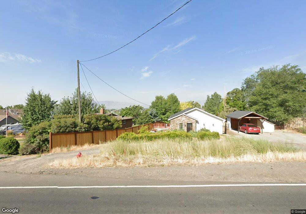
9441 N Canyon Rd Cedar Hills, UT 84062
Estimated Value: $482,000 - $549,000
3
Beds
2
Baths
1,636
Sq Ft
$312/Sq Ft
Est. Value
About This Home
This home is located at 9441 N Canyon Rd, Cedar Hills, UT 84062 and is currently estimated at $510,616, approximately $312 per square foot. 9441 N Canyon Rd is a home located in Utah County with nearby schools including Deerfield Elementary School, Mountain Ridge Junior High School, and American Fork High School.
Ownership History
Date
Name
Owned For
Owner Type
Purchase Details
Closed on
May 18, 2021
Sold by
Mcbride Branum
Bought by
Lunt Christian and Lunt Carly
Current Estimated Value
Home Financials for this Owner
Home Financials are based on the most recent Mortgage that was taken out on this home.
Original Mortgage
$358,000
Outstanding Balance
$324,437
Interest Rate
3.1%
Mortgage Type
New Conventional
Estimated Equity
$186,179
Purchase Details
Closed on
Mar 26, 2020
Sold by
Mcbride Branun and Sobel Tiffany
Bought by
Mcbridge Branun
Purchase Details
Closed on
May 10, 2013
Sold by
Port Lincoln and Port Audree
Bought by
Mcbride Branun and Sobel Tiffany
Home Financials for this Owner
Home Financials are based on the most recent Mortgage that was taken out on this home.
Original Mortgage
$175,147
Interest Rate
3.75%
Mortgage Type
FHA
Purchase Details
Closed on
May 8, 2012
Sold by
Tischner A Wade and Tischner Donna
Bought by
Port Lincoln and Port Audriee
Purchase Details
Closed on
Feb 28, 1997
Sold by
Macneil Stephen M and Macneil Julie
Bought by
Tischner A Wade and Tischner Donna
Home Financials for this Owner
Home Financials are based on the most recent Mortgage that was taken out on this home.
Original Mortgage
$92,600
Interest Rate
7.86%
Mortgage Type
Seller Take Back
Purchase Details
Closed on
Sep 13, 1996
Sold by
Broderick Lamar
Bought by
Macneil Stephen M and Macneil Julie
Home Financials for this Owner
Home Financials are based on the most recent Mortgage that was taken out on this home.
Original Mortgage
$144,300
Interest Rate
8.23%
Purchase Details
Closed on
Aug 22, 1996
Sold by
Broderick Lamar
Bought by
Macneil Stephen M and Macneil Julie
Home Financials for this Owner
Home Financials are based on the most recent Mortgage that was taken out on this home.
Original Mortgage
$144,300
Interest Rate
8.23%
Create a Home Valuation Report for This Property
The Home Valuation Report is an in-depth analysis detailing your home's value as well as a comparison with similar homes in the area
Home Values in the Area
Average Home Value in this Area
Purchase History
| Date | Buyer | Sale Price | Title Company |
|---|---|---|---|
| Lunt Christian | -- | Us Title Insurance Agency | |
| Mcbridge Branun | -- | None Available | |
| Mcbride Branun | -- | American Secure Title | |
| Port Lincoln | -- | Morgan Title And Escrow Inc | |
| Tischner A Wade | -- | Provo Land Title | |
| Macneil Stephen M | -- | -- | |
| Macneil Stephen M | -- | -- |
Source: Public Records
Mortgage History
| Date | Status | Borrower | Loan Amount |
|---|---|---|---|
| Open | Lunt Christian | $358,000 | |
| Previous Owner | Mcbride Branun | $175,147 | |
| Previous Owner | Tischner A Wade | $92,600 | |
| Previous Owner | Macneil Stephen M | $144,300 | |
| Previous Owner | Macneil Stephen M | $92,600 | |
| Closed | Port Lincoln | $0 |
Source: Public Records
Tax History Compared to Growth
Tax History
| Year | Tax Paid | Tax Assessment Tax Assessment Total Assessment is a certain percentage of the fair market value that is determined by local assessors to be the total taxable value of land and additions on the property. | Land | Improvement |
|---|---|---|---|---|
| 2025 | $1,890 | $245,355 | $271,500 | $174,600 |
| 2024 | $1,890 | $223,850 | $0 | $0 |
| 2023 | $1,757 | $223,520 | $0 | $0 |
| 2022 | $1,849 | $229,845 | $0 | $0 |
| 2021 | $1,515 | $280,400 | $170,500 | $109,900 |
| 2020 | $1,395 | $252,100 | $152,200 | $99,900 |
| 2019 | $1,229 | $230,600 | $143,700 | $86,900 |
| 2018 | $1,145 | $202,400 | $126,800 | $75,600 |
| 2017 | $1,022 | $96,580 | $0 | $0 |
| 2016 | $959 | $84,315 | $0 | $0 |
| 2015 | $951 | $79,090 | $0 | $0 |
| 2014 | $846 | $69,905 | $0 | $0 |
Source: Public Records
Map
Nearby Homes
- 3810 W Valley View Dr
- 9547 N Canyon Rd
- 9481 N 3830 W
- 9575 Aztec Dr
- 9506 N 4000 W
- 4124 N 810 W
- 9157 N Canyon Heights Dr
- 9078 Renaissance Dr
- 3851 W Mountaintop Cir Unit 5
- 2837 N 550 W
- 3408 W Bear Canyon Ln N Unit 53
- 3870 Mountaintop Cir
- 8923 N Cottage Canyon Dr
- 9900 N Meadow Dr
- 3373 Bear Canyon Ln
- 2969 N 1350 W
- 4441 W Bridgestone Dr
- 8905 N Pine Hollow Dr
- 248 N Deerfield Ln
- 1243 N 1270 E
- 9441 Canyon Rd
- 9449 Canyon Rd
- 9449 N Canyon Rd
- 9427 N Canyon Rd
- 9427 N Canyon Rd
- 9436 N 3830 W
- 3784 W Valley View Dr
- 9452 N 3830 W
- 3784 W Valley View Dr
- 9464 N 3830 W
- 9454 Canyon Rd
- 9450 N Canyon Rd
- 3810 W Valley View Dr
- 9472 Canyon Rd
- 9473 N Canyon Rd
- 9466 N 3830 W
- 3822 W Valley View Dr
- 9540 Canyon Rd
- 3822 W Valley View Dr
- 9540 N Canyon Rd