L
Seller's Agent in 2014
Lynette Hermann-
Area One Realtors LLC

Estimated Value: $39,276 - $57,000
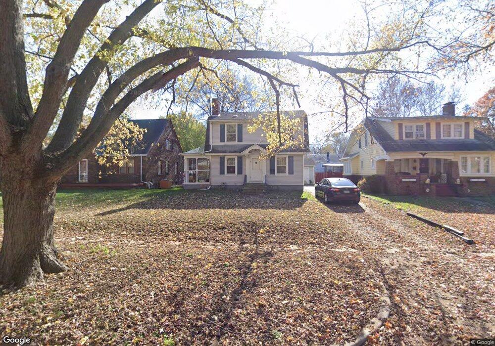
Picture perfect 2 story home with large livingroom that features fireplace, nice dining room, kitchen has nice cabinets and built in breakfast table. 2 large bedrooms upstairs and 1 small bedroom upstairs. Nice bathroom. Basement has finished family room, possible 4th bedroom, laundry area and utility room. Boiler approx 6 years old. Home is fully insulated, low utility bills. Realtor Owned
Last Agent to Sell the Property
Lynette Hermann-
Area One Realtors LLC Listed on: 04/23/2013
Last Buyer's Agent
Glenda Williamson
Glenda Williamson Realty License #471004505
| Date | Buyer | Sale Price | Title Company |
|---|---|---|---|
| Byrne Randall J | $34,000 | None Available | |
| -- | $20,500 | -- |
| Date | Status | Borrower | Loan Amount |
|---|---|---|---|
| Open | Byrne Randall J | $32,300 |
| Date | Event | Price | List to Sale | Price per Sq Ft |
|---|---|---|---|---|
| 05/16/2014 05/16/14 | Sold | $34,000 | -20.7% | $19 / Sq Ft |
| 04/24/2014 04/24/14 | Pending | -- | -- | -- |
| 04/23/2013 04/23/13 | For Sale | $42,900 | -- | $25 / Sq Ft |
| Year | Tax Paid | Tax Assessment Tax Assessment Total Assessment is a certain percentage of the fair market value that is determined by local assessors to be the total taxable value of land and additions on the property. | Land | Improvement |
|---|---|---|---|---|
| 2024 | $970 | $10,021 | $1,303 | $8,718 |
| 2023 | $962 | $9,666 | $1,257 | $8,409 |
| 2022 | $927 | $9,063 | $1,163 | $7,900 |
| 2021 | $871 | $8,464 | $1,086 | $7,378 |
| 2020 | $858 | $8,072 | $1,036 | $7,036 |
| 2019 | $858 | $8,072 | $1,036 | $7,036 |
| 2018 | $912 | $8,677 | $1,618 | $7,059 |
| 2017 | $933 | $8,908 | $1,661 | $7,247 |
| 2016 | $951 | $8,999 | $1,678 | $7,321 |
| 2015 | $904 | $8,840 | $1,648 | $7,192 |
| 2014 | $839 | $8,753 | $1,632 | $7,121 |
| 2013 | $867 | $9,081 | $1,693 | $7,388 |
L
Seller's Agent in 2014
Lynette Hermann-
Area One Realtors LLC
G
Buyer's Agent in 2014
Glenda Williamson
Glenda Williamson Realty
Source: Central Illinois Board of REALTORS®
MLS Number: 5191129
APN: 04-12-14-454-006
Ask me questions while you tour the home.
