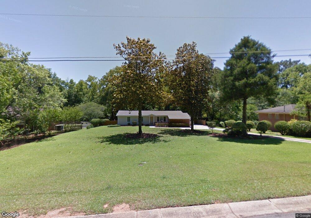
945 Glenbrook Rd Macon, GA 31210
Estimated Value: $176,000 - $220,000
3
Beds
3
Baths
1,566
Sq Ft
$126/Sq Ft
Est. Value
About This Home
This home is located at 945 Glenbrook Rd, Macon, GA 31210 and is currently estimated at $197,941, approximately $126 per square foot. 945 Glenbrook Rd is a home located in Bibb County with nearby schools including Lane Elementary School, Howard Middle School, and Howard High School.
Ownership History
Date
Name
Owned For
Owner Type
Purchase Details
Closed on
Sep 28, 2006
Sold by
Secretary Of Hud
Bought by
Pettigrew Calvin
Current Estimated Value
Home Financials for this Owner
Home Financials are based on the most recent Mortgage that was taken out on this home.
Original Mortgage
$115,000
Interest Rate
6.36%
Mortgage Type
New Conventional
Purchase Details
Closed on
Mar 7, 2006
Purchase Details
Closed on
Jun 5, 2000
Create a Home Valuation Report for This Property
The Home Valuation Report is an in-depth analysis detailing your home's value as well as a comparison with similar homes in the area
Purchase History
| Date | Buyer | Sale Price | Title Company |
|---|---|---|---|
| Pettigrew Calvin | -- | Not Available | |
| -- | $111,400 | -- | |
| Federal National Mortgage Association | -- | None Available | |
| -- | $103,000 | -- |
Source: Public Records
Mortgage History
| Date | Status | Borrower | Loan Amount |
|---|---|---|---|
| Closed | Pettigrew Calvin | $115,000 |
Source: Public Records
Tax History
| Year | Tax Paid | Tax Assessment Tax Assessment Total Assessment is a certain percentage of the fair market value that is determined by local assessors to be the total taxable value of land and additions on the property. | Land | Improvement |
|---|---|---|---|---|
| 2025 | $1,575 | $71,101 | $14,938 | $56,163 |
| 2024 | $1,628 | $71,101 | $14,938 | $56,163 |
| 2023 | $1,444 | $55,763 | $11,950 | $43,813 |
| 2022 | $1,620 | $53,779 | $11,478 | $42,301 |
| 2021 | $1,828 | $55,112 | $11,478 | $43,634 |
| 2020 | $1,424 | $43,688 | $9,183 | $34,505 |
| 2019 | $1,436 | $43,688 | $9,183 | $34,505 |
| 2018 | $2,379 | $43,688 | $9,183 | $34,505 |
| 2017 | $1,337 | $42,696 | $8,724 | $33,972 |
| 2016 | $1,081 | $38,237 | $8,264 | $29,973 |
| 2015 | $1,342 | $34,397 | $7,346 | $27,050 |
| 2014 | $1,595 | $34,397 | $7,346 | $27,050 |
Source: Public Records
Map
Nearby Homes
- 122 Lundy Ct
- 840 Balim Ct
- 835 Old Lundy Rd
- 1024 Normandy Rd
- 636 Lokchapee Ridge
- 715 Gay Dr
- 1209 Normandy Rd
- 843 Green Oak Terrace
- 673 Commanche Dr
- 166 Brookstone Way
- 177 Brookstone Way
- 1161 Ousley Place
- 556 Commanche Place
- 870 Glen Hill Ct
- 532 Sioux Dr
- 610 Chastain Place
- 3640 Northside Dr
- 3622 Northside Dr
- 3602 Northside Dr
- 3678 Northside Dr
- 953 Glenbrook Rd
- 933 Glenbrook Rd
- 122 Lundy Place
- 925 Glenbrook Rd
- 950 Lundy Terrace
- 124 Lundy Place
- 965 Glenbrook Rd
- 950 Glenbrook Rd
- 950 Glenbrook Rd Unit 341
- 946 Lundy Terrace
- 126 Lundy Place
- 1106 Darlington Dr
- 130 Lundy Place
- 942 Lundy Terrace
- 975 Old Lundy Rd
- 917 Glenbrook Rd
- 924 Glenbrook Rd
- 1109 Darlington Dr
- 970 Glenbrook Rd
- 940 Lundy Terrace
Your Personal Tour Guide
Ask me questions while you tour the home.