Estimated Value: $264,269 - $317,000
3
Beds
2
Baths
1,344
Sq Ft
$215/Sq Ft
Est. Value
About This Home
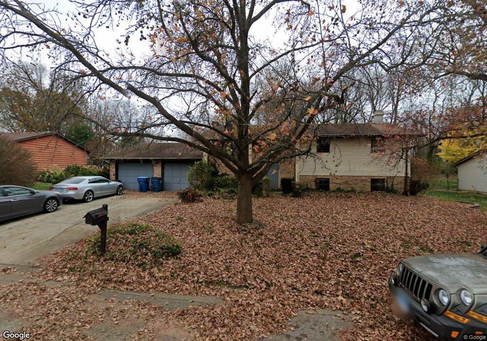
This home is located at 945 Olde Farm Rd, Troy, IL 62294 and is currently estimated at $288,817, approximately $214 per square foot. 945 Olde Farm Rd is a home located in Madison County with nearby schools including Silver Creek Elementary School, Triad Middle School, and Triad High School.
Ownership History
Date
Name
Owned For
Owner Type
Purchase Details
Closed on
Jun 30, 2008
Sold by
Wittmann Marion
Bought by
Barbour Michael E
Current Estimated Value
Home Financials for this Owner
Home Financials are based on the most recent Mortgage that was taken out on this home.
Original Mortgage
$152,347
Outstanding Balance
$97,734
Interest Rate
5.96%
Mortgage Type
FHA
Estimated Equity
$191,083
Purchase Details
Closed on
Apr 4, 2003
Sold by
Wittmann Roy
Bought by
Wittmann Marion
Create a Home Valuation Report for This Property
The Home Valuation Report is an in-depth analysis detailing your home's value as well as a comparison with similar homes in the area
Home Values in the Area
Average Home Value in this Area
Purchase History
| Date | Buyer | Sale Price | Title Company |
|---|---|---|---|
| Barbour Michael E | $154,500 | Abstracts & Titles Inc | |
| Wittmann Marion | -- | -- |
Source: Public Records
Mortgage History
| Date | Status | Borrower | Loan Amount |
|---|---|---|---|
| Open | Barbour Michael E | $152,347 |
Source: Public Records
Tax History
| Year | Tax Paid | Tax Assessment Tax Assessment Total Assessment is a certain percentage of the fair market value that is determined by local assessors to be the total taxable value of land and additions on the property. | Land | Improvement |
|---|---|---|---|---|
| 2024 | $5,529 | $85,150 | $16,930 | $68,220 |
| 2023 | $5,118 | $77,300 | $15,370 | $61,930 |
| 2022 | $5,118 | $71,180 | $14,150 | $57,030 |
| 2021 | $4,737 | $67,650 | $13,450 | $54,200 |
| 2020 | $4,736 | $65,900 | $13,100 | $52,800 |
| 2019 | $4,655 | $64,540 | $12,830 | $51,710 |
| 2018 | $4,532 | $59,800 | $11,890 | $47,910 |
| 2017 | $4,374 | $58,550 | $11,640 | $46,910 |
| 2016 | $4,338 | $58,550 | $11,640 | $46,910 |
| 2015 | $3,889 | $56,600 | $11,250 | $45,350 |
| 2014 | $3,889 | $56,600 | $11,250 | $45,350 |
| 2013 | $3,889 | $56,600 | $11,250 | $45,350 |
Source: Public Records
Map
Nearby Homes
- 7300 Fulham Ln Unit B
- 1847 Robins Mill Ct
- 2002 Morningside Place
- 1824 Appleton Ct
- 1847 Appleton Ct
- 205 Eisenhower Blvd
- 821 Copper Ridge
- 213 George Bush Blvd
- 221 George Bush Blvd
- 224 George Bush Blvd
- 0 Homes of Liberty Place
- 308 George Bush Blvd
- 404 Rumsfeld Dr
- 15 Sonata Ln
- 421 George Bush Blvd
- 420 Chamberlain Dr
- 13 Sonata Ln
- 421 Chamberlain Dr
- 620 Eisenhower Blvd
- 7430 Clarence Ct
- 947 Olde Farm Rd
- 943 Olde Farm Rd
- 946 Olde Farm Rd
- 949 Olde Farm Rd
- 944 Olde Farm Rd
- 941 Olde Farm Rd
- 942 Olde Farm Rd
- 940 Olde Farm Rd
- 939 Olde Farm Rd
- 951 Olde Farm Rd
- 948 Olde Farm Rd
- 113 Pinewood Ct
- 953 Olde Farm Rd
- 111 Pinewood Ct
- 115 Pinewood Ct
- 938 Olde Farm Rd
- 937 Olde Farm Rd
- 950 Olde Farm Rd
- 119 Pinewood Ct
- 110 Pinewood Ct
Your Personal Tour Guide
Ask me questions while you tour the home.