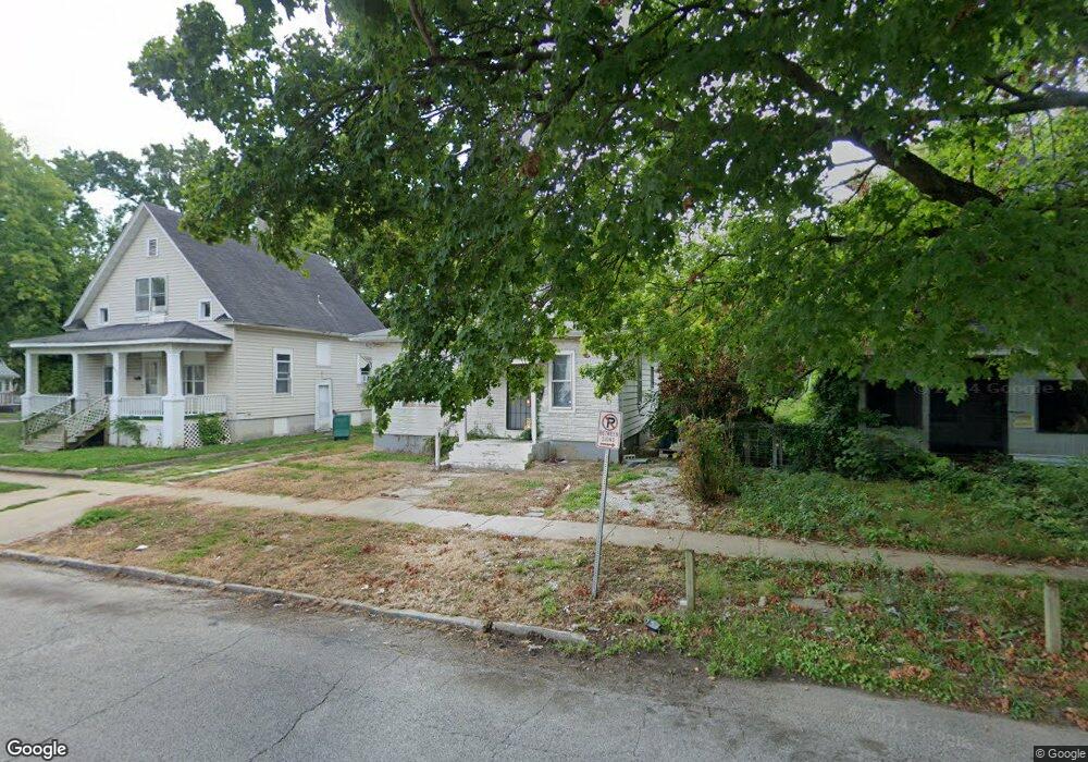
945 S Maffit St Decatur, IL 62521
Mueller Park NeighborhoodEstimated Value: $34,000 - $50,000
--
Bed
--
Bath
1,032
Sq Ft
$42/Sq Ft
Est. Value
About This Home
This home is located at 945 S Maffit St, Decatur, IL 62521 and is currently estimated at $42,952, approximately $41 per square foot. 945 S Maffit St is a home located in Macon County with nearby schools including South Shores Elementary School, Stephen Decatur Middle School, and St. Patrick School.
Ownership History
Date
Name
Owned For
Owner Type
Purchase Details
Closed on
Jun 21, 2022
Sold by
Joe Gipson Jr
Bought by
Black Bruce
Current Estimated Value
Purchase Details
Closed on
Jan 29, 2015
Sold by
Macon County
Bought by
Christianson Samantha
Purchase Details
Closed on
Sep 30, 2014
Sold by
Concepcion Alfredo
Bought by
Macon County
Purchase Details
Closed on
Jul 21, 2010
Sold by
Miller Michael Lynn and Miller Cheryl I
Bought by
Concspeion Alfredo J
Purchase Details
Closed on
Feb 26, 2007
Sold by
First National Bank
Bought by
S A
Purchase Details
Closed on
Feb 1, 1999
Create a Home Valuation Report for This Property
The Home Valuation Report is an in-depth analysis detailing your home's value as well as a comparison with similar homes in the area
Home Values in the Area
Average Home Value in this Area
Purchase History
| Date | Buyer | Sale Price | Title Company |
|---|---|---|---|
| Black Bruce | -- | Bourey Andrew D | |
| Christianson Samantha | -- | None Available | |
| Macon County | -- | None Available | |
| Concspeion Alfredo J | $3,500 | None Available | |
| S A | -- | None Available | |
| -- | $7,500 | -- |
Source: Public Records
Tax History Compared to Growth
Tax History
| Year | Tax Paid | Tax Assessment Tax Assessment Total Assessment is a certain percentage of the fair market value that is determined by local assessors to be the total taxable value of land and additions on the property. | Land | Improvement |
|---|---|---|---|---|
| 2024 | $685 | $7,071 | $603 | $6,468 |
| 2023 | $679 | $6,821 | $582 | $6,239 |
| 2022 | $646 | $6,313 | $539 | $5,774 |
| 2021 | $607 | $5,895 | $503 | $5,392 |
| 2020 | $598 | $5,621 | $479 | $5,142 |
| 2019 | $598 | $5,621 | $479 | $5,142 |
| 2018 | $638 | $6,075 | $437 | $5,638 |
| 2017 | $653 | $6,238 | $449 | $5,789 |
| 2016 | $666 | $6,302 | $454 | $5,848 |
| 2015 | $633 | $6,191 | $446 | $5,745 |
| 2014 | -- | $0 | $0 | $0 |
| 2013 | $607 | $6,361 | $459 | $5,902 |
Source: Public Records
Map
Nearby Homes
- 1232 S Silas St
- 1283 S Illinois St
- 1347 S Maffit St
- 1104 E Moore St
- 1263 E Dickinson Ave
- 1408 E Buena Vista Ave
- 409 Southmoreland Place
- 318 S Martin Luther King Junior Dr
- 1232 E Johns Ave
- 632 S 17th St
- 22 Eastmoreland Ln
- 1605 E Clay St
- 1952 Florida Ct
- 1155 S 20th St
- 1127 S 21st St
- 1764 E Johns Ave
- 1645 E Wood St
- 1753 E Clay St
- 1136 S 21st St
- 580 Powers Ln
- 955 S Maffit St
- 955 S Maffit St Unit PACKAGE OF 6
- 935 S Maffit St
- 860 E Cleveland Ave
- 913 S Maffit St
- 842 E Cleveland Ave
- 909 S Maffit St
- 828 E Cleveland Ave
- 1005 S Maffit St
- 903 S Maffit St
- 825 E Lincoln Ave
- 920 S Maffit St
- 903 E Cleveland Ave
- 805 E Lincoln Ave
- 920 E Cleveland Ave
- 820 E Cleveland Ave
- 1015 S Maffit St
- 845 E Cleveland Ave
- 913 E Cleveland Ave
- 795 E Lincoln Ave