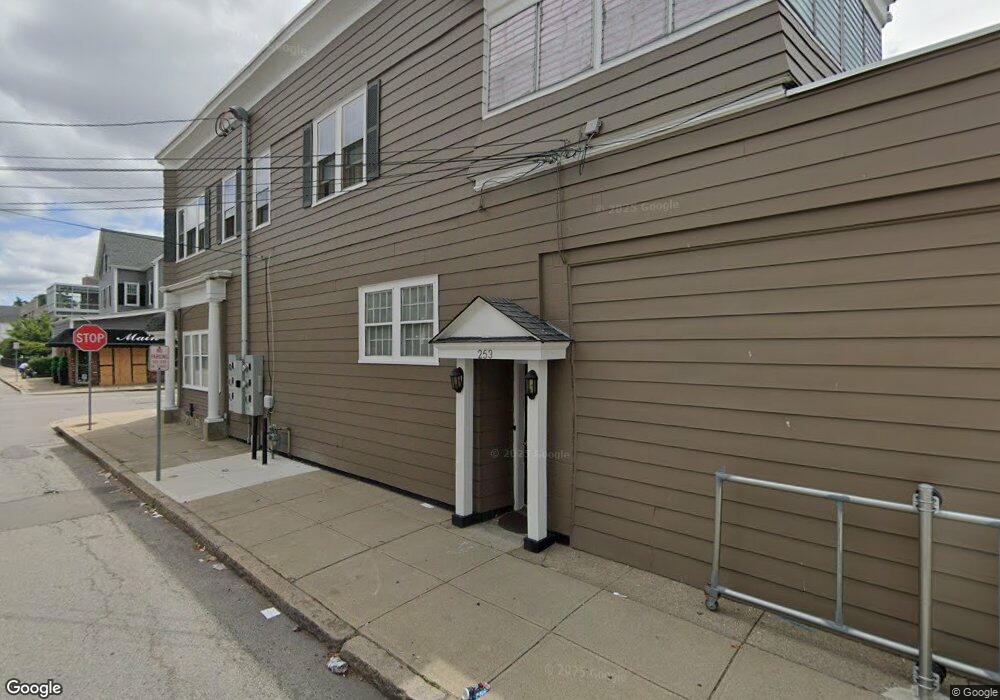
945 S Main St Fall River, MA 02724
Father Kelly Neighborhood
6
Beds
4
Baths
7,238
Sq Ft
7,841
Sq Ft Lot
About This Home
This home is located at 945 S Main St, Fall River, MA 02724. 945 S Main St is a home located in Bristol County with nearby schools including Carlton M. Viveiros Elementary School, Matthew J. Kuss Middle School, and B M C Durfee High School.
Ownership History
Date
Name
Owned For
Owner Type
Purchase Details
Closed on
Jun 26, 2019
Sold by
Hathaway Family Realty
Bought by
945 S Main St Llc
Purchase Details
Closed on
Apr 19, 2005
Sold by
Hathaway Ruth E and Hathaway William S
Bought by
Hathaway Ft Rlty Llc
Home Financials for this Owner
Home Financials are based on the most recent Mortgage that was taken out on this home.
Original Mortgage
$5,800,000
Interest Rate
5.78%
Mortgage Type
Commercial
Purchase Details
Closed on
Mar 1, 1989
Sold by
Dion Lucien J
Bought by
Hathaway William S
Home Financials for this Owner
Home Financials are based on the most recent Mortgage that was taken out on this home.
Original Mortgage
$600,000
Interest Rate
10.63%
Mortgage Type
Commercial
Create a Home Valuation Report for This Property
The Home Valuation Report is an in-depth analysis detailing your home's value as well as a comparison with similar homes in the area
Home Values in the Area
Average Home Value in this Area
Purchase History
| Date | Buyer | Sale Price | Title Company |
|---|---|---|---|
| 945 S Main St Llc | $10,000 | -- | |
| 945 S Main St Llc | $10,000 | -- | |
| 945 S Main St Llc | $10,000 | -- | |
| Hathaway Ft Rlty Llc | -- | -- | |
| Hathaway Ft Rlty Llc | -- | -- | |
| Hathaway Ft Rlty Llc | -- | -- | |
| Hathaway William S | $300,000 | -- |
Source: Public Records
Mortgage History
| Date | Status | Borrower | Loan Amount |
|---|---|---|---|
| Previous Owner | Hathaway Ft Rlty Llc | $5,800,000 | |
| Previous Owner | Hathaway William S | $600,000 |
Source: Public Records
Tax History
| Year | Tax Paid | Tax Assessment Tax Assessment Total Assessment is a certain percentage of the fair market value that is determined by local assessors to be the total taxable value of land and additions on the property. | Land | Improvement |
|---|---|---|---|---|
| 2025 | $12,217 | $546,200 | $122,900 | $423,300 |
| 2024 | $12,217 | $510,300 | $117,100 | $393,200 |
| 2023 | $0 | $423,900 | $106,300 | $317,600 |
| 2022 | $0 | $423,900 | $106,300 | $317,600 |
| 2021 | $0 | $421,000 | $104,800 | $316,200 |
| 2020 | $10,449 | $417,600 | $109,600 | $308,000 |
| 2019 | $0 | $440,000 | $109,600 | $330,400 |
| 2018 | $0 | $440,300 | $109,600 | $330,700 |
| 2017 | -- | $440,300 | $109,600 | $330,700 |
| 2016 | -- | $440,299 | $109,600 | $330,699 |
| 2015 | -- | $425,799 | $109,600 | $316,199 |
| 2014 | -- | $425,799 | $109,600 | $316,199 |
Source: Public Records
Map
Nearby Homes
- 70 Brown St
- 158 Forest St
- 150 Forest St
- 111 Park St
- 105 Park St
- 71 Mystic St Unit 3
- 82 Montaup St
- 928 Middle St
- 640 S Main St
- 420 Bradford Ave
- 334 Fountain St
- 303 Eagle St Unit C
- 1273-1279 S Main St
- 403 Division St Unit 13
- 403 Division St Unit 5
- 403 Division St Unit 9
- 403 Division St Unit 11
- 403 Division St Unit 12
- 403 Division St Unit 1
- 403 Division St Unit 18
- 229 Osborn St
- 927 S Main St
- 240 Osborn St Unit 4
- 240 Osborn St Unit 3
- 240 Osborn St Unit 5
- 240 Osborn St
- 967 S Main St
- 219 Osborn St
- 950 S Main St
- 969 S Main St
- 954 S Main St
- 230 Osborn St
- 964 S Main St Unit 2N
- 211 Osborn St Unit 1
- 220 Osborn St
- 220 Osborn St Unit 2
- 956 S Main St
- 202 Osborn St Unit 1S
- 202 Osborn St Unit studio
- 202 Osborn St Unit 3N
Your Personal Tour Guide
Ask me questions while you tour the home.