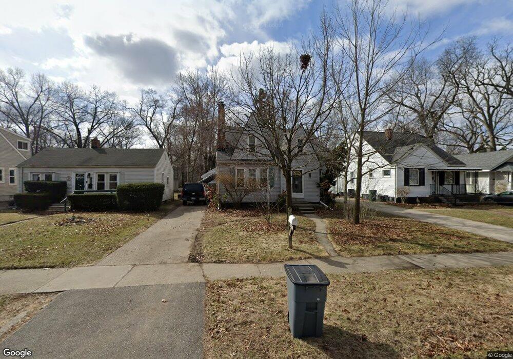
945 W Maplehurst St Ferndale, MI 48220
Estimated Value: $359,668 - $458,000
4
Beds
3
Baths
1,491
Sq Ft
$270/Sq Ft
Est. Value
About This Home
This home is located at 945 W Maplehurst St, Ferndale, MI 48220 and is currently estimated at $402,917, approximately $270 per square foot. 945 W Maplehurst St is a home located in Oakland County with nearby schools including Ferndale Lower Elementary Campus, Ferndale Upper Elementary Campus, and Ferndale Middle School.
Ownership History
Date
Name
Owned For
Owner Type
Purchase Details
Closed on
May 26, 2000
Sold by
Dantzer Judith
Bought by
Colby Daniel D
Current Estimated Value
Home Financials for this Owner
Home Financials are based on the most recent Mortgage that was taken out on this home.
Original Mortgage
$168,000
Interest Rate
8.55%
Purchase Details
Closed on
Jul 15, 1998
Sold by
Chacko Anitha
Bought by
Dantzer Judith
Home Financials for this Owner
Home Financials are based on the most recent Mortgage that was taken out on this home.
Original Mortgage
$139,500
Interest Rate
7.07%
Create a Home Valuation Report for This Property
The Home Valuation Report is an in-depth analysis detailing your home's value as well as a comparison with similar homes in the area
Home Values in the Area
Average Home Value in this Area
Purchase History
| Date | Buyer | Sale Price | Title Company |
|---|---|---|---|
| Colby Daniel D | $210,000 | -- | |
| Dantzer Judith | $155,000 | -- |
Source: Public Records
Mortgage History
| Date | Status | Borrower | Loan Amount |
|---|---|---|---|
| Previous Owner | Colby Daniel D | $168,000 | |
| Previous Owner | Dantzer Judith | $139,500 |
Source: Public Records
Tax History
| Year | Tax Paid | Tax Assessment Tax Assessment Total Assessment is a certain percentage of the fair market value that is determined by local assessors to be the total taxable value of land and additions on the property. | Land | Improvement |
|---|---|---|---|---|
| 2025 | $4,873 | $168,790 | $0 | $0 |
| 2024 | $4,677 | $166,920 | $0 | $0 |
| 2023 | $4,547 | $157,650 | $0 | $0 |
| 2022 | $4,575 | $144,550 | $0 | $0 |
| 2021 | $4,603 | $141,770 | $0 | $0 |
| 2020 | $4,360 | $140,310 | $0 | $0 |
| 2019 | $4,431 | $131,110 | $0 | $0 |
| 2018 | $4,448 | $118,170 | $0 | $0 |
| 2017 | $4,391 | $115,960 | $0 | $0 |
| 2016 | $4,342 | $101,420 | $0 | $0 |
| 2015 | -- | $92,060 | $0 | $0 |
| 2014 | -- | $82,600 | $0 | $0 |
| 2011 | -- | $68,800 | $0 | $0 |
Source: Public Records
Map
Nearby Homes
- 928 W Maplehurst Ave
- 920 W Maplehurst St
- 910 W Maplehurst St
- 910 W Drayton
- 2019 Hyland St
- 861 W Lewiston Ave
- 1915 Central St
- 93 Oakdale Blvd
- 1924 Pinecrest Dr
- 86 Oakdale Blvd
- 23031 Republic Ave
- 629 W Lewiston Ave
- 1636 W Troy St
- 726 W Breckenridge St
- 23041 Roanoke Ave
- 1356 Albany St
- 582 W Breckenridge St
- 619 Withington St
- 8610 Saratoga St
- 0 Rosewood St
- 937 W Maplehurst St
- 953 W Maplehurst St
- 961 W Maplehurst St
- 927 W Maplehurst St Unit Bldg-Unit
- 927 W Maplehurst St
- 917 W Maplehurst St
- 2220 Hyland St
- 2206 Hyland St
- 2224 Hyland St
- 2234 Hyland St
- 903 W Maplehurst St
- 1044 W Lewiston Ave
- 1054 W Lewiston Ave
- 1030 W Lewiston Ave
- 966 W Maplehurst St
- 1040 W Lewiston Ave
- 1064 W Lewiston Ave
- 2302 Hyland St
- 2130 Hyland St
- 1020 W Lewiston Ave
Your Personal Tour Guide
Ask me questions while you tour the home.