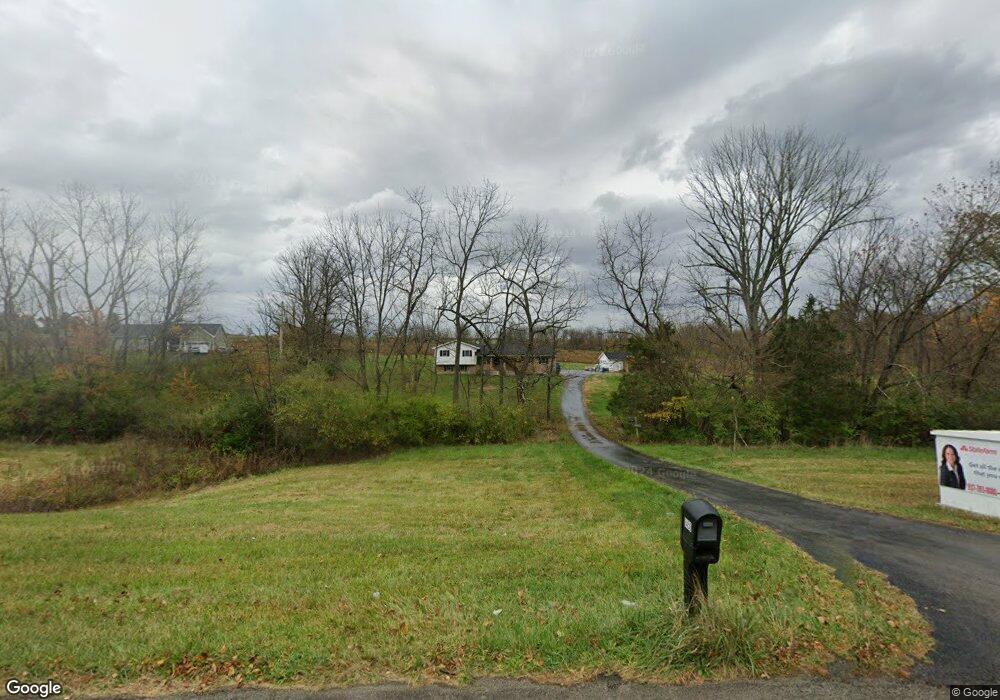
9450 State Route 73 Hillsboro, OH 45133
Estimated Value: $255,000 - $411,000
3
Beds
2
Baths
2,280
Sq Ft
$153/Sq Ft
Est. Value
About This Home
This home is located at 9450 State Route 73, Hillsboro, OH 45133 and is currently estimated at $348,395, approximately $152 per square foot. 9450 State Route 73 is a home located in Highland County with nearby schools including Hillsboro Primary School, Hillsboro Middle School, and Hillsboro High School.
Ownership History
Date
Name
Owned For
Owner Type
Purchase Details
Closed on
Apr 20, 2018
Sold by
Fawley Forest Gene and Fawley Brenda K
Bought by
Fawley Forrest Gene and Fawley Brenda Kay
Current Estimated Value
Purchase Details
Closed on
Feb 27, 1995
Sold by
Holladay Harry B
Bought by
Fawley Gene and Fawley Brenda K
Create a Home Valuation Report for This Property
The Home Valuation Report is an in-depth analysis detailing your home's value as well as a comparison with similar homes in the area
Home Values in the Area
Average Home Value in this Area
Purchase History
| Date | Buyer | Sale Price | Title Company |
|---|---|---|---|
| Fawley Forrest Gene | -- | None Available | |
| Fawley Gene | $5,000 | -- |
Source: Public Records
Tax History Compared to Growth
Tax History
| Year | Tax Paid | Tax Assessment Tax Assessment Total Assessment is a certain percentage of the fair market value that is determined by local assessors to be the total taxable value of land and additions on the property. | Land | Improvement |
|---|---|---|---|---|
| 2024 | $2,644 | $85,510 | $16,840 | $68,670 |
| 2023 | $2,518 | $72,280 | $16,560 | $55,720 |
| 2022 | $2,489 | $72,280 | $16,560 | $55,720 |
| 2021 | $2,382 | $72,280 | $16,560 | $55,720 |
| 2020 | $1,981 | $60,240 | $13,790 | $46,450 |
| 2019 | $1,957 | $60,240 | $13,790 | $46,450 |
| 2018 | $1,927 | $60,240 | $13,790 | $46,450 |
| 2017 | $1,761 | $53,480 | $15,540 | $37,940 |
| 2016 | $1,722 | $53,480 | $15,540 | $37,940 |
| 2015 | $1,888 | $53,480 | $15,540 | $37,940 |
| 2014 | $1,808 | $53,480 | $15,540 | $37,940 |
| 2013 | $1,811 | $53,480 | $15,540 | $37,940 |
Source: Public Records
Map
Nearby Homes
- 9677 Graybill Rd
- 6081 Panhandle Rd
- 10035 Wolfe Rd
- 8230 N St Rt 73
- 5810 Ohio 124
- 5216 Anderson Rd
- 5914 State Route 124
- 5914 St Rt 124
- 0 Murray Rd Unit 1841827
- 6195 State Route 124
- 0 N High St Unit 1851818
- 6805 Pea Ridge Rd
- 10105 Us Rt 62
- 8049 Selph Rd
- 7049 Pea Ridge Ct
- 6279 Riber Rd
- 7615 Pea Ridge Rd Unit B
- 7615 Pea Ridge Rd Unit A
- 7615 Pea Ridge Rd
- 7619 Pea Ridge Rd Unit A
- 9470 State Route 73
- 6208 Roundhead Rd
- 6110 Roundhead Rd
- 6060 Roundhead Rd
- 6099 Roundhead Rd
- 6123 Roundhead Rd
- 6113 Roundhead Rd
- 6143 Roundhead Rd
- 6157 Roundhead Rd
- 9354 State Route 73
- 6177 Roundhead Rd
- 6193 Roundhead Rd
- 9318 State Route 73
- 9965 Grabill Rd
- 6137 Roundhead Rd
- 9590 State Route 73
- 9600 State Route 73
- 6229 Roundhead Rd
- 6259 Roundhead Rd
- 6045 Runk Ln