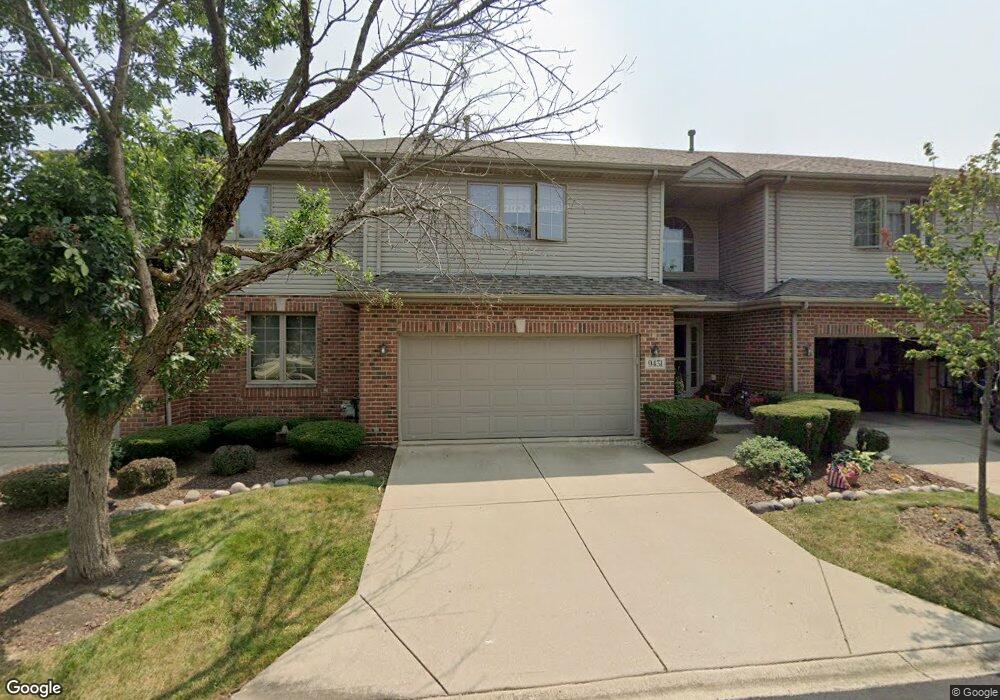
9451 Perth Cir Tinley Park, IL 60487
Central Tinley Park NeighborhoodEstimated Value: $366,000 - $394,000
3
Beds
3
Baths
1,952
Sq Ft
$192/Sq Ft
Est. Value
About This Home
This home is located at 9451 Perth Cir, Tinley Park, IL 60487 and is currently estimated at $373,816, approximately $191 per square foot. 9451 Perth Cir is a home located in Cook County with nearby schools including Christa Mcauliffe School, Prairie View Middle School, and Victor J Andrew High School.
Ownership History
Date
Name
Owned For
Owner Type
Purchase Details
Closed on
Feb 26, 2016
Sold by
Taylor Carol A and Fiorentino Carol A
Bought by
Fiorentino Albert P and Fiorentino Carol A
Current Estimated Value
Purchase Details
Closed on
Oct 11, 2000
Sold by
Prairie Bank & Trust Company
Bought by
Taylor Carol A
Home Financials for this Owner
Home Financials are based on the most recent Mortgage that was taken out on this home.
Original Mortgage
$75,000
Interest Rate
7.96%
Create a Home Valuation Report for This Property
The Home Valuation Report is an in-depth analysis detailing your home's value as well as a comparison with similar homes in the area
Home Values in the Area
Average Home Value in this Area
Purchase History
| Date | Buyer | Sale Price | Title Company |
|---|---|---|---|
| Fiorentino Albert P | -- | None Available | |
| Taylor Carol A | $193,000 | -- |
Source: Public Records
Mortgage History
| Date | Status | Borrower | Loan Amount |
|---|---|---|---|
| Previous Owner | Taylor Carol A | $75,000 |
Source: Public Records
Tax History Compared to Growth
Tax History
| Year | Tax Paid | Tax Assessment Tax Assessment Total Assessment is a certain percentage of the fair market value that is determined by local assessors to be the total taxable value of land and additions on the property. | Land | Improvement |
|---|---|---|---|---|
| 2024 | $6,689 | $30,060 | $2,256 | $27,804 |
| 2023 | $5,661 | $31,001 | $2,256 | $28,745 |
| 2022 | $5,661 | $22,037 | $1,946 | $20,091 |
| 2021 | $5,535 | $22,035 | $1,945 | $20,090 |
| 2020 | $5,529 | $22,035 | $1,945 | $20,090 |
| 2019 | $5,232 | $22,304 | $1,769 | $20,535 |
| 2018 | $5,116 | $22,304 | $1,769 | $20,535 |
| 2017 | $5,013 | $22,304 | $1,769 | $20,535 |
| 2016 | $5,492 | $20,818 | $1,592 | $19,226 |
| 2015 | $5,978 | $20,818 | $1,592 | $19,226 |
| 2014 | $5,945 | $20,818 | $1,592 | $19,226 |
| 2013 | $6,736 | $24,933 | $1,592 | $23,341 |
Source: Public Records
Map
Nearby Homes
- 9413 Caledonia Dr
- 17224 Briar Dr
- 17018 93rd Ave
- 9334 Drummond Dr Unit 3
- 17535-2 Lagrange Rd
- 17535 S La Grange Rd
- 9201 175th St
- 9260 Windsor Pkwy Unit 80
- 9280 Windsor Pkwy Unit 92
- 9404 Lindsay St
- 16779 92nd Ave
- 17230 Shetland Dr
- 16950 90th Ave
- 17533 Pecan Ln
- 16805 Hilltop Ave
- 16753 91st Ave
- 16701 Highview Ave
- 16753 Hilltop Ave
- 16813 89th Ave
- 16515 S La Grange Rd
- 9453 Perth Cir
- 9449 Perth Cir
- 9455 Perth Cir
- 17226 94th Ct
- 17228 94th Ct
- 9452 Perth Cir
- 9450 Perth Cir
- 9522 Perth Cir
- 9454 Perth Cir
- 9456 Perth Cir
- 9520 Perth Cir
- 9433 Dundee Place
- 9518 Perth Cir
- 9440 Stonebrooke Ct
- 9442 Stonebrooke Ct
- 9431 Dundee Place
- 9444 Stonebrooke Ct
- 9432 Dundee Place
- 9514 Perth Cir
- 17227 94th Ct