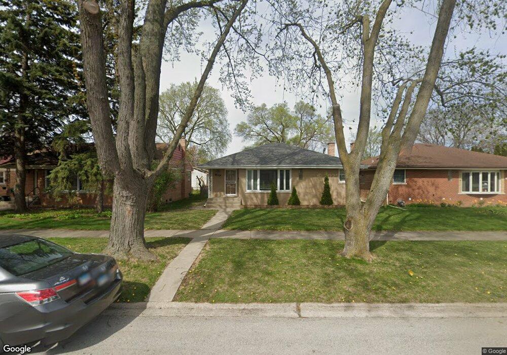
9454 Latrobe Ave Skokie, IL 60077
Barcelona NeighborhoodEstimated Value: $394,000 - $434,516
3
Beds
2
Baths
1,194
Sq Ft
$350/Sq Ft
Est. Value
About This Home
This home is located at 9454 Latrobe Ave, Skokie, IL 60077 and is currently estimated at $418,129, approximately $350 per square foot. 9454 Latrobe Ave is a home located in Cook County with nearby schools including Old Orchard Jr High School, Jane Stenson School, and Niles North High School.
Ownership History
Date
Name
Owned For
Owner Type
Purchase Details
Closed on
Jul 25, 2020
Sold by
Mathews Oommen and Mathews Annamma
Bought by
Mathews Oommen and Mathews Annamma
Current Estimated Value
Purchase Details
Closed on
Jun 16, 2004
Sold by
Urkoff Eva
Bought by
Mathews Oommen and Oomen Annamma
Home Financials for this Owner
Home Financials are based on the most recent Mortgage that was taken out on this home.
Original Mortgage
$301,000
Interest Rate
6.46%
Mortgage Type
Purchase Money Mortgage
Create a Home Valuation Report for This Property
The Home Valuation Report is an in-depth analysis detailing your home's value as well as a comparison with similar homes in the area
Home Values in the Area
Average Home Value in this Area
Purchase History
| Date | Buyer | Sale Price | Title Company |
|---|---|---|---|
| Mathews Oommen | -- | Chicago Title Insurance Co | |
| Mathews Oommen | $301,000 | Multiple |
Source: Public Records
Mortgage History
| Date | Status | Borrower | Loan Amount |
|---|---|---|---|
| Previous Owner | Mathews Oommen | $301,000 |
Source: Public Records
Tax History Compared to Growth
Tax History
| Year | Tax Paid | Tax Assessment Tax Assessment Total Assessment is a certain percentage of the fair market value that is determined by local assessors to be the total taxable value of land and additions on the property. | Land | Improvement |
|---|---|---|---|---|
| 2024 | $6,254 | $31,001 | $7,963 | $23,038 |
| 2023 | $6,041 | $31,001 | $7,963 | $23,038 |
| 2022 | $6,041 | $31,001 | $7,963 | $23,038 |
| 2021 | $5,539 | $26,231 | $4,900 | $21,331 |
| 2020 | $5,595 | $26,231 | $4,900 | $21,331 |
| 2019 | $6,416 | $29,473 | $4,900 | $24,573 |
| 2018 | $5,675 | $24,502 | $4,440 | $20,062 |
| 2017 | $5,733 | $24,502 | $4,440 | $20,062 |
| 2016 | $5,709 | $24,502 | $4,440 | $20,062 |
| 2015 | $4,963 | $20,403 | $3,828 | $16,575 |
| 2014 | $4,862 | $20,403 | $3,828 | $16,575 |
| 2013 | $4,835 | $20,403 | $3,828 | $16,575 |
Source: Public Records
Map
Nearby Homes
- 9508 Leamington Ave
- 9655 Woods Dr Unit P350
- 9655 Woods Dr Unit 517
- 9655 Woods Dr Unit 1809
- 9655 Woods Dr Unit 1411
- 9715 Woods Dr Unit 903
- 9715 Woods Dr Unit 1104
- 9449 Lavergne Ave
- 9725 Woods Dr Unit 1913
- 9725 Woods Dr Unit 309
- 9725 Woods Dr Unit 802
- 9725 Woods Dr Unit 2015
- 9529 Bronx Ave Unit 102
- 4901 Golf Rd Unit 310
- 9244 Gross Point Rd Unit A103
- 4840 Foster St Unit 304
- 4840 Foster St Unit 303
- 4840 Foster St Unit 107
- 9234 Central Ave
- 5346 Suffield Terrace
- 9450 Latrobe Ave
- 9458 Latrobe Ave
- 9446 Latrobe Ave
- 9447 Lockwood Ave
- 9443 Lockwood Ave
- 9440 Latrobe Ave
- 9445 Latrobe Ave
- 9451 Lockwood Ave
- 9439 Lockwood Ave
- 5221 Foster St
- 9435 Latrobe Ave
- 9437 Lockwood Ave
- 9434 Latrobe Ave
- 5244 Foster St
- 5246 Foster St
- 5234 Foster St
- 5250 Foster St
- 5230 Foster St
- 5220 Harmswood Terrace
- 9433 Lockwood Ave