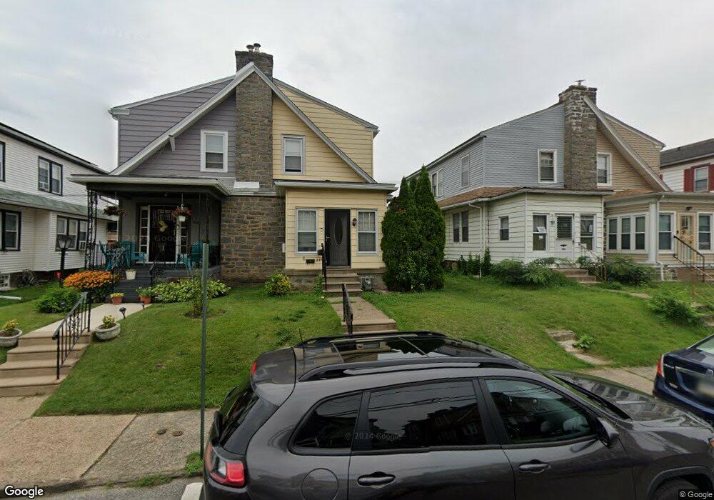
946 Bullock Ave Lansdowne, PA 19050
Estimated Value: $190,000 - $237,000
3
Beds
1
Bath
1,210
Sq Ft
$175/Sq Ft
Est. Value
About This Home
This home is located at 946 Bullock Ave, Lansdowne, PA 19050 and is currently estimated at $211,880, approximately $175 per square foot. 946 Bullock Ave is a home located in Delaware County with nearby schools including Evans Elementary School, Penn Wood Middle School, and Penn Wood High School - Cypress Street Campus.
Ownership History
Date
Name
Owned For
Owner Type
Purchase Details
Closed on
Aug 25, 2008
Sold by
Whiting Renee M
Bought by
Whiting Renee M and Driver Shelly P
Current Estimated Value
Home Financials for this Owner
Home Financials are based on the most recent Mortgage that was taken out on this home.
Original Mortgage
$102,700
Outstanding Balance
$68,375
Interest Rate
6.54%
Mortgage Type
Stand Alone Refi Refinance Of Original Loan
Estimated Equity
$143,505
Purchase Details
Closed on
Jul 25, 2008
Sold by
Richburg Allen E and Richburg Rachel E
Bought by
Whiting Renee M
Home Financials for this Owner
Home Financials are based on the most recent Mortgage that was taken out on this home.
Original Mortgage
$102,700
Outstanding Balance
$68,375
Interest Rate
6.54%
Mortgage Type
Stand Alone Refi Refinance Of Original Loan
Estimated Equity
$143,505
Create a Home Valuation Report for This Property
The Home Valuation Report is an in-depth analysis detailing your home's value as well as a comparison with similar homes in the area
Home Values in the Area
Average Home Value in this Area
Purchase History
| Date | Buyer | Sale Price | Title Company |
|---|---|---|---|
| Whiting Renee M | -- | None Available | |
| Whiting Renee M | -- | None Available |
Source: Public Records
Mortgage History
| Date | Status | Borrower | Loan Amount |
|---|---|---|---|
| Open | Whiting Renee M | $102,700 |
Source: Public Records
Tax History Compared to Growth
Tax History
| Year | Tax Paid | Tax Assessment Tax Assessment Total Assessment is a certain percentage of the fair market value that is determined by local assessors to be the total taxable value of land and additions on the property. | Land | Improvement |
|---|---|---|---|---|
| 2025 | $4,416 | $103,420 | $32,500 | $70,920 |
| 2024 | $4,416 | $103,420 | $32,500 | $70,920 |
| 2023 | $4,011 | $103,420 | $32,500 | $70,920 |
| 2022 | $3,824 | $103,420 | $32,500 | $70,920 |
| 2021 | $5,783 | $103,420 | $32,500 | $70,920 |
| 2020 | $3,819 | $61,150 | $18,750 | $42,400 |
| 2019 | $3,752 | $61,150 | $18,750 | $42,400 |
| 2018 | $3,700 | $61,150 | $0 | $0 |
| 2017 | $3,622 | $61,150 | $0 | $0 |
| 2016 | $336 | $61,150 | $0 | $0 |
| 2015 | $336 | $61,150 | $0 | $0 |
| 2014 | $336 | $61,150 | $0 | $0 |
Source: Public Records
Map
Nearby Homes
- 939 Serrill Ave
- 921 Serrill Ave
- 908 Yeadon Ave
- 1049 Yeadon Ave
- 923 Bell Ave
- 808 Serrill Ave
- 825 Laurel Rd
- 800 Bullock Ave
- 813 Arbor Rd
- 6718 Cobbs Creek Pkwy
- 6535 Windsor St
- 740 Church Ln
- 6835 Chester Ave
- 6951 Chester Ave
- 722 Yeadon Ave
- 1781 S 65th St
- 6564 Belmar St
- 711 Yeadon Ave Unit 1
- 1824 S 65th St
- 702 Cedar Ave
- 944 Bullock Ave
- 948 Bullock Ave
- 942 Bullock Ave
- 950 Bullock Ave
- 940 Bullock Ave
- 952 Bullock Ave
- 947 Yeadon Ave
- 938 Bullock Ave
- 945 Yeadon Ave
- 954 Bullock Ave
- 949 Yeadon Ave
- 943 Yeadon Ave
- 951 Yeadon Ave
- 941 Yeadon Ave
- 936 Bullock Ave
- 953 Yeadon Ave
- 956 Bullock Ave
- 939 Yeadon Ave
- 955 Yeadon Ave
- 934 Bullock Ave