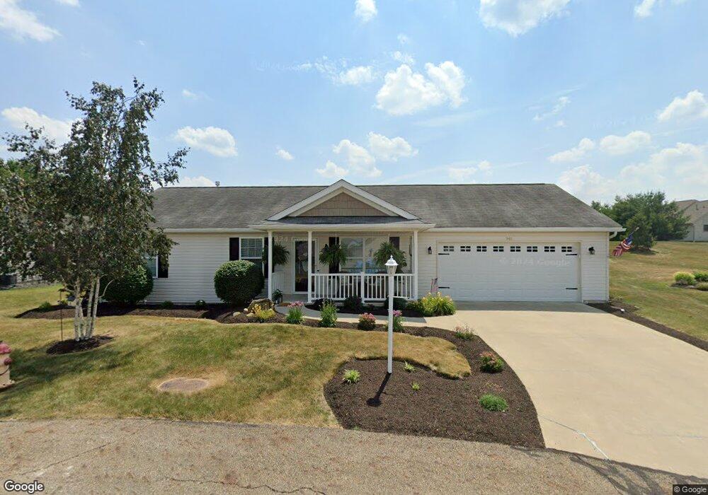
946 Cabot Dr Canal Fulton, OH 44614
Estimated Value: $252,941 - $297,000
3
Beds
2
Baths
1,488
Sq Ft
$188/Sq Ft
Est. Value
About This Home
This home is located at 946 Cabot Dr, Canal Fulton, OH 44614 and is currently estimated at $279,985, approximately $188 per square foot. 946 Cabot Dr is a home located in Stark County with nearby schools including W.S. Stinson Elementary School, Northwest Primary School, and Northwest Middle School.
Ownership History
Date
Name
Owned For
Owner Type
Purchase Details
Closed on
Sep 23, 2020
Sold by
Villas Of Summer Evening Hoa Inc
Bought by
Schalmo Properties Inc
Current Estimated Value
Purchase Details
Closed on
Jul 26, 2013
Sold by
Maple Carolyn Joyce and Maple Carolyn
Bought by
Payne Robert A and Payne Margaret E
Purchase Details
Closed on
Oct 5, 2010
Sold by
Schalmo Properties Inc
Bought by
Maple Carolyn Joyce
Create a Home Valuation Report for This Property
The Home Valuation Report is an in-depth analysis detailing your home's value as well as a comparison with similar homes in the area
Home Values in the Area
Average Home Value in this Area
Purchase History
| Date | Buyer | Sale Price | Title Company |
|---|---|---|---|
| Schalmo Properties Inc | $2,000 | None Available | |
| Payne Robert A | $124,900 | None Available | |
| Maple Carolyn Joyce | $133,500 | Cornerstone Real Estate Titl |
Source: Public Records
Tax History Compared to Growth
Tax History
| Year | Tax Paid | Tax Assessment Tax Assessment Total Assessment is a certain percentage of the fair market value that is determined by local assessors to be the total taxable value of land and additions on the property. | Land | Improvement |
|---|---|---|---|---|
| 2025 | -- | $73,370 | $13,690 | $59,680 |
| 2024 | -- | $73,370 | $13,690 | $59,680 |
| 2023 | $2,471 | $64,370 | $10,540 | $53,830 |
| 2022 | $2,493 | $64,370 | $10,540 | $53,830 |
| 2021 | $2,501 | $64,370 | $10,540 | $53,830 |
| 2020 | $2,059 | $49,850 | $8,160 | $41,690 |
| 2019 | $2,082 | $49,850 | $8,160 | $41,690 |
| 2018 | $2,132 | $49,850 | $8,160 | $41,690 |
| 2017 | $1,746 | $39,100 | $4,970 | $34,130 |
| 2016 | $1,764 | $39,100 | $4,970 | $34,130 |
| 2015 | $1,696 | $38,330 | $4,970 | $33,360 |
| 2014 | $1,794 | $37,870 | $4,900 | $32,970 |
| 2013 | $931 | $37,870 | $4,900 | $32,970 |
Source: Public Records
Map
Nearby Homes
- 919 Baffin Dr
- 915 Shackleton Dr
- 963 Saint Brendan Dr
- 2101 Livingston Dr
- 782 Beverly Ave
- 1808 Pauli St
- 1719 Bruce St
- 764 Chris Cir
- 707 Parkview Ave
- 872 Sandlewood Dr NW
- 837 Tamwood Dr
- 12347 Stover Farm Dr NW
- S/L 32 Lakewood Dr E
- S/L 27 Lakewood Dr E
- 539 E Lakewood Dr
- 537 E Lakewood Dr
- 6182 Michael Barkey Ave NW
- 542 E Lakewood Dr
- Ballenger w/ Basement Plan at Heritage Village
- Allegheny w/ Basement Plan at Heritage Village
- 942 Cabot Dr
- 950 Cabot Dr
- 619 Cabot Dr
- 955 Cabot Dr
- 925 Barents Dr
- 954 Cabot Dr
- 923 Barents Dr
- 938 Cabot Dr
- 936 Crockett Cir
- V/L Cabot Dr
- 944 Cabot Dr
- 921 Barents Dr
- 959 Cabot Dr
- 921 Shackleton Dr
- 937 Amundsen Dr
- 937 Amundsen Dr Unit C
- 938 Crockett Ave
- 935 Crockett Cir
- 933 Amundsen Dr
- 941 Amundsen Dr