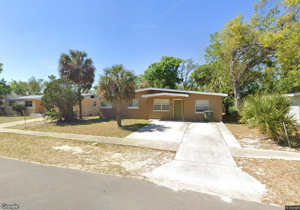
946 Lewis Dr Daytona Beach, FL 32117
Neighborhood K NeighborhoodEstimated Value: $154,256 - $198,000
2
Beds
1
Bath
1,187
Sq Ft
$152/Sq Ft
Est. Value
About This Home
This home is located at 946 Lewis Dr, Daytona Beach, FL 32117 and is currently estimated at $180,564, approximately $152 per square foot. 946 Lewis Dr is a home located in Volusia County with nearby schools including Westside Elementary School, Campbell Middle School, and Mainland High School.
Ownership History
Date
Name
Owned For
Owner Type
Purchase Details
Closed on
Dec 3, 1993
Sold by
Singler Scott D
Bought by
Carrot Family Tr
Current Estimated Value
Purchase Details
Closed on
Jul 30, 1993
Sold by
Veterans Affairs
Bought by
Singler Scott D
Home Financials for this Owner
Home Financials are based on the most recent Mortgage that was taken out on this home.
Original Mortgage
$45,329
Interest Rate
7.34%
Purchase Details
Closed on
Mar 15, 1993
Bought by
Singler Scott D & Karen M Tr
Purchase Details
Closed on
Mar 15, 1985
Bought by
Singler Scott D & Karen M Tr
Purchase Details
Closed on
Dec 15, 1984
Bought by
Singler Scott D & Karen M Tr
Purchase Details
Closed on
Nov 15, 1979
Bought by
Singler Scott D & Karen M Tr
Create a Home Valuation Report for This Property
The Home Valuation Report is an in-depth analysis detailing your home's value as well as a comparison with similar homes in the area
Home Values in the Area
Average Home Value in this Area
Purchase History
| Date | Buyer | Sale Price | Title Company |
|---|---|---|---|
| Carrot Family Tr | -- | -- | |
| Singler Scott D | $45,800 | -- | |
| Singler Scott D & Karen M Tr | $27,100 | -- | |
| Singler Scott D & Karen M Tr | $34,000 | -- | |
| Singler Scott D & Karen M Tr | $28,000 | -- | |
| Singler Scott D & Karen M Tr | $29,500 | -- |
Source: Public Records
Mortgage History
| Date | Status | Borrower | Loan Amount |
|---|---|---|---|
| Previous Owner | Singler Scott D | $45,329 |
Source: Public Records
Tax History Compared to Growth
Tax History
| Year | Tax Paid | Tax Assessment Tax Assessment Total Assessment is a certain percentage of the fair market value that is determined by local assessors to be the total taxable value of land and additions on the property. | Land | Improvement |
|---|---|---|---|---|
| 2025 | $1,310 | $99,858 | $25,350 | $74,508 |
| 2024 | $1,310 | $102,147 | $25,350 | $76,797 |
| 2023 | $1,310 | $105,263 | $25,350 | $79,913 |
| 2022 | $1,204 | $95,125 | $25,350 | $69,775 |
| 2021 | $1,078 | $71,875 | $12,155 | $59,720 |
| 2020 | $994 | $67,176 | $10,725 | $56,451 |
| 2019 | $932 | $62,974 | $10,725 | $52,249 |
| 2018 | $813 | $47,218 | $9,100 | $38,118 |
| 2017 | $757 | $40,900 | $8,450 | $32,450 |
| 2016 | $741 | $39,952 | $0 | $0 |
| 2015 | $645 | $27,582 | $0 | $0 |
| 2014 | $730 | $30,941 | $0 | $0 |
Source: Public Records
Map
Nearby Homes
- 952 Essex Rd
- 856 Essex Rd
- 1122 Lewis Dr
- 1026 Imperial Dr
- 844 Essex Rd
- 1015 Cadillac Dr
- 814 Lewis Dr
- 808 Derbyshire Rd
- 1113 Berkshire Rd
- 1033 Cadillac Dr
- 872 Hollywood St
- 882 W Coquina Dr
- 824 Pinewood St
- 888 W Coquina Dr
- 1598 3rd St
- 125 Oakwood Dr
- 1136 Lakewood Park Dr
- 884 E Coquina Dr
- 124 Baywood Dr
- 1605 N Patrick Cir
- 942 Lewis Dr
- 950 Lewis Dr
- 955 Berkshire Rd
- 951 Berkshire Rd
- 938 Lewis Dr
- 945 Lewis Dr
- 941 Lewis Dr
- 947 Berkshire Rd
- 949 Lewis Dr
- 937 Lewis Dr
- 934 Lewis Dr
- 1002 Lewis Dr
- 943 Berkshire Rd Unit 4507
- 943 Berkshire Rd
- 1001 Berkshire Rd
- 933 Lewis Dr
- 956 Essex Rd
- 1001 Lewis Dr
- 960 Berkshire Rd
- 960 Essex Rd