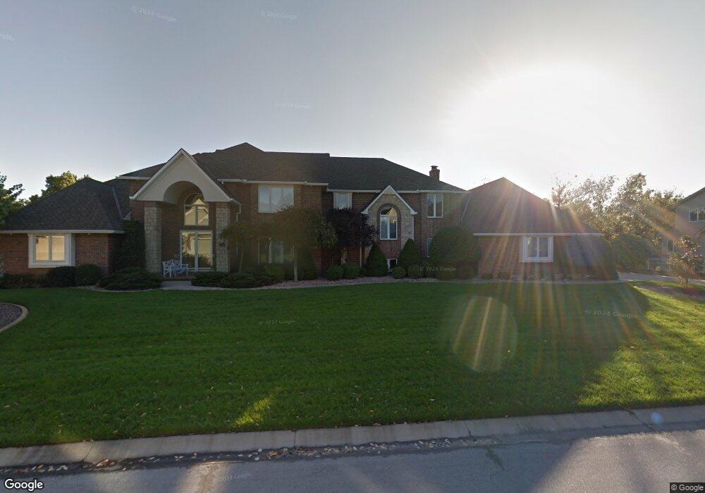
946 NW High Point Dr Lees Summit, MO 64081
Estimated Value: $866,000 - $1,136,371
5
Beds
8
Baths
6,304
Sq Ft
$157/Sq Ft
Est. Value
About This Home
This home is located at 946 NW High Point Dr, Lees Summit, MO 64081 and is currently estimated at $992,124, approximately $157 per square foot. 946 NW High Point Dr is a home located in Jackson County with nearby schools including Cedar Creek Elementary School, Bernard C. Campbell Middle School, and Lee's Summit North High School.
Ownership History
Date
Name
Owned For
Owner Type
Purchase Details
Closed on
Mar 25, 1997
Sold by
Link Deloris E
Bought by
Moxley Wesley L and Moxley Debra Vannoy
Current Estimated Value
Home Financials for this Owner
Home Financials are based on the most recent Mortgage that was taken out on this home.
Original Mortgage
$295,000
Interest Rate
7.65%
Mortgage Type
Purchase Money Mortgage
Create a Home Valuation Report for This Property
The Home Valuation Report is an in-depth analysis detailing your home's value as well as a comparison with similar homes in the area
Home Values in the Area
Average Home Value in this Area
Purchase History
| Date | Buyer | Sale Price | Title Company |
|---|---|---|---|
| Moxley Wesley L | -- | -- |
Source: Public Records
Mortgage History
| Date | Status | Borrower | Loan Amount |
|---|---|---|---|
| Closed | Moxley Wesley L | $295,000 | |
| Closed | Moxley Wesley L | $169,000 |
Source: Public Records
Tax History
| Year | Tax Paid | Tax Assessment Tax Assessment Total Assessment is a certain percentage of the fair market value that is determined by local assessors to be the total taxable value of land and additions on the property. | Land | Improvement |
|---|---|---|---|---|
| 2025 | $11,843 | $188,624 | $16,549 | $172,075 |
| 2024 | $11,757 | $164,021 | $11,750 | $152,271 |
| 2023 | $11,757 | $164,022 | $11,750 | $152,272 |
| 2022 | $13,896 | $172,140 | $12,094 | $160,046 |
| 2021 | $14,184 | $172,140 | $12,094 | $160,046 |
| 2020 | $13,640 | $163,929 | $12,094 | $151,835 |
| 2019 | $13,267 | $163,929 | $12,094 | $151,835 |
| 2018 | $12,168 | $139,520 | $14,836 | $124,684 |
| 2016 | $10,893 | $123,633 | $15,694 | $107,939 |
Source: Public Records
Map
Nearby Homes
- 2430 NW Windwood Dr
- 507 NW Ashurst Ct
- 2224 NW Summerfield Dr
- 2635 NW Ashurst Ln
- 13004 E 99th St
- 334 NW Ambersham Dr
- 321 NW Nutall Dr
- 336 NW Thoreau Cir
- 2122 NW Ashurst Dr
- 2809 NW Audubon Ln
- 10401 View High Dr
- 2110 NW Ashurst Dr
- 433 NW Kaylea Ct
- 317 NW Lovins
- 316 NW Lovins
- 320 NW Lovins
- 321 NW Lovins
- 2074 NW O'Brien Rd
- 321 NW Earle Ln
- 2214 NW Killarney Ln
- 952 NW High Point Dr
- 940 NW High Point Dr
- 947 NW High Point Dr
- 943 NW High Point Dr
- 951 NW High Point Dr
- 956 NW High Point Dr
- 939 NW High Point Dr
- 936 NW High Point Dr
- 960 NW High Point Dr
- 932 NW High Point Dr
- 935 NW High Point Dr
- 959 NW High Point Dr
- 963 NW High Point Dr
- 964 NW High Point Dr
- 928 NW High Point Dr
- 1083 NW High Point Dr
- 1079 NW High Point Dr
- 1075 NW High Point Dr
- 924 NW High Point Dr
- 967 NW High Point Dr
Your Personal Tour Guide
Ask me questions while you tour the home.