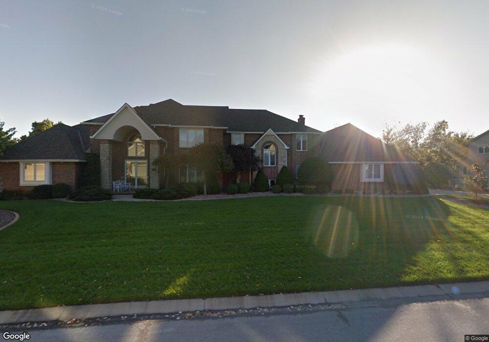
946 NW High Point Dr Lees Summit, MO 64081
Lee's Summit AreaEstimated Value: $862,000 - $1,093,567
About This Home
This home is located at 946 NW High Point Dr, Lees Summit, MO 64081 and is currently estimated at $939,856, approximately $149 per square foot. 946 NW High Point Dr is a home located in Jackson County with nearby schools including Cedar Creek Elementary School, Bernard C. Campbell Middle School, and Lee's Summit North High School.
Ownership History
We collect this data history from publicly available records. To have your information removed, we recommend requesting removal directly through your county’s website.
Purchase Details
Home Values in the Area
Average Home Value in this Area
Purchase History
We collect this data history from publicly available records. To have your information removed, we recommend requesting removal directly through your county’s website.
| Date | Buyer | Sale Price | Title Company |
|---|---|---|---|
| -- | -- |
Tax History
We collect this data history from publicly available records. To have your information removed, we recommend requesting removal directly through your county’s website.
| Year | Tax Paid | Tax Assessment Tax Assessment Total Assessment is a certain percentage of the fair market value that is determined by local assessors to be the total taxable value of land and additions on the property. | Land | Improvement |
|---|---|---|---|---|
| 2025 | $11,843 | $188,624 | $16,549 | $172,075 |
| 2024 | $11,757 | $164,021 | $11,750 | $152,271 |
| 2023 | $11,757 | $164,022 | $11,750 | $152,272 |
| 2022 | $13,896 | $172,140 | $12,094 | $160,046 |
| 2021 | $14,184 | $172,140 | $12,094 | $160,046 |
| 2020 | $13,640 | $163,929 | $12,094 | $151,835 |
| 2019 | $13,267 | $163,929 | $12,094 | $151,835 |
| 2018 | $12,168 | $139,520 | $14,836 | $124,684 |
| 2017 | $10,893 | $139,520 | $14,836 | $124,684 |
| 2016 | $10,893 | $123,633 | $15,694 | $107,939 |
| 2014 | $9,820 | $109,250 | $17,329 | $91,921 |
Map
- 2452 NW Valley View Dr
- 1056 NW High Point Dr
- 2448 NW Valley View Dr
- 2508 NW Bent Tree Cir
- 833 NW High Point Dr
- 2450 NW Lowenstein Dr
- 510 NW Ashurst Place
- 627 NW Timberbrooke Dr
- 469 NW Riven Rock Place
- 105 NW Ambersham Dr
- 336 NW Thoreau Cir
- 341 NW Thoreau Cir
- 400 NW Tennyson Place
- 324 NW Thoreau Cir
- 301 NW Rockhill Cir
- 3121 SW Merriam Dr
- 10401 View High Dr
- 433 NW Kaylea Ct
- 317 NW Lovins
- 320 NW Lovins
- 952 NW High Point Dr
- 940 NW High Point Dr
- 947 NW High Point Dr
- 943 NW High Point Dr
- 951 NW High Point Dr
- 956 NW High Point Dr
- 939 NW High Point Dr
- 936 NW High Point Dr
- 960 NW High Point Dr
- 932 NW High Point Dr
- 935 NW High Point Dr
- 959 NW High Point Dr
- 963 NW High Point Dr
- 964 NW High Point Dr
- 928 NW High Point Dr
- 1083 NW High Point Dr
- 1079 NW High Point Dr
- 1075 NW High Point Dr
- 924 NW High Point Dr
- 967 NW High Point Dr
Ask me questions while you tour the home.